Showing 174 items matching "australian geography"
-
 Sunshine and District Historical Society Incorporated
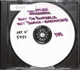
Film - Australian Geographic Best Of Australia Wet Tropics Queensland DVD
... Australian Geographic Best Of Australia Wet Tropics Queensland...Brimbank Library, 301 Hampshire Road, Sunshine 3020. melbourne Australian Geographic Best Of Australia Wet Tropics Queensland DVD Film Australian Geographic Best Of Australia Wet Tropics Queensland DVD ...Australian Geographic Best Of Australia Wet Tropics Queensland -
 Sunshine and District Historical Society Incorporated
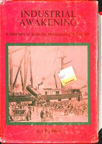
Book - Industrial Awakening A Geography of Australian Manufacturing 1788 to 1890, G.J.R. Linge, 1979
... Industrial Awakening A Geography of Australian Manufacturing 1788 to 1890...Industrial Awakening A Geography of Australian Manufacturing 1788 to 1890. ...McKay Massey Harris Industrial Awakening A Geography of Australian Manufacturing 1788 to 1890. ...Hard cover booknon-fictionmanufacturing, h.v. mckay, massey harris -
 Williamstown High School
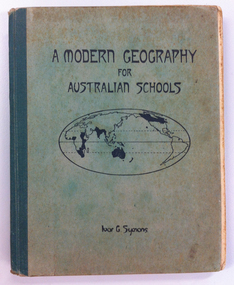
Geography textbook 1945, A Modern Geography for Australian schools, by Ivor G. Symons. Adelaide: Gillingham & Co., 1937, 1944
... A Modern Geography for Australian schools, by Ivor G. Symons. ...A Modern Geography for Australian schools, by Ivor G. Symons. ...Olive board covered book with green binding tape, used by Bob Gerring in studies, whilst in Form IB at Williamstown High School in 1945.See jpg above for inscription inside front cover.williamstown high school, 1945, textbooks, robert gerring -
 Wodonga & District Historical Society Inc
Book - The Book of the Murray, Lawrence, G. V.; and Smith, Graeme Kinross, 1975
... ...Australian geography...It gives a fascinating look at one of Australia's most important geographical and historical features. ...This book contains contributions from 16 writers who have first-hand knowledge of the Murray River area. It provides a comprehensive picture of the river in all its aspects. It gives a fascinating look at one of Australia's most important geographical and historical features. Contributors and chapters in this book are: - 1. Past, Present and Future – G. V. Lawrence 2. The Structure of the Murray – Edmund D. Gill 3. Seeing the Murray – Graeme Kinross Smith 4. The Mountains at the Source – Elyne Mitchell 5. The Explorers – Leigh Betheras 6. The Irrigators – G. Arch Grosvenor 7. Murray Water Conservation – W. G. L. Harrison & K. E. Johnson 8. The Murray River Steamers – Ian Mudie 9. Pioneer Days: A Story of Seventy Years Ago – Dorothy Roysland 10. Birdlife of the Murray Valley – John Eckert 11 .Aborigines in the Murray Valley, How We Learned the Story – H. A. Lindsay, The Aboriginal Occupation – Norman B. Tindale 12. Fish of the Murray River – John S. Lake 13. Native Plants of the Murray Valley – J. H. Willis 14. Murray Wildlife – K. N. G. SimpsonThis publication has a hard cover with blue boards and a pictorial dust jacket. It consists of 264 pages.This book contains contributions from 16 writers who have first-hand knowledge of the Murray River area. It provides a comprehensive picture of the river in all its aspects. It gives a fascinating look at one of Australia's most important geographical and historical features. Contributors and chapters in this book are: - 1. Past, Present and Future – G. V. Lawrence 2. The Structure of the Murray – Edmund D. Gill 3. Seeing the Murray – Graeme Kinross Smith 4. The Mountains at the Source – Elyne Mitchell 5. The Explorers – Leigh Betheras 6. The Irrigators – G. Arch Grosvenor 7. Murray Water Conservation – W. G. L. Harrison & K. E. Johnson 8. The Murray River Steamers – Ian Mudie 9. Pioneer Days: A Story of Seventy Years Ago – Dorothy Roysland 10. Birdlife of the Murray Valley – John Eckert 11 .Aborigines in the Murray Valley, How We Learned the Story – H. A. Lindsay, The Aboriginal Occupation – Norman B. Tindale 12. Fish of the Murray River – John S. Lake 13. Native Plants of the Murray Valley – J. H. Willis 14. Murray Wildlife – K. N. G. Simpsonmurray river, australian geography, settlement on the murray river, native plants, aborigines in the murray valley, murray valley flora and fauna -
 Federation University Historical Collection
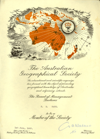
Certificate, Australian Geographical Society, Australian Geographical Society certificate made out to Keith Rash, 1957, 01/06/1957
... Certificate of the Australian Geographical Society made out to Keith Rash. ...Barker Library (top floor) Mount Helen goldfields Rash Keith Rash Australian Geographical Society G.B. Walker G. B. Walker (signature) Certificate of the Australian Geographical Society made out to Keith Rash. ...Certificate of the Australian Geographical Society made out to Keith Rash. One printed page, map of Oceania including sailing ship, torch, map of Australia and surrounding islands. G. B. Walker (signature)rash, keith rash, australian geographical society, g.b. walker -
 Bendigo Military Museum
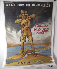
Poster - ENLISTMENT POSTER, St. Leigh & Co. Ltd, Original WW1
... A commemorative poster facsimile of an original WW1 Recruitment Poster issued in 1915 by Defence Department - Issued by Australian Geographic....Bendigo Military Museum 37 - 39 Pall Mall Bendigo goldfields A commemorative poster facsimile of an original WW1 Recruitment Poster issued in 1915 by Defence Department - Issued by Australian Geographic. WW1 Recruitment Poster On top says "A CALL FROM THE DARDENELLES" On bottom "ENLIST NOW" In middle "COO-EE - WON'T YOU COME" Large hard paper poster. ...A commemorative poster facsimile of an original WW1 Recruitment Poster issued in 1915 by Defence Department - Issued by Australian Geographic.Large hard paper poster. Symbolic image of Australian Soldier standing on a 3D image of the Dardenelles in Turkey. In colour showing map of that part of Turkey. Poster laminated with layer of clear plastic to protect it.On top says "A CALL FROM THE DARDENELLES" On bottom "ENLIST NOW" In middle "COO-EE - WON'T YOU COME"ww1, recruitment poster -
 Victorian Aboriginal Corporation for Languages
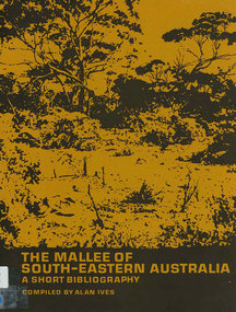
Book, The Mallee of south-eastern Australia : a short bibliography, 1973
... geography...Australian literature...Victorian Aboriginal Corporation for Languages 33 Saxon Street Brunswick melbourne Mallee region south-eastern Australia geography geology climatology water agriculture soils botany zoology national parks historical geography Australian literature anthropology sociology maps The Mallee of south-eastern Australia : a short bibliography Book Alan Ives ...mapsmallee region, south-eastern australia, geography, geology, climatology, water, agriculture, soils, botany, zoology, national parks, historical geography, australian literature, anthropology, sociology -
 Kilmore Historical Society
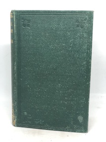
PHYSICAL GEOGRAPHY OF AUSTRALIA, Manual of Physical Geography of Australia, 1873
... PHYSICAL GEOGRAPHY OF AUSTRALIA...Manual of Physical Geography of Australia ...Green leather cover with gold writing on spine 'Physical Geography of Australia' 167 pages ; 17 cm ; Illu ; index...Handwritten inscription on first page '137' Stamp on multiple pages 'Kilmore Mechanics Institute' Green leather cover with gold writing on spine 'Physical Geography of Australia' 167 pages ; 17 cm ; Illu ; index Manual of Physical Geography of Australia PHYSICAL GEOGRAPHY OF AUSTRALIA George Robertson H. ...Green leather cover with gold writing on spine 'Physical Geography of Australia' 167 pages ; 17 cm ; Illu ; indexHandwritten inscription on first page '137' Stamp on multiple pages 'Kilmore Mechanics Institute'geography, kilmore mechanics institute library. -
 Sunshine and District Historical Society Incorporated
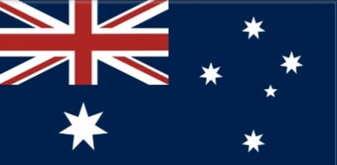
Flag - Australian Flag
... . - Symbolises Australia’s geographical location and its identity as a southern nation. .... - Symbolises Australia’s geographical location and its identity as a southern nation. ...The Australian flag symbolises the nation’s origins, identity, and political structure. Its three core elements, the Union Jack, the Commonwealth Star, and the Southern Cross represent a different layer of Australia’s history and national story. The Union Jack - Located in the canton (top-left corner), the position of honour. - Acknowledges the history of British settlement and the institutions inherited from Britain, the parliamentary democracy, rule of law, and civic rights. The Commonwealth Star - Large seven‑pointed star beneath the Union Jack. - Six points, the six points represent the states, the seventh point represents all territories. - Represents federation and the unity of Australia as a Commonwealth. The Southern Cross - Five stars on the fly side of the flag. - A constellation visible only in the Southern Hemisphere, long used for navigation by explorers and sailors. - Holds deep significance in First Nations astronomy, with many cultural stories attached to it. - Symbolises Australia’s geographical location and its identity as a southern nation. The Australian flag was first flown in 1901 after a public design competition with over 32,000 entries. It was officially adopted in 1903 and modified in 1908 to add the seventh point to the Commonwealth Star. It became the official national flag in 1954 under the Flags Act, reflecting Australia’s growing independence from Britain.Australian Flag. This flag is suitable to be flown on a flagpole.Manufacturer's Tag: Manufactured in Australia by Carroll & Richardsonaustralian flag -
 Federation University Historical Collection
Book, The World: A General Geography for the Schools of Australia and New Zealand, c1938, 1933
... The World: A General Geography for the Schools of Australia and New Zealand, c1938...Contenta include mathematical geography, the atmosphere, the Hydrosphere, The Lithosphers, Geographical Contril, Australia and New Zealand, Asia, North America, South America, Africa....Contenta include mathematical geography, the atmosphere, the Hydrosphere, The Lithosphers, Geographical Contril, Australia and New Zealand, Asia, North America, South America, Africa. ...This book has been passed through the hands of a number of students, including Rex HollioalBrown hard covered book of 712 pages. Contenta include mathematical geography, the atmosphere, the Hydrosphere, The Lithosphers, Geographical Contril, Australia and New Zealand, Asia, North America, South America, Africa.R. Hollioake Form V K. Datts Form V C/O Mr I Kerr, Private Bag, Wycheproof Peter Hoskin Form V B.H.S.geography -
 Federation University Historical Collection
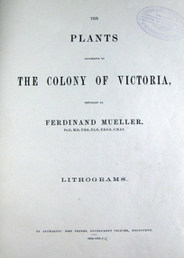
Book, The Plants Indigenous to the Colony of Victoria, 1865 (exact); "1864-1865, CR"
... He published many volumes on the Victorian plants. Many of Australian geographical features were named after him such as: the Mueller Ranges (WA), Muellers Range (Qld), Mount Mueller (in WA, NT, Tas and Vic) and many more. ...He published many volumes on the Victorian plants. Many of Australian geographical features were named after him such as: the Mueller Ranges (WA), Muellers Range (Qld), Mount Mueller (in WA, NT, Tas and Vic) and many more. ...Baron Sir Ferdinand Jacob Heinrich von Mueller was born in Germany on 30 June 1825. Ferdinand was a German-Australian physician, geographer, and a botanist. After passing the pharmaceutical examinations he studied botany at Kiel University. In 1847 he received the degree of Doctor of Philosophy from Kiel University.when he was 21 years old for a thesis on the flora of Schleswig-Holstein. In 1847, he moved to Adelaide, Australia and worked as a chemist. From 1848 to 1852 he travelled through the colony, discovering and describing a large number of unknown to Western science plants. He wrote a few papers to German periodicals on botanical subjects. In 1851, Mueller moved to Melbourne, capital of the new colony of Victoria. In 1853, He was appointed Government Botanist for Victoria by Governor Charles La Trobe. In 1873, Ferdinand received an honorary doctorate of the University of Rostock. In 1883, he was awarded the Clarke Medal by the Royal Society of New South Wales. He published many volumes on the Victorian plants. Many of Australian geographical features were named after him such as: the Mueller Ranges (WA), Muellers Range (Qld), Mount Mueller (in WA, NT, Tas and Vic) and many more. Mueller died in Melbourne on 10 October 1896 and is buried in the St. Kilda Cemetery A green cloth hard cover book. Title and author's name is engraved in gold on spine. It includes an introduction, a table of contents and plates. Lithograms in b/w. Each plate accompanied by a page with descriptive print. Number of plates XIII-LXXI. No. of supplement plates XII-XVII. The book illustrates Victorian plants and outlines the principal characters of those species. This book is No 1290 in the Original Register of Books (Cat. No. 005)Hand written pencil notes on contents page. Stamped throughout with "The School of Mines, Industries & Science, Ballarat. Ingenio Effodere Opes. In the University of Melbourne."australia, botany victoria, plants, ferdinand mueller, ferdinand von mueller, biodiversity, flora -
 Vision Australia
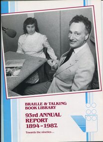
Administrative record - Text, Braille and Talking Book Library 93rd Annual Report 1894-1987: towards the nineties, 1987
... Items also included are: CEP (Community Employment Programs) allowed for duplication of master tapes for storage off-site and development of computer catalogue records, budget estimate requires raising $600,000 in funds which has resulted in 1987 facing serious financial challenges, negotiations with RVIB broken down as print-handicapped philosophy not shared, Braille Book of the Year judges (Joyce Nicholson, Barrett Reid and Stephen Murray-Smith) shortlisted titles for readers to vote upon (John Bryson, Evil Angels) and best narrator (The Bathurst) went to Sean Myers, organisational restructure, resignation of Barbara Johnston and David Blyth, appointment of Jill Keeffe, new borrowers now waiting 11 months to receive first book due to limited staffing levels, bright orange cassette containers introduced (replacing pouches), Otari duplicating system first year in use, 'In Future' and 'Australian Geographic' began, 45 audio magazines including 1 Greek and 3 Italian now circulating, Braille Reading Marathon held, large print collection expanded due to Fitzroy Public Library discarding stock, Versapoint embosser purchased and link with Royal Society for the Blind in South Australia through Braille book catalogue....Items also included are: CEP (Community Employment Programs) allowed for duplication of master tapes for storage off-site and development of computer catalogue records, budget estimate requires raising $600,000 in funds which has resulted in 1987 facing serious financial challenges, negotiations with RVIB broken down as print-handicapped philosophy not shared, Braille Book of the Year judges (Joyce Nicholson, Barrett Reid and Stephen Murray-Smith) shortlisted titles for readers to vote upon (John Bryson, Evil Angels) and best narrator (The Bathurst) went to Sean Myers, organisational restructure, resignation of Barbara Johnston and David Blyth, appointment of Jill Keeffe, new borrowers now waiting 11 months to receive first book due to limited staffing levels, bright orange cassette containers introduced (replacing pouches), Otari duplicating system first year in use, 'In Future' and 'Australian Geographic' began, 45 audio magazines including 1 Greek and 3 Italian now circulating, Braille Reading Marathon held, large print collection expanded due to Fitzroy Public Library discarding stock, Versapoint embosser purchased and link with Royal Society for the Blind in South Australia through Braille book catalogue. ...Annual report of the Braille & Talking Book Library including Minutes of the AGM, Board of Director's Report, President's report and financial statements. Items also included are: CEP (Community Employment Programs) allowed for duplication of master tapes for storage off-site and development of computer catalogue records, budget estimate requires raising $600,000 in funds which has resulted in 1987 facing serious financial challenges, negotiations with RVIB broken down as print-handicapped philosophy not shared, Braille Book of the Year judges (Joyce Nicholson, Barrett Reid and Stephen Murray-Smith) shortlisted titles for readers to vote upon (John Bryson, Evil Angels) and best narrator (The Bathurst) went to Sean Myers, organisational restructure, resignation of Barbara Johnston and David Blyth, appointment of Jill Keeffe, new borrowers now waiting 11 months to receive first book due to limited staffing levels, bright orange cassette containers introduced (replacing pouches), Otari duplicating system first year in use, 'In Future' and 'Australian Geographic' began, 45 audio magazines including 1 Greek and 3 Italian now circulating, Braille Reading Marathon held, large print collection expanded due to Fitzroy Public Library discarding stock, Versapoint embosser purchased and link with Royal Society for the Blind in South Australia through Braille book catalogue.1 volume of text and illustrationsannual report, braille and talking book library, paul eddington, elaine harris, john bryson, book of the year, jan smark, alison forbes, paul korsten, maria cafici, alannah mccann, joan harris, carole yelland, iris whittaker, seija makinen, lloyd smith, john cockayne, max charlesworth, john blackman, joyce nicholson, stewart culbard, ken robertson, rita erlich, carmen hannaker, paul korner, fiona woods, helene dennett, pat rosenbrook, wendy kemp, bobby mccartney-snape, merrie handbury, jane grimwade, julie stafford, pamela reynolds, jean mccaughey, dianne monopoli, norman curry, peter cole-adams -
Federation University Historical Collection
Document, Zelda Martin, Central Victorian Goldmining towns - Boom Towns or Ghost Towns?, c1996
... Christie, Sydney University Press, 1979 +"Urban and Industrial Australia: readings in Human Geography" ed J.M. Powell, Melb. ...Christie, Sydney University Press, 1979 +"Urban and Industrial Australia: readings in Human Geography" ed J.M. Powell, Melb. ...Zelda Martin was a PhD candidate at the University of Melbourne.[.1] 4th item in light blue display book titled Research Approach/Overview of Chapters/Confirmation of Canditure/Chapters1,2,3&4 of proposed thesis. *Twenty-seven page article on Victorian goldfields towns titled: Central Victorian Goldmining Towns - Boom Towns or Ghost Towns. The article was written during the author's PhD study. It outlines the context methodology, and resources and the chapters of the proposed thesis: (1) Central Victorian Goldmining Towns - The Context (2) Contemporary Views of the Factors Necessary for Town Growth (3) Outward Manifestations of Town Growth (4) The Trappings of Government (5-9) The Main Towns and Their Hinterland. [.2] 5th item in Light Blue display book as above item. *Chapter 1 of proposed thesis titled 'Pick, Shovel and Tin Dish Mining.' Covers in Section A: Central Victoria - Pre 1851: Aborigines in Central Victoria, Squatters, and Government. Section B: The years 1851-1854: The Early Gold Rushes, Government Reaction, Township Surveys, Legislation, Town Development, Local Government and Early Settlement. [.3] 6th item in Light Blue display book as above item. *2A of proposed thesis titled 'Contemporary Views of the Factors Necessary for Town Growth'. Similar information to Chapter 1 plus extra re towns and maps. Sections: Introduction, Context of Place - Geographical Towns Listed, The Context of Time - Pre1851 Aborigines, Governance of Port Phillip, The Squatters, The Villages of Central Victorian Highlands, Conclusion, Condensed Version of Chapter2B. [.4] 7th item in Light Blue display book as above item. *Chapter2B of proposed thesis. Sections: Area of Research, Schools, Banks, Newspapers, Progress Association, Town Development - Sandhurst (Bendigo), Ballarat, Castlemaine,, Maryborough, Ararat and Stawell. [.5] 8th item in Light Blue display book as above item. *Chapter 3 of proposed thesis titled 'Outward Manifestations of Town Growth'. Sections: Introduction, Contemporary Writing, Educationalists, The Bankers, The Townsfolk, Current Theory, General Theories of Urban Development, and Conclusion. [.6] 9th item in Light Blue display book as above item. *Chapter 4 of proposed thesis titled 'Trappings of Government' Sections: Introduction, Early Government Attitudes to Mining and Town Development, Law and Order, Township Surveys, Legislation, Local Government, Transport and Communication, The People and Lobbyists. [.7] 10th item in Light Blue display book as above item. *'The Rise and Fall of Central Victorian Goldmining Towns'. Includes a map showing main Goldfields, a table showing towns and villages at two points in time - 1857 and 1871; a Bibliography of Primary and Secondary Sources. [.8] Resource No1. Black display book titled Local Towns 1 : Alma: *Brief history *Directory *Maps Amphitheatre / Mountain Hut: *Brief History Post Office Directory Ararat: *Brief History *Post Office Directory 1869 - Alphabetical Listing by Occupation *Ararat - Prominent Citizens of 1858 *Langi-Morgala Museum Avoca: *Brief History *Excerpts from 'Avoca The Early Years', Margery and Betty Beavis; pg1 - Beginnings; pg11 - The Midas Touch; pg25 - Local Gold Escorts; pg27 - A Town is Born; pg51- The Administration of Justice; pg53 - The Ways of the Law; pg61 - News of the Day; pg65 - A Time to Play; pg72 - Land Ownership *Post Office Directory (Bailliere's) 1869 *Tourism Map and Information of area *Historic Avoca - A 5.5km Tour *Avoca & the Pyrenees Region - information pamphlet Ballarat: *Early History of Ballarat - Ballarat Historical Society, Publication No.1: origin of the name; Ballaarat - the Beginning; Fabulous Yields from the Ballaarat Goldfield; *Streetscape Lydiard Street. *Hand drawn map showing Leigh River, Old Portland Bay Road, plaque on road to Colac; etc. *Newspaper article re 'The Theatre Royal' ( which stood in the vicinity of the current Owen Williams store) - 'The News'15/04/1998 *Article - 'Ballarat's Mechanics' Institute Lives On' Ballarat Courier, 14/09/1985 *Article - Standing the Test of Time' The News 17/11/1993 re The Mechanics Institute & picture of the Reading Room *'Ballarat a Study of a City, Phyllis Reichl, pub. Nelson, 1968; no.3 place, time and people field studies series *Investigator Vol.33 No.2, 1998 Geelong Historical Society. Article on pg75 describes Ballarat in 1861 *Folded poster - 'Ballarat 100' a history of telegraph communication, pub. Telecom. Beaufort (Fiery Creek): *Brief history *Post Office Directory [.9] Resource No.2 Black Folder Titled Towns cont.No2 Bendigo (Sandhurst): *'Family & Local History at the Bendigo Library - 1851-2001 150 years of gold'. *Bendigo Government Camp in 1853 illustration; key to sketch and names of Government officers stationed there *Excerpts from 'Bendigo and Vicinity' Adolph Haman *The Bendigo Goldfield Registry - pgs 1-7 Introduction *Excerpt: 'Breaking the Grip' *Excerpt: The Most Go-Ahead Place *Excerpts from 'History of Bendigo' - anti license agitation; laying out of town; proposed railway; gold calls and dividends; the Sandhurst Municipality; journalism *Bibliography Blackwood: *Excerpts from 'Aspects of Early Blackwood - The Goldfield, the Landmarks, the Pioneers' Alan J Buckingham and Margaret F Hitchcock, JG Publishing,1980 Buninyong: *A Brief History *Investigator Vol1 No.2 Feb 1966 Geelong Historical Society. Pg3 - Article re gold escort route - Mt Alexander to Adelaide - (see a simple monument on the Western Highway a few miles out of Horsham. Pg 15 - Ballarat Excursion - re the finding of gold. *Three articles published by Buninyong and District Historical Society Inc: (Magpie Exploration; Finding Gold In The Green Hills; Magpie Exploration; Burnt Bridge to Cargarie to Mt Mercer) *Copies of newspaper articles/items *Buninyong Street Directory Carisbrook: *In the Beginning There Was Carisbrook *The History of the Carisbrook Racecourse Carngham / Snake Valley: *Brief History *Directory Castlemaine: *Directory 1865-1866 - Alphabetical and Street *Poster - Castlemaine A Contemporary Guide "The Great Centre" 1866 - A Contemporary Guide to the Fascinating Past *Pamphlet - Castlemaine District Community Hospital *Map - Castlemaine, Maldon & Surrounding Districts *Map and Information - The Dry Diggings Track - a 55kl walk among historic goldfields relics ( Castlemaine Fryerstown Vaughan Mt Franklin Hepburn Daylesford) *Postcard - Former Court House *Directory 1867 - Alphabetical, Trade [.10] Resource No.3 Grey folder Titled Towns 3 Creswick to Maryborough Creswick: *Brief History *Booklet - "Creswick Cemetery Walk" *Booklet - The Buried Rivers of Gold Heritage Trail Creswick *Creswick Historical Museum Information Sheet *Chronological History of Creswick *Alphabetical Directory of the Borough of Creswick *Creswick's Creek Directory 1856 *Historic Creswick Walking Tour *A Brief Account of the Schools of Creswick - Past and Present *100 Years of Railway Travel in Creswick *The Berry Deep Leads *The Spence Home at Jackass Gully in the Creswick State Forest ( William Guthrie Spence - Pioneer) *The New Australian Mine and the 1882 Disaster *Creswick District News, Issue 7, July August 1999 *The Creswick Miners Walk - Information and Map *Maps Chewton: *Brief History *Directory Clunes: *Brief History *Clunes Street Directory Daylesford: *Brief History *Notable Bushfires in Daylesford District Over More Than a Century - "Black Thursday" 1851; 1862; 1899; the Disastrous Hepburn Fire of 1906; 1939; 1944; 1969. *Post Office Directory -Daylesford and Hepburn Dunolly / Inkerman: *Brief History *Directory *Pamphlet - Goldfields Historical Museum *Pamphlet - Historic Dunolly - Victoria's Best Kept Secret *Map of Gold Workings at Dunolly Area - showing where the main gold rushes occurred *Brief History - Inglewood *Directory - Inglewood - Name Occupation, Dwelling Kingower: *Brief History *Directory - Name / Ocupation / Dwelling Linton / Happy Valley / Piggoreet: *Brief History *Directory - Lintons McIvor: *"A History of the Shire and the Township of Heathcote" by J.O. Randell Majorca: *Brief History *Official Post Office Directory 1869 - Name / Occupation/ Address Maldon (Tarrangower): *Brief History Part 1 *Brief History Part 2 *Post Office Directory *List - Alphabetical Order by Names plus Business and Trade (Tarrangower Times Oct/1858) *List - Alphabetical Order by Trade plus Name and Business *Directory - Name / Occupation / Dwelling Maryborough: *Worsley Cottage - built by Arthur Worsley, a contractor in stonework in 1894 [.11] Resource No. 4 Blue Display Book titled Towns 4 Moliagul to Stawell Moliagul: *Brief History *Moligul Legislative Assembly (Voting?) List - Names and Occupations *Moliagul Victorian Post Office Directory 1868 - Name / Ocupation / Address / Comments *"The Welcome Stranger" gold nugget *The Sunday School *The Welcome Stranger Discovery Walk - information and map Moonambel (Mountain Creek) Redbank *Brief History *List of names extracted from advertisments of the Pioneer and Mountain Creek Advertiser 16/02/1861. *Bailliere's Directory 1869 - Alphabetical List of Name / Occupation / Place St Arnaud: *Brief History Sebastapol: *Brief History *Directory 1869 - Alphabetical by Name; plus occupation and address. Browns and Scarsdale: *Brief History *Browns Street Directory - Name and Occupation Smythesdale: *Brief Description *Smythesdale Street Directory -Name and Occupation Stawell (Pleasant Creek) *Brief History *Victorian Official Post Office Directory - Name /Occupation / Dwelling *Chronology - 1841-1920 *Production of gold statistics - 1879 - 1900 *Big Hill *Extracts from "The Golden Years of Stawell". Chapt 1 - Stawell's Coming Out. Capt. 2 - The Gold Rush. Caapt.3 - Cradle of Democracy. Chapt.4 - The Reefs Becomes Stawell. Chapt. 5 - Rushing In. Chapt.6 - The Pioneers. Chapt 7 - The Decade of Optimism. [.12] Resource No. 5: Blue Display Book titled 'Towns Steiglitz to the The Golden Triangle. Steiglitz: Brief History Victorian Post Office Directory 1869 *Map of Steiglitz *List of maps relevant to Steiglitz history *Information 6 tables of data from "Reports of Mining Surveyors Talbot (Back Creek) Brief History Taradale: Post office Directory 1869 - Name/Occupation/Street. Also list in alphabetical order by Occupation Taradale *Chronological Reference to Taradale Mines *Water - The Coliban System of Waterworks *Joseph Brady *The Syphon Tarnagulla (Sandy Creek) *Brief History *Tarnagulla Businessmen Cameos to give depth to advertisments in 'The Tarnagulla Courier' various issues 1864-1871 *Directory - Name/Occupation /Address *List - Name/Business/Trade Wedderburn (Koorong) *Brief History *List - Name/Occupation The Golden Triangle: *The Early Rushes - Wedderburn / Moliagul / Sandy Creek - Tarnagulla / Jones Creek - Waanyarra / Kingower / Dunolly - Goldsborough / Inglweood *Census of 1857 - Population / Occupations *1858-1871 - A Time of Consolidation- Wedderburn / Moliagul / Sandy Creek- Tarnagulla / Arnold *Census 1871 - Population *Information gleaned from the census data - Demographics / Population / Occupations / marital / Birthplace / Religion / Literacy/ Occupation and Housing Cameos *Graphs - Birthplace of settlers /Male-Female Ratio / Married males / Children under 15 as Percentage of Population / Religion *Census 1857 - Statistical data *Maps *Bibliography [.13] Resource No. 6 - Black Display Book Information and Research in Central Victoria including: *Banking - Research from ANZ Bank Archives *Institutions - also includes articles listed from the Ballarat Times Newspaper *Australian mining History Association - A.M.H.A. Bibliography *Australia's Mining History * Bibliography - Land Surveys Victoria - *1853 Administration (Statistics and Other) includes: schools / ministers of religion / police / military / local administration / licences for sale of spirits / distances between various Victorian gold fields. * Victoria Government Gazette (Copy) - N0. 116, 12/12/1854 includes: Gold Felds Commission of Enquiry & No. 85, 15/09/1854 - Addresses presented to the Lieutenant Governor (Sir Charles Hotham) during his tour through the Gold Fields of Victoria,1854. Addresses on behalf of : the people of Bendigo; Members of the Church of England, Bendigo; Members of the Wesleyan Church on the Bendigo Gold Fields; Bendigo Gold District General Hospital; the Bendigo Prospecting Association; Committee of the Bendigo Local Exhibition; Bendigo District Medical Association; Coloured Americans Resident at Bendigo; German Inhabitants of Bendigo; Landowners, Inhabitants, and Miners of Castlemaine; Inhabitants of Forest Creek; Inhabitants of Heathcote and Gold Miners of McIvor; Residents and landholders of the District of Bacchus Marsh; Inhabitants of Kilmore and Vicinity. *Gold Fields Correspondence 1853: letter from Lieutenant Colonel Valiant, (Officer commanding the Troops in Victoria) to the Lieutenant Governor re threatened disturbance at Sandhurst (Bendigo) regarding the Gold License Fee. * Extracts from a book "Victoria" re Gold Fields Commission of Enquiry involving mainly Ballarat and Castlemaine and a chapter titled 'A Tour to the Victorian Gold-Fields' *Lists of central Victorian newspapers - listed by date published 1851to 1874; by first date available to State Library. *A list of cities and towns showing County, population in 1861 &1871, and municipal status. [.14] Resource no.7. Black display book. *Reference: Papers presented to Parliament Victoria - 1859-1860 4 volumes - relevant sections copied. Contains information on Branches of Government. General / Finance / Gold / Gazette / Commission and Warrant / Statistic. *Gold Fields Act. In accordance with the Act the gold fields are divided into six districts - Ballaarat, Castlemaine , Sandhurst, Avoca, Ararat, and Beechworth.. Official staff in each gold district consists of a Resident Warden, Wardens, Wardens' Clerks, Bailiffs, Chinese Protectors, Chinese Interpreters, and Mining Surveyors. *Gold Receiver *Gaols *Police magistrates and Clerks of Petty Sessions, etc. *Field Branch *Immigration and Emigration Overland - Chinese - 1859 *Population on the Goldfields *The Geological Survey - The Government Geologist is assisited by staff from four branches - the office Branch; the Publishing Branch; the Field Branch and the Museum Branch. *Commission to Enquire Into Sludge dated 10/02/1859 (Some sections copied) - Report to the Honorable Chief Commissioner of Public Works, Melbourne re the mode of carrying the sludge from the puddling mills in Sandhurst without interfering with the drainage of the town and the roads in the neighbourhood. [.15] Resource No.8: Camel display book titled Resource No. 8. Aborigines *Lists of book titles - +"Readings in Victorian prehistory" +"The Aborigines of Port Phillip" +Aboriginal languages and clans" +"A History of the Port Phillip District" +"Langi Ghiran 1: Aboriginal Rock...." +"Koorie History: sources for aboriginal studies in the State Library of Victoria", ed. Tom Griffiths, Melb. Friends of the State Library, 1989 +"The Public Lands of Australia Felix"; settlement and land appraisal in Victoria1834-91 with special reference to the Western Plains", J.M.Powell, Melb. Oxford University Press 1970 +*Bibliography of the Victorian Aborigines' from the earliest manuscripts to 31st December 1970, Massoa, Aldo, Melb. Hawthorn Press, 1971 +"Aborigines in Colonial Victoria, 1836-1886", M.F. Christie, Sydney University Press, 1979 +"Urban and Industrial Australia: readings in Human Geography" ed J.M. Powell, Melb. Sorrett Pub. 1974 *Extracts: -Processes of Pioneer Settlement - The Squatting Occupation of Victoria, 1834-60. J.M. Powell -Areal Variations in the Class Structure of the Central-Place Hierarchy. P. Scott - Volume1 and Volume 2: Notes Relating to the Habits of the Natives of Other Parts of Australia and Tasmania. Compiled from various sources for the Government of Victoria by R Brough Smyth. John Curry, O'Neil, Melb. 1st pub. Melb. 1876. p31-45 - Numbers and Distribution of the Aborigines in Victoria -Victorian Aborigines 1835-1901 - A Resource Guide to the Holdings of the Public Record Office, Victoria; published by the Government Information Centre 1984. *History of the Aboriginal Artefacts Displayed in the Daylesford Museum. F. G. Powell (4 page pamphlet) *Letter to Zelda Martin from Peter Lovett, Cultural Officer, Ballarat & District Aboriginal Co- Operative, 05/02/1997 *Map: Ian Clarke Victorian Tribunal Boundary Map - Clans of Central Victoria. *Victorian Rock Art and Mythology - Article about Mount Langhi Ghiran and myths of the Tjapwarong people. *Two Aboriginal myths relating to the Grampians - 'The Monster Emu' / 'The Aquisition of Fire', by the Aborigines in the Grampians Areas *Article titled (chapter 8) Ballarat - information re camping sites in the region. Lake Wendouree / Lake Burrumbeet (includes a myth) / Mt Bunninyong / Lal Lal / Pitfield / Mount Elephant / Mount Egerton / Meredith / Lake Goldsmith / Lake Learmonth / Ercildoune *Notes on the Aborigines of the Wider Ballarat Region plus European names=Aboriginal names. John Morris 26/07/1995 *Role of Aborigines in Town Development in Central Victoria. Mentions Native Police Force est. in Port Phillip 1842 and Central Board for Aborigines est. 1860 *The Grave of King Billy. (Frank Wilson) Pamphlet. *Camping Places in Central and Northern Victoria. Article re Lake Burrumbeet site. *Programme for the Unveiling of Memorial Cairn for Edward Stone Parker 1802-1865. Note portrait not accurate. Accurate portrait is available in the book "A Successful Failure A Trilogy The Aborigines and Early Settlers", Edgar Morrison, Graffiti Publications, 2002. * Large envelope addressed to Mr G Netherway containing newspaper cuttings regarding the life of Edward Stone Parker, the unveiling of the Memorial Cairn as mentioned above, articles titled 'Episodes from Our Early Days' (Edgar Morrison, Yandoit)- The Black's School, A School At Last and The Final years. Also a typed page titled 'Historical Background to E.S.Parker's Career. Includes an interesting tale titled 'When the cat lay doggo' re laying power leads for the unveiling ceremony at the memorial site. [.16] green display folder titled 'Research Aids' *List of references to Commissioners' & W'ardens' Reports (formerly held at La Trobe Library Archives, now at Public Records Office [PRO]). Indicates town referred to / date of report / name of camp if different to town. * Archive information re Anglican Records *Movement around the Goldfields - Miners and Storekeepers - usefulness of newspapers in providing information - areas covered - Castlemaine, Maldon, Ararat, Stawell, Tarnagulla, Dunolly. *Port Phillip /Victoria Directories 1839/1867 - Chronological list of Directories included in this series. *"Notes on the History of Local Government in Victoria" A.W. Greig Melb. University Press 1925 - Photo-copied extract p5-p40. (Source - Deakin University Library) - Introduction by W.Harrison Moore. Section 1 - Development in New South Wales Before Separation. Section 2 - Development in Victoria After Its Separation from New South Wales. Hand written notations: 'roads, markets, and local government 1855 on' ;'opportunity of squatters in parliament' and 'opportunities of matters in parliament p33' * Notes on the Establishment of Surveyor General's Department 1851and Commissioner of Crown Lands and Survey. * Newspaper articles from The Argus, 1849, re the discovery of gold in the Pyrenees region. * Excerpt - a report on schools - A.B.Orlebar, Inspector; re the need for permanent school buildings rather than tents. *Excerpt from - 'Approaches to Urban History', Sean Glynn: The Case for Caution * Except from - 'The Urban Sprinkle', Weston Bate: Country Towns and Australian Regional History *Reference- 'The History of Land Tenure in the Colony of Victoria', John Quick. References the Haines Land Bill, land tenure and Land Leagues. [.17] Light blue envelope folder titled 'Birtchnell's Ballarat, etc. Directory 1862 *Contains various directories for Smythesdale, Buninyong, Clunes, Brown's and Creswick. [.18] Red envelope folder no.2 titled Victorian Gazetteer *Selected pages from 1869 Victorian Gazetteer on A4 paper (with a handwritten note questioning if some pages are from 1868 Victorian Gazetteer as appears to be different sizes - A3 pages.) Information includes locations and descriptions of towns, hotels, banks, communications and populations. (Does not include names, residences and occupations) [.19] Red Envelope folder titled Bailliere's Official Post Office Directory 1868 (or1869 or a mixture of both?) *Preface *Contains a selection of pages of towns highlighted in yellow in the the index *Work on this directory was commenced in 1867. *Information includes: Municipalities - mayors and councilors; lists of towns naming male inhabitants and their occupations. [.20]Yellow manila folder titled Post Grad Seminar Presentation 1996 *Gives some background to Zelda Martin's proposed thesis and why she chose the topic Gold Mining Towns Boom or Bust [.21] A3 display book - No. 1A * A list of 'Relevant Newspapers collected: The Tarrangower Times and Maldon Advertiser (first published 1858) Includes dates 1858-1867. The Mount Alexander Mail. Includes dates 1854-1866 The Tarnagulla Courier. Includes dates from1864-1871 Dunolly and Burnt Creek Express. Includes dates from 1862-1871 * Selection of newspaper pages from The Mount Alexander Mail 1854 to 1856, mostly showing advertisements for businesses and services provided to that community. [.22] A3 display book - No. 1B * Selection of newspaper pages from The Mount Alexander Mail 1857 to 1866, mostly showing advertisements for businesses and services provided to that community. [.23] A3 display book -No. 2 * Selection of newspaper pages from The Tarnagulla Courier 1864 to 1871, mostly showing advertisements for businesses and services provided to that community. [.24] A3 display book - No. 3 *Selection of newspaper pages from The Tarrangower Times (and Maldon and Newstead) Advertiser 1858 to1867, mostly showing advertisements for businesses and services provided to that community. [.25] A3 display book - No.4 * Selection of newspaper pages from The Dunolly and Burnt Creek Express; and The Dunolly and Betbetshire Express 1862 to 1871, mostly showing advertisements for businesses and services provided for that community. [.26] A3 display book - No.5 Includes: * Bryce Ross's Diggings Directory. Includes instructions for using this directory. This directory was used by "all persons having connexion or desiring to communicate with 'working parties, private friends, or Stores at the Diggings." As a directory for each area wwas completed it was published in each month's issue of Bonwick's "Digger's Magazine." Years c1852/1853. This Directory commences first at the head of Forest Creek. Includes a directory for Bendigo and Ballarat. Of interest at the end of the Bendigo and Ballarat directory is a list of the number of storekeepers, butchers, doctors, smiths, eating houses, lemonade sellers and chapels. * The Castlemaine Directory and Book of General Information Comprehending Glass's Model Calendar for the Two Years 1862 and1863. "zelda martin, victorian goldfield towns, bendigo, castlemaine, ballarat, maldon, stawell, ararat, maryborough, creswick, avoca, heathcote, banks, bank of australasia, union bank of australia, government camp, sandhurst, water supply, tarnagulla, talbot, back creek, mountain creek, police court, carisbrook, dunolly, thompson's foundry, charles clacy, anthony trollope, robert cecil, mount alexander, urbanisation, national schools, education, govenrment, industry, railway, transport, settlement, land settlement in central victoria, steiglitz, joseph brady, the new australian mine, berry deep leads, william guthrie spence, creswick state forest, arthur worsley, worsley cottage, the welcome stranger, moliagul, moonambel, redbank, st arnaud, sebastapol, brown's, scarsdale, clunes, chewton, daylesford, bushfires, inkerman, inglewood, kingower, lintons, happy valley, piggoreet, mcivor, majorca, tarrangower, taradale, the coliban system, the syphon, sandy creek, wedderburn, koorong, arnold, jones creek, waanyarra, the golden triangle, census 1857, blackwood, buninyong, durham lead, magpie, carngham, snake valley, alma, amherst, daisy hill, amphitheatre, mountain hut, beaufort, fiery creek, counties, population, gold fields commission of enquiry1854, william westgarth, gold license fee, lieutenant colonel valiant, administration of the victorian gold fields, commission to enquire into sludge 1859, e.s. parker, edward stone parker, edgar morrison, mount franklin protectorate, dja dja wurrung, memorial cairn, franklinford, mt franklin memorial cairn, jajowurrong, dja dja wurung, tjaowarong, wothowurong, assistant protectors, daylesford museum, buluk, rock art - grampians, aboriginal mythology - grampians, aborigines, first nations people, mount franklin, aboriginal artifacts, lake burrumbeet, native police force, central board of aborigines, yandoit, commissioners' reports, wardens' reports, port phillip/victoria directories 1839-1867, local government - victoria 1853/1854, surveyor general's department - 1850's, victorian schools 1850's, a.b.orlebar, haines land bill, william charles haines, wilson gray, land tenure, land leagues, victorian gazetteer, the tarrangower times and maldon advertiser - 1858-1867, the mount alexander mail 1854-1866, the tarnagulla courier 1864, dunolly and burnt creek express 1862-1871, bryce rose's diggings directory, the castlemaine directory 1862-1863 -
 Warrnambool and District Historical Society Inc.
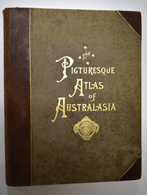
Book - Antiquarian book, Hon. Andrew Garran, Picturesque Atlas of Australasia Volume One, 1886
... geographical and contemporary information on parts of Australasia and in particular, New South Wales and Victoria including the Western District. There are several pages on Warrnambool and District. This is a seminal reference book and is of particular value to local researchers because of the section featuring sketches and descriptions of Warrnambool and District in the 19th Century. Warrnambool History Western District History Australian ...Contemporary and geographical record of Australasia in the 19th centuryThis is a leather covered book. The cover is decorated with gold panels of fruit and gold lettering on the spine and has a plastic cover to protect it. There is gilt edging on the 388 pages. It contains text, sketches, lithographs and some coloured maps and engravings on wood..non-fictionContemporary and geographical record of Australasia in the 19th centurywarrnambool history, western district history, australian history, australasian history, picturesque atlas of australasia, picturesque atlas of australasia volume 1 -
 Warrnambool and District Historical Society Inc.
Book - Antiquarian Book, Hon Andrew Garran, Picturesque Atlas of Australasia Volume Two, 1886
... This is a contemporary and geographical record of Australasia in the 19th century featuring the areas of Queensland, Tasmania, South Australia, Western Australia and New Zealand....Warrnambool and District Historical Society Inc. 2 Gilles Street (south of Merri St) Warrnambool great-ocean-road This is a contemporary and geographical record of Australasia in the 19th century featuring the areas of Queensland, Tasmania, South Australia, Western Australia and New Zealand. ...A contemporary and geographical record of Australasia in the 19th centuryThis is a leather covered book of 801 pages. The cover is decorated with gold panels of fruit and has gold lettering on the spine. The pages have gilt edges. It contains text, sketches, lithographs, maps and five loose maps. non-fictionA contemporary and geographical record of Australasia in the 19th centuryaustralasian history, antiquarian books, picturesque atlas of australasia, warrnambool, picturesque atlas of australasia volume 2 -
 Warrnambool and District Historical Society Inc.
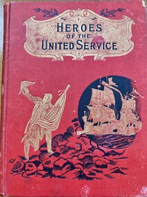
Literary work - Antiquarian Book, Heroes of The United Service, 1901
... geography,Spelling and dictation. Sadly he died in September 1901 from meningitis following influenza and pneumonia and is buried with other members of the Jackman family at the Clear Lake cemetery near Horsham. The two schools mentioned on the name plate St Patrick's and St Francis Xavier Colleges were both public Schools which were run by the Catholic order of priests, The Jesuits.(SJ) The bookplate is signed by Father Patrick Keating was one of the most highly regarded Jesuits to come to Australia...geography,Spelling and dictation. Sadly he died in September 1901 from meningitis following influenza and pneumonia and is buried with other members of the Jackman family at the Clear Lake cemetery near Horsham. The two schools mentioned on the name plate St Patrick's and St Francis Xavier Colleges were both public Schools which were run by the Catholic order of priests, The Jesuits.(SJ) The bookplate is signed by Father Patrick Keating was one of the most highly regarded Jesuits to come to Australia ...This book contains a number of stories which relate to heroes of the British Army and Navy . After a brief synopsis of the history of British military, it then commences from the conquest of Canada in 1759 and relates the stories of renown personnel through to the beginning of the 20th century.This book has a red cloth over card cover with black text mounted in a gold shield at the top of the cover with a gold figure of a sailor who is standing on black rocks. There is a gold image of two galleons inside a black circle. The spine has the title in black on a gold shield , similar to the front cover . The back cover is plain. It has 248 pages relating to the Armed Forces and 256 pages relating to naval stories.There are a number of colour plates and black and white drawings many depicting military scenes. Inside front and back covers are faced with brown and mustard coloured pages. There is a name plate inside the front cover. non-fictionThis book contains a number of stories which relate to heroes of the British Army and Navy . After a brief synopsis of the history of British military, it then commences from the conquest of Canada in 1759 and relates the stories of renown personnel through to the beginning of the 20th century.heroes of the united service, arthur jackman, jackman family, clear lake cemetery, jesuits st patricks college melbourne, jesuits st francis xavier melbourne, rector patrick keating -
 Warrnambool and District Historical Society Inc.
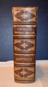
Book - educational encyclopaedia, Charles Beale & M. Gately, Gately's Universal Educator, 1886
... geography, legal matters, history, agriculture, mathematics, music and poetry. No information has been found on the two names in the inscription but the way the date has been written suggests an American or other foreign influence. This book is retained because of its antiquarian interest 19th century Australia ...An encyclopaedia and business guide (late 19th century)This book has a brown leather cover which is heavily embossed with brown and gold patterns and gold lettering, The spine is torn at the top and the cover is worn at the edges.The pages are gilt-edged and contain printed text and black and white sketches, illustrations, maps and diagrams. non-fictionAn encyclopaedia and business guide (late 19th century)19th century australia, 19th century encyclopaedia, 19th century business guide -
 Bendigo Military Museum
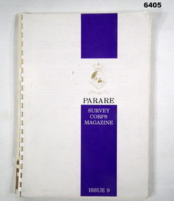
Magazine - "Parare" Survey Corps Magazine Issue 9, Royal Australian Survey Corps, 1993
... Military Geographic Information Pilot Project page 92. Royal Australian Survey Corps Aerial photography Team personnel list page 95. ...Military Geographic Information Pilot Project page 92. Royal Australian Survey Corps Aerial photography Team personnel list page 95. ...An annual magazine published for release on RASvy Corps birthday 1st July. All units with RASvy Corps are invited / expected to submit an article depicting their activities over the preceding years 1991 to 1993. 4Fd Svy Sqn Adventure training list pages 7, 8. Army Map Depot - Unit Ski Day, pages 20, 21. The William Patton Expedition - Locating his grave as part of the " Burke and Wills " expedition, list of personnel involved - page 43. 8 Fd Svy Sqn - names mentioned and photo - page 50. 4 Fd Svy Sqn (1992) names mentioned page 69. The G Res manning list on page 70. Names mentioned in "Unit sports pages 73, 74. Exercise Kokoda Cartographer July 1992 list of participants on Page 78. Iraq - The Gulf War, Topographic Support page 52. Adelaide (4 Fd Svy Sqn) 1992 page 65. 8 Fd Svy Sqn manning wind down list pages 89-90. Military Geographic Information Pilot Project page 92. Royal Australian Survey Corps Aerial photography Team personnel list page 95. Operation Belama 92 Team list page 96. Long term Schooling attendees and promotions, page 105. Litho Sqn Postings in and out pages 116-117. Special awards SGT Durrant page 113, SSGT SR Hill page 114. RASvy completes 1:50,000 scale mapping of the Pilbara Region page 121. 1st Topo Svy Sqn personnel mentioned on page 122. A4 sized booklet with soft glossy card covers, paper pages held together with a plastic spiral binder.army survey regiment, army survey regt, fortuna, royal australian survey corps, rasvy, asr -
 Bendigo Military Museum
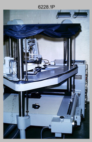
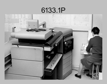
Photograph - Orthorectification Equipment - Army Survey Regiment, Fortuna, Bendigo, c1975, c1988
... geographic area. Once an image is orthorectified, features on the image are shown in their planimetric locations. The WILD OR1 orthophoto projector and workstation shown in photos .2P to.4P was introduced in the mid-1980s. It was the second-generation equipment used to orthorectify colour and monochrome film aerial photography, replacing the system introduced in 1973. See items 6124.5P and 6133.4P for more photographs of orthorectification equipment. Royal Australian ...Orthophoto mapping provided the Survey Corps with the capability to produce map products quickly in the event of a crisis. These are four photographs of equipment used by the Army Survey Regiment to produce orthophotomaps. The Wild GZ1 orthophoto projector shown in photo.1P was introduced in 1973 and was the first equipment used to orthorectify colour and monochrome film aerial photography. Height profiles were originally produced on a PEB8 Stereo profiler and later were software generated. Photos of the PEB8 are available in Victorian Collections item 6222.17P, photos .5P and .6P. In the same era the IBM 1130 computer; OMI/Nistri AP/C-3 analytical plotter with coordinatograph, OP/C orthophoto projector and Zeiss Planimat D2 stereoplotters were introduced. Orthorectification is the process of removing geometric distortions and scale errors/variations from images. Images have tilt and relief distortions that make it difficult to compare accurately a map and an image of the same geographic area. Once an image is orthorectified, features on the image are shown in their planimetric locations. The WILD OR1 orthophoto projector and workstation shown in photos .2P to.4P was introduced in the mid-1980s. It was the second-generation equipment used to orthorectify colour and monochrome film aerial photography, replacing the system introduced in 1973. See items 6124.5P and 6133.4P for more photographs of orthorectification equipment.These four photographs of orthorectification equipment were taken at the Army Survey Regiment at Fortuna, Bendigo, c1975 and c1988. The photos are on 35mm colour slides and scanned at 96 dpi. They are part of the Army Survey Regiment’s Collection. .1) - Photo, colour, c1975, Wild GZ1 orthophoto projector. .2) - Photo, colour, c1988, WILD OR-1 unrectified colour photo in carrier, orthorectified and re-scaled colour image. .3) & .4) - Photo, colour, c1988, WILD OR-1 Orthorectification Workstation.1P to .4P – Some of the equipment is annotated on the frame of the 35mm slides.royal australian survey corps, rasvy, army survey regiment, asr, army svy regt, fortuna -
 Bendigo Military Museum
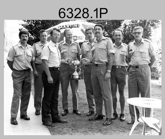
Photograph - Army Survey Regiment’s Rifle Shooting Team, Fortuna, Bendigo, c1979
... geographic mapping unit at the time to the Army Survey Regiment. The bent .303 rifle seen in photo .3P was retrieved from the bottom of Fortuna’s lake when it was drained for restoration. It is believed an excavator drove over the rifle before it was retrieved. Royal Australian ...This set of 10 photographs of the Army Survey Regiment’s victorious rifle shooting team was taken outside the Tavern at Fortuna, Bendigo in c1979. The rifle shooting competition was the ‘Irwin Trophy for Shooting’, a contest with the British Army’s 42nd Engineer Regiment, the equivalent military geographic mapping unit at the time to the Army Survey Regiment. The bent .303 rifle seen in photo .3P was retrieved from the bottom of Fortuna’s lake when it was drained for restoration. It is believed an excavator drove over the rifle before it was retrieved.This set of 10 photographs of the Army Survey Regiment’s rifle shooting team was taken at Fortuna, Bendigo in c1979. The photographs were printed on photographic paper and are part of the Army Survey Regiment’s Collection. The 35mm positive photographic proofs were scanned at 600 dpi. Larger prints of .1P, .3P and .10P were scanned at 300 dpi. .1) & 2) - Photo, black & white, c1979, Rifle Shooting Team - L to R: Warren ‘Waldo’ Shirley, John Waight, Peter Searle UK Exchange, CO LTCOL Bob Skitch, Jim Macdonald, John Harrison, Max Neil, Stan Vote. .3) - Photo, black & white, c1979, Rifle Shooting Team - L to R: Stan Vote, John Harrison, Max Neil, Warren ‘Waldo’ Shirley, Jim Macdonald, John Waight. .4) - Photo, black & white, c1979, Rifle Shooting Team - L to R: CO LTCOL Bob Skitch, Jim Macdonald, Stan Vote. .5) - Photo, black & white, c1979, Rifle Shooting Team - L to R: John Waight, Warren ‘Waldo’ Shirley. .6) - Photo, black & white, c1979, Rifle Shooting Team - L to R: Warren ‘Waldo’ Shirley, CO LTCOL Bob Skitch. .7) - Photo, black & white, c1979, Rifle Shooting Team - L to R: CO LTCOL Bob Skitch, Warren ‘Waldo’ Shirley, Stan Vote, Jim Macdonald, Max Neil. .8) - Photo, black & white, c1979, Rifle Shooting Team - L to R: Jim Macdonald, Max Neil, Stan Vote. .9) - Photo, black & white, c1979, Rifle Shooting Team - L to R: CO LTCOL Bob Skitch, Peter Searle UK Exchange, Warren ‘Waldo’ Shirley. .10) - Photo, black & white, c1979, Irwin Trophy for Shooting..1P to .10P –No personnel are identified.royal australian survey corps, rasvy, army survey regiment, army svy regt, fortuna, asr -
 Bendigo Military Museum
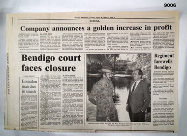
Newspaper - Army Survey Regiment farewells Bendigo
... As part of the CSP competitive tendering process, the ATSE Australian Public Service organisation was awarded the contract to continue to provide geographic support to the Australian Defence Force. ...As part of the CSP competitive tendering process, the ATSE Australian Public Service organisation was awarded the contract to continue to provide geographic support to the Australian Defence Force. ...A single folded page (Page 3) of the Bendigo Advertiser dated 30 April 1996 containing an article about the Army Survey Regiment handing over to the Army Topographic Support Establishment (ATSE). As part of the CSP competitive tendering process, the ATSE Australian Public Service organisation was awarded the contract to continue to provide geographic support to the Australian Defence Force. This article is about the handover.A single folded page (Page 3) of the Bendigo Advertiser dated 30 April 1996 containing an article about the Army Survey Regiment handing over to the Army Topographic Support Establishment (ATSE)royal australian survey corps, rasvy, fortuna, army survey regiment, army svy regt, atse -
 Kiewa Valley Historical Society
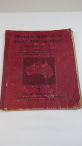
Book - Educational - School Atlas, Collins' Australian Clear School Atlas
... Australian schools used Atlases to teach students geography and the nationalities of countries worldwide....Kiewa Valley Historical Society Mount Beauty Information Centre 31 Bogong High Plains Rd Mt Beauty high-country Australian schools used Atlases to teach students geography and the nationalities of countries worldwide. ...Australian schools used Atlases to teach students geography and the nationalities of countries worldwide.Clare Roper was a resident of the Kiewa Valley. This atlas is of interest because it is circa 1950s and shows the world at this time.Thick red cardboard cover with black print and map of Australia on cover. It includes coloured maps of countries, black & white photos and an index at the back. On the inside of the cover both front and back it has black and white maps. There are 30 pages and it is bound. Circa 1950sCover page: handwritten "Margaret Tulloh / C. Roper / Margaret Tulloh / M.L.C. Some pages have been marked with pencilaustralian school atlas, clare roper -
 Bendigo Military Museum
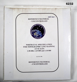
Manual - Portrayal Specification for Topographic Line Mapping at Scales1:50,000, 1:25,000 and 1:10,000, 16.07.1998
... Royal Australian Survey Corps RASvy Fortuna Army Survey Regiment Army Svy Regt ASR Director of Strategic Military Geographic Information DSMGI Plastic covered white four ring binder, 14 Chapters, 4 Annexes Portrayal Specification for Topographic Line Mapping at Scales1:50,000, 1:25,000 and 1:10,000 Manual Portrayal Specification for Topographic Line Mapping at Scales1:50,000, 1:25,000 and 1:10,000 DSMGI ...These specifications enabled the hard copy representation of digital topographic data for the Australian Defence Force (ADF) covering Australia and nearer regions.Plastic covered white four ring binder, 14 Chapters, 4 Annexesroyal australian survey corps, rasvy, fortuna, army survey regiment, army svy regt, asr, director of strategic military geographic information, dsmgi -
 Bendigo Military Museum
Photograph - Orthophotomap Workstation, Lithographic Squadron – Army Survey Regiment, Fortuna, Bendigo, 1988
... geographic area. Once an image is orthorectified, features on the image are shown in their planimetric locations. Royal Australian ...This collection of four photos was most likely taken at Lithographic Squadron, Army Survey Regiment, Fortuna, Bendigo in 1988. Orthophoto mapping provided the Survey Corps with the capability to produce map products quickly in the event of a crisis. These are four photographs of equipment used by the Army Survey Regiment to produce orthophotomaps. The OR1 orthophoto projector and workstation was introduced in the mid-1980s. It was the second-generation equipment used to orthorectify colour and monochrome film aerial photography, replacing the system introduced in 1973. Orthorectification is the process of removing geometric distortions and scale errors/variations from images. Images have tilt and relief distortions that make it difficult to compare accurately a map and an image of the same geographic area. Once an image is orthorectified, features on the image are shown in their planimetric locations. These four photographs of orthorectification equipment in operation were taken at the Army Survey Regiment at Fortuna, Bendigo, 1988. The photographs were on 35mm negative film and were scanned at 96 dpi. They are part of the Army Survey Regiment’s Collection. .1) to .4) - Photo, black & white, 1988, WILD OR-1 Orthorectification Workstation, SPR Carmel (Butler) Fauth.No personnel are identifiedroyal australian survey corps, rasvy, army survey regiment, army svy regt, fortuna, asr, litho -
 Bendigo Military Museum
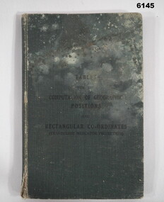
Manual - Mathematical Tables for the Computation of Geographic positions and Rectangular Coordinates, 1942
... Bendigo Military Museum 37 - 39 Pall Mall Bendigo goldfields Numerous mathematical tables for the computation of Geographical Positions and rectangular coordinates Royal Australian Survey Corps RASvy Fortuna Army Survey Regiment Army Svy Regt ASR "? ...Numerous mathematical tables for the computation of Geographical Positions and rectangular coordinatesHard covered Book, cloth covered, A5 in size, 169 pages, Title Page, contents Page, 5 x blank pages at front, 15 x blank pages at rear."? Slattery" , "Sgt RC Andrews. School Tac? Adm. Seymour" all crossed out, on 1st page inside cover. "Please Return to: Survey Directorate AHQ Victoria Barracks Melbourne" Front and rear pages.royal australian survey corps, rasvy, fortuna, army survey regiment, army svy regt, asr -
 Bendigo Military Museum
Manual - Australian Defence Force - Military Geographic Information Encyclopedia, Information Strategic Concepts Branch of the Australian Defence Force Strategic Command Division, Directorate of Strategic Military Geographic Information, 27 Aug 1998
... Bendigo Military Museum 37 - 39 Pall Mall Bendigo goldfields Military Geographic Information Encyclopedia in 3 Parts- Acronyms, Definitions, Web sites Royal Australian Survey Corps RASvy Fortuna Army Survey Regiment Army Svy Regt ASR Soft Film Cover, 3 Parts (Chapters), 77 Pages Australian Defence Force - Military Geographic Information Encyclopedia Manual Australian Defence Force - Military Geographic Information Encyclopedia Information Strategic Concepts Branch of the Australian Defence Force Strategic Command Division, Directorate of Strategic Military Geographic Information ...Military Geographic Information Encyclopedia in 3 Parts- Acronyms, Definitions, Web sitesSoft Film Cover, 3 Parts (Chapters), 77 Pagesroyal australian survey corps, rasvy, fortuna, army survey regiment, army svy regt, asr -
 Bendigo Military Museum
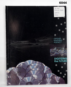
Manual - Defense Mapping Agency (US) - Digitizing the Future Third Edition, c1990
... Digitizing the Future Third Edition, An information booklet describing the types of new digital geographic products produced by the US Defense Mapping Agency. The Australian Army Survey Regiment went on to also produce many of these digital products...Bendigo Military Museum 37 - 39 Pall Mall Bendigo goldfields Digitizing the Future Third Edition, An information booklet describing the types of new digital geographic products produced by the US Defense Mapping Agency. The Australian Army Survey Regiment went on to also produce many of these digital products Royal Australian Survey Corps RASvy Fortuna Army Survey Regiment Army Svy Regt ASR Front Cover, "DO NOT REMOVE FROM CARTO SQN" Soft Cover Book, Paper Pages, 3 parts with Numerous Sections in each Part, Text, Diagrams and Photographs, Data Information Sheets, DMA Stock No: DDIPDIGITALPAC Defense Mapping Agency (US) - Digitizing the Future Third Edition Manual Defense Mapping Agency (US) - Digitizing the Future Third Edition US Defense Mapping Agency ...Digitizing the Future Third Edition, An information booklet describing the types of new digital geographic products produced by the US Defense Mapping Agency. The Australian Army Survey Regiment went on to also produce many of these digital productsSoft Cover Book, Paper Pages, 3 parts with Numerous Sections in each Part, Text, Diagrams and Photographs, Data Information Sheets, DMA Stock No: DDIPDIGITALPACFront Cover, "DO NOT REMOVE FROM CARTO SQN"royal australian survey corps, rasvy, fortuna, army survey regiment, army svy regt, asr -
 Kiewa Valley Historical Society
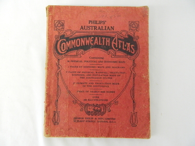
Atlas Australian Commonwealth, Philips' Australian Commonwealth Atlas, 1944
... This atlas, printed in 1944, details not only the geographic and political boundaries of the world as it was at that time but also the snap shot of life of the time. This snap shot in time covers the major Australian cities, the major farming, grazing, industrial and sporting/recreational activities. ...Kiewa Valley Historical Society Mount Beauty Information Centre 31 Bogong High Plains Rd Mt Beauty high-country This atlas, printed in 1944, details not only the geographic and political boundaries of the world as it was at that time but also the snap shot of life of the time. This snap shot in time covers the major Australian cities, the major farming, grazing, industrial and sporting/recreational activities. ...This atlas, printed in 1944, details not only the geographic and political boundaries of the world as it was at that time but also the snap shot of life of the time. This snap shot in time covers the major Australian cities, the major farming, grazing, industrial and sporting/recreational activities. Also there are snap shots of similar activities from other global areas. The period also covered World War II, detailed by a photo of "shell making", munitions, required by Australian soldiers. The great political and territorial changes made as a result of World War II can be clearly identified for example , Israel (the Jewish homeland). The various prewar colonies of major European nations.This atlas was used by children of a Kiewa Valley family and shows the value and the general educational exposure that these children had at this time. The rural setting and within the backdrop of a world war did not severely alter the life style of children in this region. The "news reels" shown in cinemas of cities and larger towns were the only visual realisations of major events of global significance available to these children. The information provided by this atlas allowed students to glimpse at what the "outside world" was. The majority of these students would possibly never see these regions for themselves. The great communication facilities of the late 1900s and beyond, was still only science fiction.This atlas has a thick (350 g/m) red cardboard cover with bold black lettering and shading. The cover is set out within a shield like frame. The shield is held up by two square markings, each with a four part circular pattern and a cord entwining two pendulum structures ending with a bowl figure at the bottom. There is a semi circular form enclosing a printed book contents list. The inside cover has the atlas title and contents and the publisher details. The atlas contain 56 pages of world and Australian maps, vegetation and rainfall maps. Within this atlas there are 27 double sided pages of black and white photographs depicting life styles, buildings, landscapes and prominent and significant to Australia males from 1652 to 1944. The pages are of approximately 200 g/m and have the yellow aged appearance.On front cover "Philips' Australian COMMONWEALTH ATLAS" and underneath "Containing" underneath "60 PHYSICAL, POLITICAL AND ECONOMIC MAPS". Publisher George Philip & Son, Limited 32 Fleet Street, London E.C. 4. Inside cover are: written, in freehand and in ink the following names and dates; "J.Muller Form V 1945", "L L Muller Form IV 1946", "N.J. Muller Form I + II + III 1948 +49 + 50" and "D Muller Form I 1949". also handwritten and in pencil is "Peter Leslie". On the last page is a small freehand sketch of Australia in biro.1940s school curriculum, rural education, 1940s atlas, australian atlas -
 Kiewa Valley Historical Society
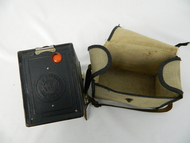
Bag Camera, circa 1920s
... The world, through Australia eyes, was still a very large planet and supply of "modern" lifestyle equipment emphasised the geographic isolation of Australia. ...This item was manufactured in a period where the cheapest containers for portable equipment was canvas. The market place for cheap cameras was still restricted to European, England and its colonies. It was well before the post World War II explosion of the Asian manufacturing juggernaut.This item shows one of the most popular avenues of not only bringing new "modern" age equipment into the Kiewa Valley but also providing the local market with actual overseas inexpensive merchandise. It was a time when the new European fashion and "new age" equipment took years to permeate into regional Australia. The world, through Australia eyes, was still a very large planet and supply of "modern" lifestyle equipment emphasised the geographic isolation of Australia. Post World War II emigrants and an increasing flow of tourists to Australia provided the contact needed by rural settlements to open up not only their social contacts but lifestyle activities.Canvas, yellow, cream in color and with a weave pattern on the external side. It has stitched brown laminated fabric boarders containing all ends and corners. A flap opening top fastened on one side by a large press stud (15mm). A brown coloured leather carry strap (adjustable and 10mm wide) fasted at either of the longitudinal ends of the bag.camera, case photography, hobby, personal equipment -
 Emerald Museum & Nobelius Heritage Park
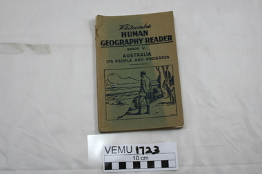
Book, Whitcombes Human Geography Reader Grade V. Australia It's People and Progress, 3rd Edition Revised, After 1940s
... Whitcombes Human Geography Reader Grade V. Australia It's People and Progress, 3rd Edition Revised...Whitcombes Human Geography Reader Grade V. Australia It's People and Progress, 3rd Edition Revised Book ..."Specially written to meet the requirements of the social studies (Geography) course in Victorian elementary schools."Paperback book with light cardboard cover.whitcombe's human geography reader grade v