
Showing 44 items matching "mill settlement"
-
 Marysville & District Historical Society
Document (item) - Memories document, James (Jim) Brown, MEMORIES OF ANDERSONS MILL & WILKS CREEK STATE SCHOOL 1940-1946, Unknown
... ...mill settlement...A document outlining Jim Brown's memories of living at the Andersons Mill and attending the Wilks Creek State School near Marysville. marysville victoria australia andersons no. 1 mill andersons no. 2 mill wilks creek state school mountain ash cumberland mill cambarville frank austin roy southwell colin album brenton smith alexander craig bernie goodwin don prentice kevin rye george bryan horrie wilson kevin webb jean young james (jim) brown michael (mick) brown eileen brown thomas (tom) brown mill settlement alfred edgar (mick) brown acheron valley bib gale george webb c.j. rowe e.j. anderson mount bismark mount kitchener ron anderson ballarat pine industries beat anderson A document outlining Jim Brown's memories of living at the Andersons Mill and attending the Wilks Creek State School near Marysville. ...A document outlining Jim Brown's memories of living at the Andersons Mill and attending the Wilks Creek State School near Marysville. The document relates to memories of the years of 1940 through until 1946.A document outlining Jim Brown's memories of living at the Andersons Mill and attending the Wilks Creek State School near Marysville.marysville, victoria, australia, andersons no. 1 mill, andersons no. 2 mill, wilks creek state school, mountain ash, cumberland mill, cambarville, frank austin, roy southwell, colin album, brenton smith, alexander craig, bernie goodwin, don prentice, kevin rye, george bryan, horrie wilson, kevin webb, jean young, james (jim) brown, michael (mick) brown, eileen brown, thomas (tom) brown, mill settlement, alfred edgar (mick) brown, acheron valley, bib gale, george webb, c.j. rowe, e.j. anderson, mount bismark, mount kitchener, ron anderson, ballarat pine industries, beat anderson -
 Coal Creek Community Park & Museum
Photograph (item) - Sawmill Interior, Coal Creek Community Park & Museum
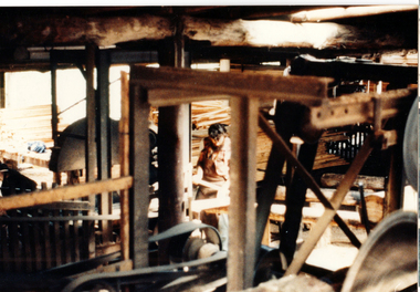
... The mill was essential to settlement towns, often being the first building to be constructed. ...The mill was essential to settlement towns, often being the first building to be constructed. sawmill timber worker pencilled on the reverse 'A8'. ...The interior of the timber sawmill was designed to replicate what a mill may have looked like in a small country town circa 1890s. The image shows a rough-hewn building made from tree trunks and raw timber. In the centre, a man is working on making timber planks - around him lat many more pieces. In front a large piece of machinery showing belt-driven parts. The mill was essential to settlement towns, often being the first building to be constructed. pencilled on the reverse 'A8'. Kodak watermarks.sawmill, timber worker -
 Flagstaff Hill Maritime Museum and Village
Functional object - Hand operated embossing document press, 1910
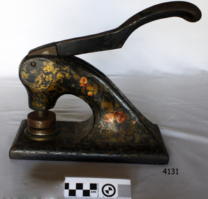
... The woollen mill was a vital part of Warrnambool for all but 22 years of the town’s history since it's the establishment in 1847 when the first land sales were held and white settlement began. ...The woollen mill was a vital part of Warrnambool for all but 22 years of the town’s history since it's the establishment in 1847 when the first land sales were held and white settlement began. ...The woollen mill was a vital part of Warrnambool for all but 22 years of the town’s history since it's the establishment in 1847 when the first land sales were held and white settlement began. In 1869 the Warrnambool Meat Preserving Company began operations on the mill site, in 1875, shareholders of the then defunct Warrnambool Meat Preserving Company happily sold the land and buildings on the Merri river to Warrnambool Woollen Mill Company Ltd for £5,000. The site was sold again in 1876 to grazer Robert Hood of Sherwood, who was chairman of directors of the failed company, which couldn’t raise sufficient capital to keep the works operating. The entrepreneurial Hood then used the existing plant to turn his own wool into tweed cloth. But just as the mill was starting to show a profit, a fire destroyed the building and plant on the night of 25 March 1882. So again, the mill was operational for six short years. Insurers only paid a fraction over 10% of the damage, Hood couldn't raise sufficient capital to rebuild on his own, and so the site lay unused until 1910. In 1908 Marcus Saltau and Peter John McGennan convinced the Warrnambool Chamber of Commerce to invest in a secondary industry with local capital. A public meeting in September 1908 agreed to raise £40,000, electing Saltau chairman of directors, a post he held for 34 years. A year later, using mostly local money, the Warrnambool Woollen Mill Company dispatched its first manager, John E. Bennett, to buy a plant and recruit 20 experienced staff from the Yorkshire woollen industry in December 1909. Another year more, the new mill was officially opened on 14 November 1910 by Marcus Saltau as company chairman and town mayor. Eighteen months on, in May 1912, the mill paid its first half-yearly dividend of 2 ½%. It was now working two shifts, with a year's orders to fill. In 1914 the mill ordered its own generator, providing the town with electricity and effectively doubling its plant size by October 1915, six months after Gallipoli. Thereafter, government orders for cloth and military supplies assured the mill’s success right through the First World War and on until 1923. A plant upgrade in 1922 for machinery to make worsted fabric drained profits, which, with a fall in demand, led to a loss in 1925. Profits were restored by the 1930s, despite the Depression, mostly due to tight management and robust marketing. Production boomed again during the Second World War, but soon foreign competition bit into profits, forcing the company to consolidate operations. The ‘50s and ‘60s were golden years for the mill. Security and growth gave the company confidence to trial Australia’s first electric blanket in 1958 and to install Swiss Sulzer looms in 1965. Over time, the building facades took on the modern look that the mill presented until it closed. The Dunlop company bought the mill in 1968, fending off a challenge from Onkaparinga in South Australia, and continued to expand by adding Wendouree Woollen Mill in the same year and Dream-spun Textiles a decade later, in 1979. Soon after that purchase, however, the mill began its slippery slide into decline. Dunlop sold to its former rival bidder Onkaparinga Woollen Co. Ltd in 1982, which in turn was taken over by Macquarie Worsted's only a year later, in 1983. Operations remained stable for a decade until 1994 when the Macquarie Group signaled that its newly rationalised operations left no room for the Warrnambool investment. The final operator of the mill was The Smith Family charity group, which ran the site by agreement with the Warrnambool City Council and a state government grant in that same year, 1994. The mill became more of a fabric recycler than a manufacturer. The site was sold to private operators in February 2003 and rezoned four months later to allow for the mixed housing development. The embossing press is significant for its association with the Warrnambool Woollen Mills 1910-1968, a major employer in the Warrnambool district. The press is also significant as an example of commercial office equipment used in the 19th and 20th century.Press, metal, for Company seal of Warrnambool Woollen Mill, stamping their brand as Western District Worsted Mills Pty Ltd. Metal is black with red and gold floral markings. Inscription of stamp reads "WESTERN DISTRICT WORSTED MILLS PROPRIETRY LIMITED" flagstaff hill, warrnambool, shipwrecked-coast, flagstaff-hill, flagstaff-hill-maritime-museum, maritime-museum, warrnambool woollen mills, western district worsted mills proprietry limited, worsted fabric, printing press, logo printing press, stamp printing press, shipwreck-coast, flagstaff-hill-maritime-village -
 Flagstaff Hill Maritime Museum and Village
Wagon, circa 1850s
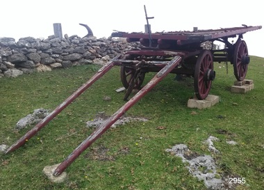
... settlement. The wagon is significant for its historical and economic association with the local Warrnambool business of Manifold & Bostock. These men had leased and owned vast tracts of land and operated businesses around the district together at various times often associated with the farming industry. One example is the Manifold & Bostock store and flour mill ...Bostock & Manifold were all from pioneering families in the Western District of Victoria almost from the time of settlement. Family history: The Bostock family were prominent in Warrnambool from the 1850s to the 1880s. Patriarch Robert Bostock had in 1813 been transported to Sydney from Sierra Leone for having 'felonious traded in slaves' and sentenced to 14 years transportation. He moved to Tasmania in 1821 where he died in 1847. A number of his children came to Port Phillip. Edward Robert Bostock held the Jellabad run from 1849 to 1853. George Bostock (1826-1858) was a Warrnambool Shire Councillor in 1856. Thomas Edward Bostock (1828-1874) was a Shire Councillor in the late 1860s. Augustus Bostock (1833-1920) lived in Warrnambool. Augustus Bostock was the 9th child of Robert and Rachael Bostock of Vaucluse Epping Forest, Van Diemen's Land. He was only 4 years old when his mother died. He was inspired by his father to seek his fortune in the Western District of Victoria. He arrived around 1850. He married Margaret Aitkin in July 1865. Augustus owned several properties in the district and leased others. He sat on the court of Warrnambool, Mortlake or Hexham as required. He resided at Marramook in Hawkesdale and later moved to Vaucluse in Hopetoun Road Warrnambool, where he died in 1920 at the age of 87. The Wagon is significant locally and state wide for its association with Augustus Bostock who was involved in many aspects of life in the Western District of Victoria, racing, cricket, and social activities to name a few. Bostock & Manifold were all from pioneering families in the Western District of Victoria almost from the time of settlement. The wagon is significant for its historical and economic association with the local Warrnambool business of Manifold & Bostock. These men had leased and owned vast tracts of land and operated businesses around the district together at various times often associated with the farming industry. One example is the Manifold & Bostock store and flour mill from which the wagon dray is believed to have been associated with for the delivery of goods. Their flour mill began operation in 1850 in 7-17 Stanley St South Warrnambool and was known as “Jetty Mills” Manifold and Bostock in 1858 purchased the Mill from John and G Elliot (brothers) with half an acre of ground and a cottage for £1600. It appears addresses of the company changed over the years as the town grew. These are listed in “Jones, Lewis & Peggy flour mills of Victoria” showing the company operating from, Fairy Street and later at the Merri River near the cutting, known as Banyan and Merri Streets. The company ceased trading in 1870. The Wagon Dray is also an example of agricultural freight and general transportation during the 1800 and 1900 century.A four-wheeled wooden horse-drawn wagon with flat top described as a Wagon Dray in historical writings. Painted brown and black. The wagon has rear brakes, wooden, operated from a metal handle at the front of the Wagon. Front wheels are attached to a turnstile to allow easy turning of the wagon. This flat-topped, horse driven, four-wheeled Wagon was used for cartage by the business of Manifold & Bostock, Warrnambool. The original sign writing of the wagon is obscured or painted over. There is a feint mark of lettering to the sides and back edges of the cart Manifold & Bostock. "Manifold and Bostock" very feintflagstaff hill, warrnambool, shipwrecked-coast, flagstaff-hill, flagstaff-hill-maritime-museum, maritime-museum, flagstaff-hill-maritime-village, cartage, manifold and bostock of warrnambool, manifold family of western victoria, bostock family of western victoria, four wheeled wagon, wagon, horse drawn wagon, farm wagon, aitkin, aitkin bostock manifold, dray, aitkin family, cart, aitken, flour mill -
 Flagstaff Hill Maritime Museum and Village
Equipment - Gauze & Box, Flexlock Products, Early - Mid 20th Century
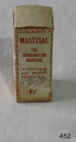
... settlement days of Victoria could take quite some time, especially in remote areas. From 1888 First Aid Kits and instructions became available for work sites, offices, community groups and individuals, helping to bridge the gap between the accident and the arrival of medical assistance. Gauze was widely used in many medical conditions. Flagstaff Hill Warrnambool Shipwrecked-coast Flagstaff-Hill Flagstaff-Hill-Maritime-Museum Maritime-Museum Shipwreck-coast Flagstaff-Hill-Maritime-Village First Aid Bandages Dressings Medical Mastisac ‘The combination Bandage. A convenient and effective FIRST AID. Prepared and distributed by Flexlock products, 15 Mills ...When used as a medical dressing, woven gauze is usually made of cotton. It is especially useful for dressing wounds where other fabrics might stick to the burn or laceration. Many modern medical gauzes are covered with a perforated plastic film such as Telfa or a polyblend which prevents direct contact and further minimizes wound adhesion. Also, it can be impregnated with a thick, creamy mixture of zinc oxide and calamine to promote healing, as in Unna's boot. (An Unna’s boot is a special gauze (usually 4 inches wide and 10 yards long) bandage, which can be used for the treatment of venous stasis ulcers and other venous insufficiencies of the leg. It can also be used as a supportive bandage for sprains and strains of the foot, ankle and lower leg. The gauze is impregnated with a thick, creamy mixture of zinc oxide and calamine to promote healing. It may also contain acacia, glycerin, castor oil and white petrolatum.) Gauze is also used during procedures involving accidental tooth loss; either the gauze is used to provide pressure as the tooth is moved back into its corresponding socket, or the tooth is wrapped in gauze and placed in milk or saline to keep it alive while the tooth is being transported or prepared for reinsertion. https://en.wikipedia.org/wiki/GauzeAccess to emergency medical help in early settlement days of Victoria could take quite some time, especially in remote areas. From 1888 First Aid Kits and instructions became available for work sites, offices, community groups and individuals, helping to bridge the gap between the accident and the arrival of medical assistance. Gauze was widely used in many medical conditions.Gauze and box entitled "MASTISAC?. The Combination Bandage" Bandage is complete with instructions for use inside.Mastisac ‘The combination Bandage. A convenient and effective FIRST AID. Prepared and distributed by Flexlock products, 15 Mills Street, Albert Parkflagstaff hill, warrnambool, shipwrecked-coast, flagstaff-hill, flagstaff-hill-maritime-museum, maritime-museum, shipwreck-coast, flagstaff-hill-maritime-village, first aid, bandages, dressings, medical -
 The Beechworth Burke Museum
Photograph, Estimate 1999
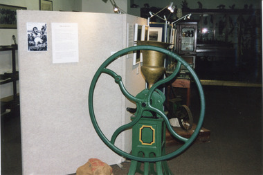
... settlement...Living in country towns...Making regional centres...Preserving traditions and commemorating...Farming and agriculture...exhibitions...Burke Museum exhibitions...building local economies...transforming land...Victorian agricultural history...Marketing and promoting agricultural products...The Harvest exhibition...harvests...Victorian gold rush towns...grain mill...This photograph may be of interest to researchers who wish to observe an image of the Purshouse grain mill. beechworth Burke Museum Promoting settlement Living in country towns Making regional centres Preserving traditions and commemorating Farming and agriculture exhibitions Burke Museum exhibitions building local economies transforming land Victorian agricultural history Marketing and promoting agricultural products The Harvest exhibition harvests Victorian gold rush towns grain mill BM Purshouse crops and grain Baking Industry Victoria Obverse: THE HARVEST / THE HARVEST Reverse: 2854 Colour rectangular photograph printed on matte AGFA photographic paper. ...This photograph was taken in 1999 at 'The Harvest' exhibition at the Burke Museum for members of Baking Industry Victoria. The grain mill, manufactured by B.M. Purshouse in Wolverhampton, England, was of special interest.This photograph is of primary social significance to the Beechworth community because it depicts a 19th-century grain mill, manufactured by B.M. Purshouse in Wolverhampton, England, which was probably used at flour mills in the Ovens District, such as that at Tarrawingee, which opened in 1866. The purchase of agricultural machinery such as the grain mill accompanied the expansion of agriculture, including grain growing, in the Ovens District following the gold mining prosperity of the 1850s. This photograph may be of interest to researchers who wish to observe an image of the Purshouse grain mill.Colour rectangular photograph printed on matte AGFA photographic paper.Obverse: THE HARVEST / THE HARVEST Reverse: 2854beechworth, burke museum, promoting settlement, living in country towns, making regional centres, preserving traditions and commemorating, farming and agriculture, exhibitions, burke museum exhibitions, building local economies, transforming land, victorian agricultural history, marketing and promoting agricultural products, the harvest exhibition, harvests, victorian gold rush towns, grain mill, bm purshouse, crops and grain, baking industry victoria -
 The Beechworth Burke Museum
Photograph, 1999
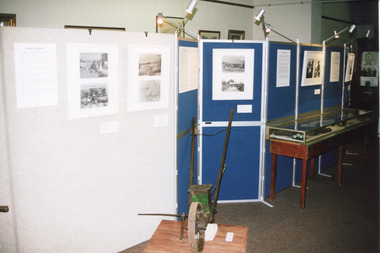
... mill made by B. M. Purshouse in Wolverhampton, United Kingdom, was of special interest during the exhibition. This photograph is of historical and research significance, connecting with various themes such as farming, adapting to diverse environments, and the promotion of settlement in Victoria. ...Taken in 1999, the photograph depicts a section of “The Harvest” exhibition held at the Burke Museum between May 1st and June 20th 1999 as part of the Baking Industry Victoria. In the foreground is believed to be an old seed distributor. The grain mill made by B. M. Purshouse in Wolverhampton, United Kingdom, was of special interest during the exhibition. This photograph is of historical and research significance, connecting with various themes such as farming, adapting to diverse environments, and the promotion of settlement in Victoria. The photograph is an example of an exhibition held at the Burke Museum in 1999, demonstrating the communal interest of Beechworth in their farming history. The photograph contains a strong interpretive capacity as it demonstrates the importance of farming to Beechworth and Beechworth's history, revealing the enduring connection between the local community and the surrounding land. The historical and research value of the photograph is further enhanced by the depiction of historical farming machinery, providing a means for future generations to view historical machines used in farming. Colour rectangular photograph printed on photographic paper.Reverse: 2857burke museum, the harvest, exhibition, baking industry, grain mill, b. m. purshouse, beechworth, baking industry victoria, seed, seed distributor -
 The Beechworth Burke Museum
Photograph, 1999
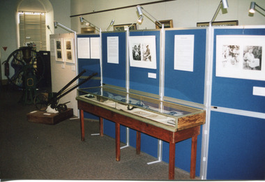
... mill, which can be seen in the background, was made by B. M. Purshouse in Wolverhampton, United Kingdom, and was of special interest during the exhibition. This photograph is of historical and research significance, connecting with various themes such as farming, adapting to diverse environments, and the promotion of settlement in Victoria. ...Taken in 1999, the photograph depicts a section of “The Harvest” exhibition held at the Burke Museum between May 1st and June 20th 1999 as part of the Baking Industry Victoria. In the foreground is depicted a seed distributor. The grain mill, which can be seen in the background, was made by B. M. Purshouse in Wolverhampton, United Kingdom, and was of special interest during the exhibition. This photograph is of historical and research significance, connecting with various themes such as farming, adapting to diverse environments, and the promotion of settlement in Victoria. The photograph is an example of an exhibition held at the Burke Museum in 1999, demonstrating the communal interest of Beechworth in their farming history. The photograph contains a strong interpretive capacity as it demonstrates the importance of farming to Beechworth and Beechworth's history, revealing the enduring connection between the local community and the surrounding land. The historical and research value of the photograph is further enhanced by the depiction of historical farming machinery, providing a means for future generations to view historical machines used in farming.Colour rectangular photograph printed on photographic paper.Reverse: 2855burke museum, the harvest, baking industry, baking industry victoria, seed distributor, grain mill, b. m. purshouse, beechworth, exhibition -
Federation University Historical Collection
Book, Frank Hurley, An Event That Never Happened: The history and politics of decentralisation in Victorian and New South Wales 1885-1985 (Thesis), 1989
... settlement acts...urbanisation...decentralisation league...war and reconstruction...central planning...town planning...victorian Decentralisatoin League...Owen paper mill...Frank hurley thesis doctorate decentralisation ppoulation economics policy Closer settlement acts urbanisation decentralisation league war and reconstruction central planning town planning victorian Decentralisatoin League Owen paper mill Slough Estate Noel Mobbs Ballarat Common Edgar Bartrop Australian Paper Mills Bendix Mintex ball ballarat development committee Red hard covered thesis undertaken for a Doctory of Philosphy ot the University of Melbourne. ...This thesis is an account of movements and policies for decentralisation of population and economic activity away from metropolitan to non-metropolitan areas in Victoria and New South Wales between 1885 and 1985. Red hard covered thesis undertaken for a Doctory of Philosphy ot the University of Melbourne. frank hurley, thesis, doctorate, decentralisation, ppoulation, economics, policy, closer settlement acts, urbanisation, decentralisation league, war and reconstruction, central planning, town planning, victorian decentralisatoin league, owen paper mill, slough estate, noel mobbs, ballarat common, edgar bartrop, australian paper mills, bendix mintex, ball, ballarat development committee -
Federation University Historical Collection
Document, Zelda Martin, Central Victorian Goldmining towns - Boom Towns or Ghost Towns?, c1996
... mills in Sandhurst without interfering with the drainage of the town and the roads in the neighbourhood. [.15] Resource No.8: Camel display book titled Resource No. 8. Aborigines *Lists of book titles - +"Readings in Victorian prehistory" +"The Aborigines of Port Phillip" +Aboriginal languages and clans" +"A History of the Port Phillip District" +"Langi Ghiran 1: Aboriginal Rock...." +"Koorie History: sources for aboriginal studies in the State Library of Victoria", ed. Tom Griffiths, Melb. Friends of the State Library, 1989 +"The Public Lands of Australia Felix"; settlement...mills in Sandhurst without interfering with the drainage of the town and the roads in the neighbourhood. [.15] Resource No.8: Camel display book titled Resource No. 8. Aborigines *Lists of book titles - +"Readings in Victorian prehistory" +"The Aborigines of Port Phillip" +Aboriginal languages and clans" +"A History of the Port Phillip District" +"Langi Ghiran 1: Aboriginal Rock...." +"Koorie History: sources for aboriginal studies in the State Library of Victoria", ed. Tom Griffiths, Melb. Friends of the State Library, 1989 +"The Public Lands of Australia Felix"; settlement ...Zelda Martin was a PhD candidate at the University of Melbourne.[.1] 4th item in light blue display book titled Research Approach/Overview of Chapters/Confirmation of Canditure/Chapters1,2,3&4 of proposed thesis. *Twenty-seven page article on Victorian goldfields towns titled: Central Victorian Goldmining Towns - Boom Towns or Ghost Towns. The article was written during the author's PhD study. It outlines the context methodology, and resources and the chapters of the proposed thesis: (1) Central Victorian Goldmining Towns - The Context (2) Contemporary Views of the Factors Necessary for Town Growth (3) Outward Manifestations of Town Growth (4) The Trappings of Government (5-9) The Main Towns and Their Hinterland. [.2] 5th item in Light Blue display book as above item. *Chapter 1 of proposed thesis titled 'Pick, Shovel and Tin Dish Mining.' Covers in Section A: Central Victoria - Pre 1851: Aborigines in Central Victoria, Squatters, and Government. Section B: The years 1851-1854: The Early Gold Rushes, Government Reaction, Township Surveys, Legislation, Town Development, Local Government and Early Settlement. [.3] 6th item in Light Blue display book as above item. *2A of proposed thesis titled 'Contemporary Views of the Factors Necessary for Town Growth'. Similar information to Chapter 1 plus extra re towns and maps. Sections: Introduction, Context of Place - Geographical Towns Listed, The Context of Time - Pre1851 Aborigines, Governance of Port Phillip, The Squatters, The Villages of Central Victorian Highlands, Conclusion, Condensed Version of Chapter2B. [.4] 7th item in Light Blue display book as above item. *Chapter2B of proposed thesis. Sections: Area of Research, Schools, Banks, Newspapers, Progress Association, Town Development - Sandhurst (Bendigo), Ballarat, Castlemaine,, Maryborough, Ararat and Stawell. [.5] 8th item in Light Blue display book as above item. *Chapter 3 of proposed thesis titled 'Outward Manifestations of Town Growth'. Sections: Introduction, Contemporary Writing, Educationalists, The Bankers, The Townsfolk, Current Theory, General Theories of Urban Development, and Conclusion. [.6] 9th item in Light Blue display book as above item. *Chapter 4 of proposed thesis titled 'Trappings of Government' Sections: Introduction, Early Government Attitudes to Mining and Town Development, Law and Order, Township Surveys, Legislation, Local Government, Transport and Communication, The People and Lobbyists. [.7] 10th item in Light Blue display book as above item. *'The Rise and Fall of Central Victorian Goldmining Towns'. Includes a map showing main Goldfields, a table showing towns and villages at two points in time - 1857 and 1871; a Bibliography of Primary and Secondary Sources. [.8] Resource No1. Black display book titled Local Towns 1 : Alma: *Brief history *Directory *Maps Amphitheatre / Mountain Hut: *Brief History Post Office Directory Ararat: *Brief History *Post Office Directory 1869 - Alphabetical Listing by Occupation *Ararat - Prominent Citizens of 1858 *Langi-Morgala Museum Avoca: *Brief History *Excerpts from 'Avoca The Early Years', Margery and Betty Beavis; pg1 - Beginnings; pg11 - The Midas Touch; pg25 - Local Gold Escorts; pg27 - A Town is Born; pg51- The Administration of Justice; pg53 - The Ways of the Law; pg61 - News of the Day; pg65 - A Time to Play; pg72 - Land Ownership *Post Office Directory (Bailliere's) 1869 *Tourism Map and Information of area *Historic Avoca - A 5.5km Tour *Avoca & the Pyrenees Region - information pamphlet Ballarat: *Early History of Ballarat - Ballarat Historical Society, Publication No.1: origin of the name; Ballaarat - the Beginning; Fabulous Yields from the Ballaarat Goldfield; *Streetscape Lydiard Street. *Hand drawn map showing Leigh River, Old Portland Bay Road, plaque on road to Colac; etc. *Newspaper article re 'The Theatre Royal' ( which stood in the vicinity of the current Owen Williams store) - 'The News'15/04/1998 *Article - 'Ballarat's Mechanics' Institute Lives On' Ballarat Courier, 14/09/1985 *Article - Standing the Test of Time' The News 17/11/1993 re The Mechanics Institute & picture of the Reading Room *'Ballarat a Study of a City, Phyllis Reichl, pub. Nelson, 1968; no.3 place, time and people field studies series *Investigator Vol.33 No.2, 1998 Geelong Historical Society. Article on pg75 describes Ballarat in 1861 *Folded poster - 'Ballarat 100' a history of telegraph communication, pub. Telecom. Beaufort (Fiery Creek): *Brief history *Post Office Directory [.9] Resource No.2 Black Folder Titled Towns cont.No2 Bendigo (Sandhurst): *'Family & Local History at the Bendigo Library - 1851-2001 150 years of gold'. *Bendigo Government Camp in 1853 illustration; key to sketch and names of Government officers stationed there *Excerpts from 'Bendigo and Vicinity' Adolph Haman *The Bendigo Goldfield Registry - pgs 1-7 Introduction *Excerpt: 'Breaking the Grip' *Excerpt: The Most Go-Ahead Place *Excerpts from 'History of Bendigo' - anti license agitation; laying out of town; proposed railway; gold calls and dividends; the Sandhurst Municipality; journalism *Bibliography Blackwood: *Excerpts from 'Aspects of Early Blackwood - The Goldfield, the Landmarks, the Pioneers' Alan J Buckingham and Margaret F Hitchcock, JG Publishing,1980 Buninyong: *A Brief History *Investigator Vol1 No.2 Feb 1966 Geelong Historical Society. Pg3 - Article re gold escort route - Mt Alexander to Adelaide - (see a simple monument on the Western Highway a few miles out of Horsham. Pg 15 - Ballarat Excursion - re the finding of gold. *Three articles published by Buninyong and District Historical Society Inc: (Magpie Exploration; Finding Gold In The Green Hills; Magpie Exploration; Burnt Bridge to Cargarie to Mt Mercer) *Copies of newspaper articles/items *Buninyong Street Directory Carisbrook: *In the Beginning There Was Carisbrook *The History of the Carisbrook Racecourse Carngham / Snake Valley: *Brief History *Directory Castlemaine: *Directory 1865-1866 - Alphabetical and Street *Poster - Castlemaine A Contemporary Guide "The Great Centre" 1866 - A Contemporary Guide to the Fascinating Past *Pamphlet - Castlemaine District Community Hospital *Map - Castlemaine, Maldon & Surrounding Districts *Map and Information - The Dry Diggings Track - a 55kl walk among historic goldfields relics ( Castlemaine Fryerstown Vaughan Mt Franklin Hepburn Daylesford) *Postcard - Former Court House *Directory 1867 - Alphabetical, Trade [.10] Resource No.3 Grey folder Titled Towns 3 Creswick to Maryborough Creswick: *Brief History *Booklet - "Creswick Cemetery Walk" *Booklet - The Buried Rivers of Gold Heritage Trail Creswick *Creswick Historical Museum Information Sheet *Chronological History of Creswick *Alphabetical Directory of the Borough of Creswick *Creswick's Creek Directory 1856 *Historic Creswick Walking Tour *A Brief Account of the Schools of Creswick - Past and Present *100 Years of Railway Travel in Creswick *The Berry Deep Leads *The Spence Home at Jackass Gully in the Creswick State Forest ( William Guthrie Spence - Pioneer) *The New Australian Mine and the 1882 Disaster *Creswick District News, Issue 7, July August 1999 *The Creswick Miners Walk - Information and Map *Maps Chewton: *Brief History *Directory Clunes: *Brief History *Clunes Street Directory Daylesford: *Brief History *Notable Bushfires in Daylesford District Over More Than a Century - "Black Thursday" 1851; 1862; 1899; the Disastrous Hepburn Fire of 1906; 1939; 1944; 1969. *Post Office Directory -Daylesford and Hepburn Dunolly / Inkerman: *Brief History *Directory *Pamphlet - Goldfields Historical Museum *Pamphlet - Historic Dunolly - Victoria's Best Kept Secret *Map of Gold Workings at Dunolly Area - showing where the main gold rushes occurred *Brief History - Inglewood *Directory - Inglewood - Name Occupation, Dwelling Kingower: *Brief History *Directory - Name / Ocupation / Dwelling Linton / Happy Valley / Piggoreet: *Brief History *Directory - Lintons McIvor: *"A History of the Shire and the Township of Heathcote" by J.O. Randell Majorca: *Brief History *Official Post Office Directory 1869 - Name / Occupation/ Address Maldon (Tarrangower): *Brief History Part 1 *Brief History Part 2 *Post Office Directory *List - Alphabetical Order by Names plus Business and Trade (Tarrangower Times Oct/1858) *List - Alphabetical Order by Trade plus Name and Business *Directory - Name / Occupation / Dwelling Maryborough: *Worsley Cottage - built by Arthur Worsley, a contractor in stonework in 1894 [.11] Resource No. 4 Blue Display Book titled Towns 4 Moliagul to Stawell Moliagul: *Brief History *Moligul Legislative Assembly (Voting?) List - Names and Occupations *Moliagul Victorian Post Office Directory 1868 - Name / Ocupation / Address / Comments *"The Welcome Stranger" gold nugget *The Sunday School *The Welcome Stranger Discovery Walk - information and map Moonambel (Mountain Creek) Redbank *Brief History *List of names extracted from advertisments of the Pioneer and Mountain Creek Advertiser 16/02/1861. *Bailliere's Directory 1869 - Alphabetical List of Name / Occupation / Place St Arnaud: *Brief History Sebastapol: *Brief History *Directory 1869 - Alphabetical by Name; plus occupation and address. Browns and Scarsdale: *Brief History *Browns Street Directory - Name and Occupation Smythesdale: *Brief Description *Smythesdale Street Directory -Name and Occupation Stawell (Pleasant Creek) *Brief History *Victorian Official Post Office Directory - Name /Occupation / Dwelling *Chronology - 1841-1920 *Production of gold statistics - 1879 - 1900 *Big Hill *Extracts from "The Golden Years of Stawell". Chapt 1 - Stawell's Coming Out. Capt. 2 - The Gold Rush. Caapt.3 - Cradle of Democracy. Chapt.4 - The Reefs Becomes Stawell. Chapt. 5 - Rushing In. Chapt.6 - The Pioneers. Chapt 7 - The Decade of Optimism. [.12] Resource No. 5: Blue Display Book titled 'Towns Steiglitz to the The Golden Triangle. Steiglitz: Brief History Victorian Post Office Directory 1869 *Map of Steiglitz *List of maps relevant to Steiglitz history *Information 6 tables of data from "Reports of Mining Surveyors Talbot (Back Creek) Brief History Taradale: Post office Directory 1869 - Name/Occupation/Street. Also list in alphabetical order by Occupation Taradale *Chronological Reference to Taradale Mines *Water - The Coliban System of Waterworks *Joseph Brady *The Syphon Tarnagulla (Sandy Creek) *Brief History *Tarnagulla Businessmen Cameos to give depth to advertisments in 'The Tarnagulla Courier' various issues 1864-1871 *Directory - Name/Occupation /Address *List - Name/Business/Trade Wedderburn (Koorong) *Brief History *List - Name/Occupation The Golden Triangle: *The Early Rushes - Wedderburn / Moliagul / Sandy Creek - Tarnagulla / Jones Creek - Waanyarra / Kingower / Dunolly - Goldsborough / Inglweood *Census of 1857 - Population / Occupations *1858-1871 - A Time of Consolidation- Wedderburn / Moliagul / Sandy Creek- Tarnagulla / Arnold *Census 1871 - Population *Information gleaned from the census data - Demographics / Population / Occupations / marital / Birthplace / Religion / Literacy/ Occupation and Housing Cameos *Graphs - Birthplace of settlers /Male-Female Ratio / Married males / Children under 15 as Percentage of Population / Religion *Census 1857 - Statistical data *Maps *Bibliography [.13] Resource No. 6 - Black Display Book Information and Research in Central Victoria including: *Banking - Research from ANZ Bank Archives *Institutions - also includes articles listed from the Ballarat Times Newspaper *Australian mining History Association - A.M.H.A. Bibliography *Australia's Mining History * Bibliography - Land Surveys Victoria - *1853 Administration (Statistics and Other) includes: schools / ministers of religion / police / military / local administration / licences for sale of spirits / distances between various Victorian gold fields. * Victoria Government Gazette (Copy) - N0. 116, 12/12/1854 includes: Gold Felds Commission of Enquiry & No. 85, 15/09/1854 - Addresses presented to the Lieutenant Governor (Sir Charles Hotham) during his tour through the Gold Fields of Victoria,1854. Addresses on behalf of : the people of Bendigo; Members of the Church of England, Bendigo; Members of the Wesleyan Church on the Bendigo Gold Fields; Bendigo Gold District General Hospital; the Bendigo Prospecting Association; Committee of the Bendigo Local Exhibition; Bendigo District Medical Association; Coloured Americans Resident at Bendigo; German Inhabitants of Bendigo; Landowners, Inhabitants, and Miners of Castlemaine; Inhabitants of Forest Creek; Inhabitants of Heathcote and Gold Miners of McIvor; Residents and landholders of the District of Bacchus Marsh; Inhabitants of Kilmore and Vicinity. *Gold Fields Correspondence 1853: letter from Lieutenant Colonel Valiant, (Officer commanding the Troops in Victoria) to the Lieutenant Governor re threatened disturbance at Sandhurst (Bendigo) regarding the Gold License Fee. * Extracts from a book "Victoria" re Gold Fields Commission of Enquiry involving mainly Ballarat and Castlemaine and a chapter titled 'A Tour to the Victorian Gold-Fields' *Lists of central Victorian newspapers - listed by date published 1851to 1874; by first date available to State Library. *A list of cities and towns showing County, population in 1861 &1871, and municipal status. [.14] Resource no.7. Black display book. *Reference: Papers presented to Parliament Victoria - 1859-1860 4 volumes - relevant sections copied. Contains information on Branches of Government. General / Finance / Gold / Gazette / Commission and Warrant / Statistic. *Gold Fields Act. In accordance with the Act the gold fields are divided into six districts - Ballaarat, Castlemaine , Sandhurst, Avoca, Ararat, and Beechworth.. Official staff in each gold district consists of a Resident Warden, Wardens, Wardens' Clerks, Bailiffs, Chinese Protectors, Chinese Interpreters, and Mining Surveyors. *Gold Receiver *Gaols *Police magistrates and Clerks of Petty Sessions, etc. *Field Branch *Immigration and Emigration Overland - Chinese - 1859 *Population on the Goldfields *The Geological Survey - The Government Geologist is assisited by staff from four branches - the office Branch; the Publishing Branch; the Field Branch and the Museum Branch. *Commission to Enquire Into Sludge dated 10/02/1859 (Some sections copied) - Report to the Honorable Chief Commissioner of Public Works, Melbourne re the mode of carrying the sludge from the puddling mills in Sandhurst without interfering with the drainage of the town and the roads in the neighbourhood. [.15] Resource No.8: Camel display book titled Resource No. 8. Aborigines *Lists of book titles - +"Readings in Victorian prehistory" +"The Aborigines of Port Phillip" +Aboriginal languages and clans" +"A History of the Port Phillip District" +"Langi Ghiran 1: Aboriginal Rock...." +"Koorie History: sources for aboriginal studies in the State Library of Victoria", ed. Tom Griffiths, Melb. Friends of the State Library, 1989 +"The Public Lands of Australia Felix"; settlement and land appraisal in Victoria1834-91 with special reference to the Western Plains", J.M.Powell, Melb. Oxford University Press 1970 +*Bibliography of the Victorian Aborigines' from the earliest manuscripts to 31st December 1970, Massoa, Aldo, Melb. Hawthorn Press, 1971 +"Aborigines in Colonial Victoria, 1836-1886", M.F. Christie, Sydney University Press, 1979 +"Urban and Industrial Australia: readings in Human Geography" ed J.M. Powell, Melb. Sorrett Pub. 1974 *Extracts: -Processes of Pioneer Settlement - The Squatting Occupation of Victoria, 1834-60. J.M. Powell -Areal Variations in the Class Structure of the Central-Place Hierarchy. P. Scott - Volume1 and Volume 2: Notes Relating to the Habits of the Natives of Other Parts of Australia and Tasmania. Compiled from various sources for the Government of Victoria by R Brough Smyth. John Curry, O'Neil, Melb. 1st pub. Melb. 1876. p31-45 - Numbers and Distribution of the Aborigines in Victoria -Victorian Aborigines 1835-1901 - A Resource Guide to the Holdings of the Public Record Office, Victoria; published by the Government Information Centre 1984. *History of the Aboriginal Artefacts Displayed in the Daylesford Museum. F. G. Powell (4 page pamphlet) *Letter to Zelda Martin from Peter Lovett, Cultural Officer, Ballarat & District Aboriginal Co- Operative, 05/02/1997 *Map: Ian Clarke Victorian Tribunal Boundary Map - Clans of Central Victoria. *Victorian Rock Art and Mythology - Article about Mount Langhi Ghiran and myths of the Tjapwarong people. *Two Aboriginal myths relating to the Grampians - 'The Monster Emu' / 'The Aquisition of Fire', by the Aborigines in the Grampians Areas *Article titled (chapter 8) Ballarat - information re camping sites in the region. Lake Wendouree / Lake Burrumbeet (includes a myth) / Mt Bunninyong / Lal Lal / Pitfield / Mount Elephant / Mount Egerton / Meredith / Lake Goldsmith / Lake Learmonth / Ercildoune *Notes on the Aborigines of the Wider Ballarat Region plus European names=Aboriginal names. John Morris 26/07/1995 *Role of Aborigines in Town Development in Central Victoria. Mentions Native Police Force est. in Port Phillip 1842 and Central Board for Aborigines est. 1860 *The Grave of King Billy. (Frank Wilson) Pamphlet. *Camping Places in Central and Northern Victoria. Article re Lake Burrumbeet site. *Programme for the Unveiling of Memorial Cairn for Edward Stone Parker 1802-1865. Note portrait not accurate. Accurate portrait is available in the book "A Successful Failure A Trilogy The Aborigines and Early Settlers", Edgar Morrison, Graffiti Publications, 2002. * Large envelope addressed to Mr G Netherway containing newspaper cuttings regarding the life of Edward Stone Parker, the unveiling of the Memorial Cairn as mentioned above, articles titled 'Episodes from Our Early Days' (Edgar Morrison, Yandoit)- The Black's School, A School At Last and The Final years. Also a typed page titled 'Historical Background to E.S.Parker's Career. Includes an interesting tale titled 'When the cat lay doggo' re laying power leads for the unveiling ceremony at the memorial site. [.16] green display folder titled 'Research Aids' *List of references to Commissioners' & W'ardens' Reports (formerly held at La Trobe Library Archives, now at Public Records Office [PRO]). Indicates town referred to / date of report / name of camp if different to town. * Archive information re Anglican Records *Movement around the Goldfields - Miners and Storekeepers - usefulness of newspapers in providing information - areas covered - Castlemaine, Maldon, Ararat, Stawell, Tarnagulla, Dunolly. *Port Phillip /Victoria Directories 1839/1867 - Chronological list of Directories included in this series. *"Notes on the History of Local Government in Victoria" A.W. Greig Melb. University Press 1925 - Photo-copied extract p5-p40. (Source - Deakin University Library) - Introduction by W.Harrison Moore. Section 1 - Development in New South Wales Before Separation. Section 2 - Development in Victoria After Its Separation from New South Wales. Hand written notations: 'roads, markets, and local government 1855 on' ;'opportunity of squatters in parliament' and 'opportunities of matters in parliament p33' * Notes on the Establishment of Surveyor General's Department 1851and Commissioner of Crown Lands and Survey. * Newspaper articles from The Argus, 1849, re the discovery of gold in the Pyrenees region. * Excerpt - a report on schools - A.B.Orlebar, Inspector; re the need for permanent school buildings rather than tents. *Excerpt from - 'Approaches to Urban History', Sean Glynn: The Case for Caution * Except from - 'The Urban Sprinkle', Weston Bate: Country Towns and Australian Regional History *Reference- 'The History of Land Tenure in the Colony of Victoria', John Quick. References the Haines Land Bill, land tenure and Land Leagues. [.17] Light blue envelope folder titled 'Birtchnell's Ballarat, etc. Directory 1862 *Contains various directories for Smythesdale, Buninyong, Clunes, Brown's and Creswick. [.18] Red envelope folder no.2 titled Victorian Gazetteer *Selected pages from 1869 Victorian Gazetteer on A4 paper (with a handwritten note questioning if some pages are from 1868 Victorian Gazetteer as appears to be different sizes - A3 pages.) Information includes locations and descriptions of towns, hotels, banks, communications and populations. (Does not include names, residences and occupations) [.19] Red Envelope folder titled Bailliere's Official Post Office Directory 1868 (or1869 or a mixture of both?) *Preface *Contains a selection of pages of towns highlighted in yellow in the the index *Work on this directory was commenced in 1867. *Information includes: Municipalities - mayors and councilors; lists of towns naming male inhabitants and their occupations. [.20]Yellow manila folder titled Post Grad Seminar Presentation 1996 *Gives some background to Zelda Martin's proposed thesis and why she chose the topic Gold Mining Towns Boom or Bust [.21] A3 display book - No. 1A * A list of 'Relevant Newspapers collected: The Tarrangower Times and Maldon Advertiser (first published 1858) Includes dates 1858-1867. The Mount Alexander Mail. Includes dates 1854-1866 The Tarnagulla Courier. Includes dates from1864-1871 Dunolly and Burnt Creek Express. Includes dates from 1862-1871 * Selection of newspaper pages from The Mount Alexander Mail 1854 to 1856, mostly showing advertisements for businesses and services provided to that community. [.22] A3 display book - No. 1B * Selection of newspaper pages from The Mount Alexander Mail 1857 to 1866, mostly showing advertisements for businesses and services provided to that community. [.23] A3 display book -No. 2 * Selection of newspaper pages from The Tarnagulla Courier 1864 to 1871, mostly showing advertisements for businesses and services provided to that community. [.24] A3 display book - No. 3 *Selection of newspaper pages from The Tarrangower Times (and Maldon and Newstead) Advertiser 1858 to1867, mostly showing advertisements for businesses and services provided to that community. [.25] A3 display book - No.4 * Selection of newspaper pages from The Dunolly and Burnt Creek Express; and The Dunolly and Betbetshire Express 1862 to 1871, mostly showing advertisements for businesses and services provided for that community. [.26] A3 display book - No.5 Includes: * Bryce Ross's Diggings Directory. Includes instructions for using this directory. This directory was used by "all persons having connexion or desiring to communicate with 'working parties, private friends, or Stores at the Diggings." As a directory for each area wwas completed it was published in each month's issue of Bonwick's "Digger's Magazine." Years c1852/1853. This Directory commences first at the head of Forest Creek. Includes a directory for Bendigo and Ballarat. Of interest at the end of the Bendigo and Ballarat directory is a list of the number of storekeepers, butchers, doctors, smiths, eating houses, lemonade sellers and chapels. * The Castlemaine Directory and Book of General Information Comprehending Glass's Model Calendar for the Two Years 1862 and1863. "zelda martin, victorian goldfield towns, bendigo, castlemaine, ballarat, maldon, stawell, ararat, maryborough, creswick, avoca, heathcote, banks, bank of australasia, union bank of australia, government camp, sandhurst, water supply, tarnagulla, talbot, back creek, mountain creek, police court, carisbrook, dunolly, thompson's foundry, charles clacy, anthony trollope, robert cecil, mount alexander, urbanisation, national schools, education, govenrment, industry, railway, transport, settlement, land settlement in central victoria, steiglitz, joseph brady, the new australian mine, berry deep leads, william guthrie spence, creswick state forest, arthur worsley, worsley cottage, the welcome stranger, moliagul, moonambel, redbank, st arnaud, sebastapol, brown's, scarsdale, clunes, chewton, daylesford, bushfires, inkerman, inglewood, kingower, lintons, happy valley, piggoreet, mcivor, majorca, tarrangower, taradale, the coliban system, the syphon, sandy creek, wedderburn, koorong, arnold, jones creek, waanyarra, the golden triangle, census 1857, blackwood, buninyong, durham lead, magpie, carngham, snake valley, alma, amherst, daisy hill, amphitheatre, mountain hut, beaufort, fiery creek, counties, population, gold fields commission of enquiry1854, william westgarth, gold license fee, lieutenant colonel valiant, administration of the victorian gold fields, commission to enquire into sludge 1859, e.s. parker, edward stone parker, edgar morrison, mount franklin protectorate, dja dja wurrung, memorial cairn, franklinford, mt franklin memorial cairn, jajowurrong, dja dja wurung, tjaowarong, wothowurong, assistant protectors, daylesford museum, buluk, rock art - grampians, aboriginal mythology - grampians, aborigines, first nations people, mount franklin, aboriginal artifacts, lake burrumbeet, native police force, central board of aborigines, yandoit, commissioners' reports, wardens' reports, port phillip/victoria directories 1839-1867, local government - victoria 1853/1854, surveyor general's department - 1850's, victorian schools 1850's, a.b.orlebar, haines land bill, william charles haines, wilson gray, land tenure, land leagues, victorian gazetteer, the tarrangower times and maldon advertiser - 1858-1867, the mount alexander mail 1854-1866, the tarnagulla courier 1864, dunolly and burnt creek express 1862-1871, bryce rose's diggings directory, the castlemaine directory 1862-1863 -
Marysville & District Historical Society
Document (item) - Magazine article, Mr. J. Feiglin, FEIGLIN'S SAWMILL, Original was written for the Mansfield Historical Society Magazine-November 1985
... Feiglin's was established in the Acheron Valley, employing local mill workers who lived in a small settlement of four-room cottages on Withers Lane. ...Feiglin's was established in the Acheron Valley, employing local mill workers who lived in a small settlement of four-room cottages on Withers Lane. ...A transcription of a magazine article outlining the history of Feiglin's Sawmill near Marysville in Victoria. The article was originally published in the Mansfield Historical Society Magazine in November 1985. Feiglin's Sawmill (later the Narbethong Timber & Trading Co.) was a cornerstone of the regional timber industry on the Acheron Way in Narbethong, just outside Marysville. Following the devastating 1939 Black Friday bushfires, sawmill owners expanded into the region to salvage dead timber. Feiglin's was established in the Acheron Valley, employing local mill workers who lived in a small settlement of four-room cottages on Withers Lane. By 1956, the broader Marysville area was a bustling timber hub with numerous mills, including Feiglin's, processing over 56,000 cubic metres of timber annually and supporting livelihoods for roughly 1,000 people.Black Saturday: The 2009 fires decimated the forest and completely destroyed the Narbethong Timber & Trading Co. (formerly Feiglins).A transcription of a magazine article outlining the history of Feiglin's Sawmill near Marysville in Victoria.marysville, victoria, australia, narbethong, feiglin's sawmill, archeron way, 1939 black friday bushfires, acheron valley, narbethong timber & trading co., 2009 black saturday bushfires, mansfield historical society magazine november 1985, mr. j. feiglin -
 Marysville & District Historical Society
Photograph (item) - Black and white photograph, Unknown
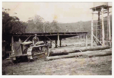
... Feiglin's was established in the Acheron Valley, employing local mill workers who lived in a small settlement of four-room cottages on Withers Lane....Feiglin's was established in the Acheron Valley, employing local mill workers who lived in a small settlement of four-room cottages on Withers Lane. ...A copy of a black and white photograph taken at Feiglin's Sawmill near Marysville in Victoria. Feiglin's Sawmill (later the Narbethong Timber & Trading Co.) was a cornerstone of the regional timber industry on the Acheron Way in Narbethong, just outside Marysville. Following the devastating 1939 Black Friday bushfires, sawmill owners expanded into the region to salvage dead timber. Feiglin's was established in the Acheron Valley, employing local mill workers who lived in a small settlement of four-room cottages on Withers Lane.A copy of a black and white photograph taken at Feiglin's Sawmill near Marysville in Victoria.marysville, victoria, australia, narbethong, feiglin's sawmill, archeron way, 1939 black friday bushfires, acheron valley, narbethong timber & trading co., 2009 black saturday bushfires, mr. j. feiglin, photograph -
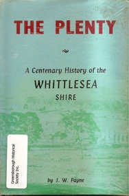 Greensborough Historical Society
Book, J. W. Payne, The Plenty: a centenary history of the Whittlesea shire, 1975_
... settlement of Whittlesea Shire. In particular it has detail of the Plenty Valley corridor. whittlesea shire plenty river janefield bundoora flour mills Copy one has library stamps and some pencil markings. 234 pages, illus., hard cover, pale green dust cover. 2 Copies The Plenty: a centenary history of the Whittlesea shire. ...This book was issued for the Centenary of the Whittlesea Shire and written by J.W.Payne.This records the history of the white settlement of Whittlesea Shire. In particular it has detail of the Plenty Valley corridor.234 pages, illus., hard cover, pale green dust cover. 2 CopiesCopy one has library stamps and some pencil markings.whittlesea shire, plenty river, janefield, bundoora, flour mills -
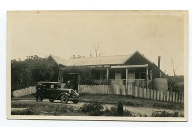 Orbost & District Historical Society
black and white photograph, 1920s -1930s
... Five timber mills worked full time supporting the families that were drawn to the area's wealth of natural resources. The settlement...Five timber mills worked full time supporting the families that were drawn to the area's wealth of natural resources. The settlement ...The Cabbage Tree Creek township was originally established to support the booming timber industry of the mid 20th century. Five timber mills worked full time supporting the families that were drawn to the area's wealth of natural resources. The settlement of Cabbage Tree Creek is located on the Princes Highway, 27 km east of Orbost in East Gippsland. The first white settler arrived in the valley in 1887 cutting a dray track from Marlo to the south-west. Several families cleared the alluvial flats, growing maize, peas and beans and raising pigs, cattle and sheep. Later the farmers milked cows, sending cream to Orbost. In the late 1890s, small quantities of alluvial gold were found in the creek. A school commenced classes in 1913, but enrolment was small and at times the school operated part time with several other small schools in the area. The school building served as a hall for the district. From the 1920s the Cabbage Tree Hotel catered to drivers on the improved Princes Highway. (info. from Victorian Places)This is a pictorial record of Cabbage Tree, East Gippsland in the late 20th century. It shows a building that no longer exists.A small black / white photograph of a single storey timber building. On a sign below the roof is "Cabbage Tree Hotel". The hotel is surrounded by a wooden picket fence. A man and woman are standing on either side of a motor car parked on the roadway in front of the building.on back - on label - Cabbage Tree Hotelcabbage-tree-hotel -
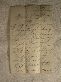 Mortlake and District Historical Society
Letter
... mill in the days of the pioneers. The horse was purchased from Francis Jones at Grasmere some 45 kilometres distant. Francis Jones and descendants were closely associated with the settlement of Grasmere (district) and 'The Union', a well-known pastoral property still in existence today....mill in the days of the pioneers. The horse was purchased from Francis Jones at Grasmere some 45 kilometres distant. Francis Jones and descendants were closely associated with the settlement of Grasmere (district) and 'The Union', a well-known pastoral property still in existence today. ...This letter describes a business transaction of an item essential to conducting a mill in the days of the pioneers. The horse was purchased from Francis Jones at Grasmere some 45 kilometres distant. Francis Jones and descendants were closely associated with the settlement of Grasmere (district) and 'The Union', a well-known pastoral property still in existence today.The conduct of business in the 19th century could be slow and arduous. Horses were an essential component of business and communication. Their labour was pivotal to success and so their physical soundness (or otherwise) was vital. The horse trade was open to manipulation by the unscrupulous, selling unfit animals. Veterinary care and treatment was primitive, so a buyer could not be confident of a positive result, despite (as in this case) Jones' assurances of the triviality of the injury and Knights' capabilities. Handwritten letter on paper folden in half - water stained.Grasmere. April 4th 1864. Messrs. Hamilton & Co. I beg to acknowledge the receipt of yours of the 29th March enclosing a cheque for [pound sign] balance of the price of the bay mare for which I am much obliged to you for your punctuality in sending it. I enclose you a receipt for the the (sic) same. With reference to the swelling on the mares leg it could only have been there a very short time before you purchased her. It can easily be removed if the proper remedies are applied. M. Knights the veterinary surgeon will give you medicine that will remove it for a trifle. Hoping the mare will give you ample satisfaction. I am scy. (sic) [sincerely] yours respecfully Francis Jones. mortlake mill hamilton transport communication francis jones grasmere michael knights veterinary surgeon -
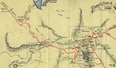 Halls Gap & Grampians Historical Society
Map - Coloured
... settlement. The mining Department had paid L300 for its construction and, when completed, the track was "three miles and 30 chains in length, the side cuttings at the narrowest part being 10 feet between" and "the watercourses which cross the track at various points" having been "filled up with rocks rolled down the sides of the hills, and consequently there can be no damage caused by bushfires which destroyed the former wooden bridges erected on the old track to Wakeham's saw-mill, the remains of which are still to be seen at the side of the diggings" The article goes on to further describe the track as one which "can with ease travel with a two horse conveyance either up or down" and that the workmen engaged in the construction of the track would be attending "a ball that night at McKeon's farm near the mouth of the gap to celebrate the successful completion of the undertaking". 1900s At what time the bridle path was extended beyond Valley Gap to the Wartook basin on the Mt. ...settlement. The mining Department had paid L300 for its construction and, when completed, the track was "three miles and 30 chains in length, the side cuttings at the narrowest part being 10 feet between" and "the watercourses which cross the track at various points" having been "filled up with rocks rolled down the sides of the hills, and consequently there can be no damage caused by bushfires which destroyed the former wooden bridges erected on the old track to Wakeham's saw-mill, the remains of which are still to be seen at the side of the diggings" The article goes on to further describe the track as one which "can with ease travel with a two horse conveyance either up or down" and that the workmen engaged in the construction of the track would be attending "a ball that night at McKeon's farm near the mouth of the gap to celebrate the successful completion of the undertaking". 1900s At what time the bridle path was extended beyond Valley Gap to the Wartook basin on the Mt. ...Background on Bridle Path up Stony Creek Gorge Pre 1840 C. B. Hall, squatter on Mokepilly Run 1841-1842, first European to discover the Fyans Creek valley, the entrance of which became known as Hall's Gap. He later recorded that he followed a number of tracks which he assumed had been made by the Aboriginies and described one as "leading up a wild romantic glen and over on to the source of the Glenelg River". This could well have been the route taken up Stony Creek gorge by the first timber-cutters in this part of the Grampians to the saddle between the Wonderland and Mt. Difficult ranges known as Valley Gap 1850s/60s Timber cutters and shingle splitters were reported to be moving into the eastern side of the Grampians and by the mid 1860s there were a number of families connected to the supplying of timber to Pleasant Creek living in the "Hall's Gap ranges". John Wakeham, the first store owner in Pleasant Creek in 1854, established a timer-mill in upper Stony Creek Gorge in the late 1850s. Wakeham is credited for the clearing and levelling of the first bridle-path up the gorge. 1870s By the mid 1870s the track had been extended over Valley Gap to the Victoria Forest (the upper region of the Victoria Valley). McKeon's bullock team was known to have hauled red gum from the Valley to Stawell in the late 1870s and the 1880s. 1880s In 1887 an article in the Pleasant Creek news describes the Stony Creek Gorge track as "being a ledge alongside the mountain range, formed in the early days with the aid of earth and timber, along which the bullock teams used to travel to Horsham and plains of the Wimmera beyond." 1890s Gold was discovered in the catchment area of Stony Creek and by the end of the 1890s a new track was built from "near the junction of Fyan's and Stony Creeks, up the gorge to the diggings settlement. The mining Department had paid L300 for its construction and, when completed, the track was "three miles and 30 chains in length, the side cuttings at the narrowest part being 10 feet between" and "the watercourses which cross the track at various points" having been "filled up with rocks rolled down the sides of the hills, and consequently there can be no damage caused by bushfires which destroyed the former wooden bridges erected on the old track to Wakeham's saw-mill, the remains of which are still to be seen at the side of the diggings" The article goes on to further describe the track as one which "can with ease travel with a two horse conveyance either up or down" and that the workmen engaged in the construction of the track would be attending "a ball that night at McKeon's farm near the mouth of the gap to celebrate the successful completion of the undertaking". 1900s At what time the bridle path was extended beyond Valley Gap to the Wartook basin on the Mt. Difficult Range has not yet been determined. However, it is known that, by the turn of the century, people were travelling between Halls Gap and the caretakers' residence at Wartook Reservoir along what was now known as the "Bluff Road. Wartook's embankment had been constructed in 1887 and at that time there was already a track from Rosebrook Station homestead (near the present day Wartook Pottery) to the reservoir. Philip Rose owned both Rosebrook and Wartook Stations from the mid 1840s to the late 1850s and had regularly leased the Wartook basin to Cobb & Co. to rest horses there. 1920s Following the war of 1914-1918, tourism really took off in the Grampians, and Halls Gap rapidly grew. People would travel as far as they could on the many tracks then hike to the many lookouts being discovered by local tour guides. This led to the need for access across the range so that horse riders and the increasing number of vehicles could travel between Horsham and Halls Gap. To this end, the Bluff Road was improved and extended on 1929 and at its opening in March, 1930, by Lady Somers it was renamed the Mt. Victory Road.Map of Mt Victory Road and othersaccess routes, mt victory rd, bridle path, roads -
 Eltham District Historical Society Inc
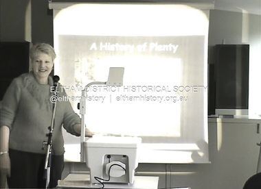
Film - Video (DVD), Neisha Forbes et al, Tales of Old Nillumbik; stories of life in years gone by - Plenty Historical Society, 15 November 2005
... A series of talks held October - December 2005 at the Eltham Living and Learning Centre which allowed Nillumbik Historical Societies to record the verbal history of the area with some of the well known residents of Nillumbik and surrounds Recorded and edited by Marie Ryan of Plenty Valley FM Speaker: Neisha Forbes 15th November 2005 This session covers the early settlement of Plenty. Learn about the mills situated on the Plenty River from the 1840s. ...A series of talks held October - December 2005 at the Eltham Living and Learning Centre which allowed Nillumbik Historical Societies to record the verbal history of the area with some of the well known residents of Nillumbik and surrounds Recorded and edited by Marie Ryan of Plenty Valley FM Speaker: Neisha Forbes 15th November 2005 This session covers the early settlement of Plenty. Learn about the mills situated on the Plenty River from the 1840s. ...A series of talks held October - December 2005 at the Eltham Living and Learning Centre which allowed Nillumbik Historical Societies to record the verbal history of the area with some of the well known residents of Nillumbik and surrounds Recorded and edited by Marie Ryan of Plenty Valley FM Speaker: Neisha Forbes 15th November 2005 This session covers the early settlement of Plenty. Learn about the mills situated on the Plenty River from the 1840s. Early industry such as fruit growing, poultry farming, goldmining, rabbit skinning and how they contributed to the development and employment of the area and in the case of rabbit skinning the development of other industries in Victoria during the Depressionvideo recording -
 Eltham District Historical Society Inc
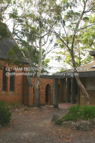
Photograph - Digital Photograph, Alan King, St Margaret's Anglican Church, Pitt Street, Eltham, 30 January 2008
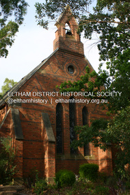
... mill. Dendy chaired the meeting held in 1860 “for the purpose of devising such means as may be expedient for the establishment of a Church of England in the township of Eltham”. He became chairman and treasurer of the church committee. Unlike the establishment of many early churches in Victoria where a vicar was appointed to a parish and later a permanent church was constructed, the population at Eltham initiated action to build a church. The nearest church at that time was at Heidelberg and the Eltham settlement...mill. Dendy chaired the meeting held in 1860 “for the purpose of devising such means as may be expedient for the establishment of a Church of England in the township of Eltham”. He became chairman and treasurer of the church committee. Unlike the establishment of many early churches in Victoria where a vicar was appointed to a parish and later a permanent church was constructed, the population at Eltham initiated action to build a church. The nearest church at that time was at Heidelberg and the Eltham settlement ...St Margaret’s Church of England was officially opened on December 12, 1861. It is the oldest intact church building in Eltham. At the time it was known as Christ Church until its consecration in 1871, when it was completely free of debt (£1,700 for the church and parsonage) despite the district’s poverty. This was largely due to the free labour and materials, including locally made bricks donated by local artisans and others. The church is historically significant because it is the oldest church in the former Shire of Eltham and has associations with the philanthropist and founder of Brighton, Henry Dendy (who donated the land on which the church is built), the architect Nathaniel Billing and the prominent local builder, George Stebbing. The church is architecturally and aesthetically significant because it is constructed in the Gothic Revival style with several stained-glass windows of various dates and is also a very early use of polychromatic brickwork in Victoria. Billing was one of the first Melbourne architects to employ polychromatic brickwork and an important early architect. The rear wall was intended to be temporary. A major feature of the design is the large buttresses with long, steeply graded upper faces. The overall design is well proportioned with the surface brick patterns relieving an otherwise austere design. The church is spiritually and socially significant because it has been an important place of worship for the people of Eltham for almost 150 years. The land on which the buildings stand was donated by Henry Dendy. Dendy arrived in Melbourne in 1841 after purchasing in England eight square miles at Brighton under the system of "special surveys". After this land passed out of his hands, Dendy moved about Victoria, visited England, then returned to settle in Eltham where he purchased a flour mill. Dendy chaired the meeting held in 1860 “for the purpose of devising such means as may be expedient for the establishment of a Church of England in the township of Eltham”. He became chairman and treasurer of the church committee. Unlike the establishment of many early churches in Victoria where a vicar was appointed to a parish and later a permanent church was constructed, the population at Eltham initiated action to build a church. The nearest church at that time was at Heidelberg and the Eltham settlement was part of the parish of St Johns Heidelberg. Isolation and the tedious, time consuming journey between Heidelberg and Eltham resulted in the Eltham community taking its own action. The original vicarage (Dendy House) at the rear of the church is also an important part of the cultural significance of this place because it is connected to the church and the development of the Eltham area. Together, the church and the vicarage are aesthetically significant because they form a significant streetscape feature. The mud-brick community hall designed by Robert Marshall was added in 1978. In 2014 the original temporary rear wall was removed as part of a modern extension designed by Architects Atelier Wagner and constructed by Conrad Construction and Management. Covered under Heritage Overlay, Nillumbik Planning Scheme. National Trust of Australia (Victoria) State significance Victorian Heritage Published: Nillumbik Now and Then / Marguerite Marshall 2008; photographs Alan King with Marguerite Marshall.; p67 St Margaret’s Anglican Church in Pitt Street, Eltham, which officially opened on December 12, 1861, is the oldest intact church building in Eltham.1 With the nearby courthouse and police station, it was one of the first permanent community buildings in the district. The church and vicarage are on the Register of the Heritage Council of Victoria and the National Trust of Australia – Victoria. The church is important as an early example of polychrome brickwork by the notable architect Nathaniel Billings. It is also notable for its historic associations with the early settlement of the Shire of Eltham and its connection with Henry Dendy, Brighton’s founder.2 Henry Dendy, who lived in Eltham much longer than at Brighton, chaired the original meeting which planned the church, and he donated the half-acre (0.2ha) site. Dendy had arrived in Melbourne in 1841 after buying eight square miles (20.7sq km) at Brighton while in England. After this land passed out of his hands, he eventually settled in Eltham where he bought a flour mill, west from the corner of Main Road and Pitt Street (then called Brewery Lane). The vicarage was named Dendy House after him. The Eltham settlers were unusual in initiating the establishment of a church. Usually in Victoria a vicar was appointed to a parish and then a permanent church was constructed. But then, the nearest church was at Heidelberg, which was a tedious and time-consuming journey. St Margaret’s builder was a local, George Stebbing, who also constructed the former Methodist, later Uniting, Church at John Street and the Shillinglaw Cottage near Eltham’s Central Park. It is believed the first Anglican Bishop of Melbourne, Bishop Perry, dedicated the church. After the ceremony he joined in the festivities at the nearby pub and a bill was sent to the parish for teas taken there by the bishop with other participants. The first vicar was the Reverend Robert Mackie from 1864 to1866. St Margaret’s Church was originally called Christ Church until its consecration in 1871, when it was completely free of debt (£1700 pounds for the church and parsonage) despite the district’s poverty. This was largely due to the free labour and materials, including local bricks, donated by local artisans and others. St Margaret’s Church is in the Gothic Revival tradition with a buttressed nave, paired lancet windows, porch and bell-cote. It was the first polychromatic brick church in Australia, using softly contrasting coloured brickwork.3 Billing was one of the first architects to introduce polychrome brickwork into Melbourne. His original drawings for St Margaret’s survive in a folio of his architectural work. However the church’s brickwork is more subdued than in his drawings. About half the windows – those in clear glass with gold borders – are original. The stained glass windows were made much later, but the one behind the altar is thought to be the oldest in the Diamond Valley. It was to be temporary until the congregation could afford to extend the church. In the early 1960s the original cedar pews were replaced by blonde timber pews and the originals were sold to restaurants and to private individuals. Eminent local sculptor Matcham Skipper created a crucifix for the church. A major addition was made in 1978, when the weatherboard hall was replaced by a mud-brick hall. Made of local material, it was designed by local architect and a former shire president Robert Marshall. The mud-brick hall reflects the style of building in Eltham of the late 1970s and for which Eltham is well-known. Perhaps because its earthy tones blend with the surrounding environment, the hall sits well with the church building. St Margaret’s membership has included economist and ABC chairman, Richard Downing; political commentator, diplomat and academic, William Macmahon Ball; Eltham civic leader, Charles Wingrove; artist, Peter Glass; and Eltham’s first postmaster, Frederick Falkiner.This collection of almost 130 photos about places and people within the Shire of Nillumbik, an urban and rural municipality in Melbourne's north, contributes to an understanding of the history of the Shire. Published in 2008 immediately prior to the Black Saturday bushfires of February 7, 2009, it documents sites that were impacted, and in some cases destroyed by the fires. It includes photographs taken especially for the publication, creating a unique time capsule representing the Shire in the early 21st century. It remains the most recent comprehenesive publication devoted to the Shire's history connecting local residents to the past. nillumbik now and then (marshall-king) collection, eltham, st margaret's anglican church, st margaret's church, st margarets church hall, christ church -
 Eltham District Historical Society Inc
Photograph - Digital Photograph, Alan King, St Margaret's Anglican Church, Pitt Street, Eltham, 30 January 2008
... mill. Dendy chaired the meeting held in 1860 “for the purpose of devising such means as may be expedient for the establishment of a Church of England in the township of Eltham”. He became chairman and treasurer of the church committee. Unlike the establishment of many early churches in Victoria where a vicar was appointed to a parish and later a permanent church was constructed, the population at Eltham initiated action to build a church. The nearest church at that time was at Heidelberg and the Eltham settlement...mill. Dendy chaired the meeting held in 1860 “for the purpose of devising such means as may be expedient for the establishment of a Church of England in the township of Eltham”. He became chairman and treasurer of the church committee. Unlike the establishment of many early churches in Victoria where a vicar was appointed to a parish and later a permanent church was constructed, the population at Eltham initiated action to build a church. The nearest church at that time was at Heidelberg and the Eltham settlement ...St Margaret’s Church of England was officially opened on December 12, 1861. It is the oldest intact church building in Eltham. At the time it was known as Christ Church until its consecration in 1871, when it was completely free of debt (£1,700 for the church and parsonage) despite the district’s poverty. This was largely due to the free labour and materials, including locally made bricks donated by local artisans and others. The church is historically significant because it is the oldest church in the former Shire of Eltham and has associations with the philanthropist and founder of Brighton, Henry Dendy (who donated the land on which the church is built), the architect Nathaniel Billing and the prominent local builder, George Stebbing. The church is architecturally and aesthetically significant because it is constructed in the Gothic Revival style with several stained-glass windows of various dates and is also a very early use of polychromatic brickwork in Victoria. Billing was one of the first Melbourne architects to employ polychromatic brickwork and an important early architect. The rear wall was intended to be temporary. A major feature of the design is the large buttresses with long, steeply graded upper faces. The overall design is well proportioned with the surface brick patterns relieving an otherwise austere design. The church is spiritually and socially significant because it has been an important place of worship for the people of Eltham for almost 150 years. The land on which the buildings stand was donated by Henry Dendy. Dendy arrived in Melbourne in 1841 after purchasing in England eight square miles at Brighton under the system of "special surveys". After this land passed out of his hands, Dendy moved about Victoria, visited England, then returned to settle in Eltham where he purchased a flour mill. Dendy chaired the meeting held in 1860 “for the purpose of devising such means as may be expedient for the establishment of a Church of England in the township of Eltham”. He became chairman and treasurer of the church committee. Unlike the establishment of many early churches in Victoria where a vicar was appointed to a parish and later a permanent church was constructed, the population at Eltham initiated action to build a church. The nearest church at that time was at Heidelberg and the Eltham settlement was part of the parish of St Johns Heidelberg. Isolation and the tedious, time consuming journey between Heidelberg and Eltham resulted in the Eltham community taking its own action. The original vicarage (Dendy House) at the rear of the church is also an important part of the cultural significance of this place because it is connected to the church and the development of the Eltham area. Together, the church and the vicarage are aesthetically significant because they form a significant streetscape feature. The mud-brick community hall designed by Robert Marshall was added in 1978. In 2014 the original temporary rear wall was removed as part of a modern extension designed by Architects Atelier Wagner and constructed by Conrad Construction and Management. Covered under Heritage Overlay, Nillumbik Planning Scheme. National Trust of Australia (Victoria) State significance Victorian Heritage Published: Nillumbik Now and Then / Marguerite Marshall 2008; photographs Alan King with Marguerite Marshall.; p67This collection of almost 130 photos about places and people within the Shire of Nillumbik, an urban and rural municipality in Melbourne's north, contributes to an understanding of the history of the Shire. Published in 2008 immediately prior to the Black Saturday bushfires of February 7, 2009, it documents sites that were impacted, and in some cases destroyed by the fires. It includes photographs taken especially for the publication, creating a unique time capsule representing the Shire in the early 21st century. It remains the most recent comprehenesive publication devoted to the Shire's history connecting local residents to the past. nillumbik now and then (marshall-king) collection, eltham, st margaret's anglican church, st margaret's church, christ church -
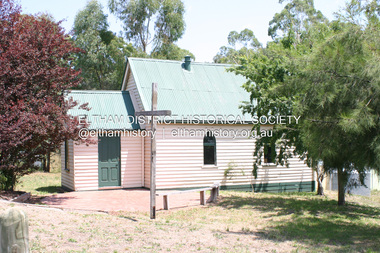 Eltham District Historical Society Inc
Photograph - Digital Photograph, Alan King, St Andrews Anglican Church, St Andrews, 30 January 2008
... mill.2 In 1861, Queenstown was officially proclaimed a township. From 1865, the name Queenstown was interchangeable with St Andrews, until 1952, when the town was officially named St Andrews. As gold declined from the early 1880s, Queenstown changed dramatically into a settlement...mill.2 In 1861, Queenstown was officially proclaimed a township. From 1865, the name Queenstown was interchangeable with St Andrews, until 1952, when the town was officially named St Andrews. As gold declined from the early 1880s, Queenstown changed dramatically into a settlement ...Built c.1868, St Andrew’s Anglican Church is Nillumbik Shire’s oldest timber church and is historically, socially, and spiritually significant to the Shire of Nillumbik. The church is historically significant because it may have given its name 'St Andrews' to the town (another suggestion is that the name came from the local hotel), it is also historically significant as one of only four buildings that remain from the Caledonian goldfields era of Queenstown (now St Andrews) and one of only a handful of buildings that survived the 1960s bushfires. The church is historically, socially, and spiritually significant because it has played an important part in community life for more than 150 years; a proposal to move the church in 1984 met with strenuous opposition. Much of the fires on Black Saturday 2009 were the north of the town. The town itself remained intact - as did this heritage building. Covered under Heritage Overlay, Nillumbik Planning Scheme. National Trust of Australia (Victoria) Local significance Published: Nillumbik Now and Then / Marguerite Marshall 2008; photographs Alan King with Marguerite Marshall.; p69 The St Andrews Anglican Church and former St Andrews Primary School, are two reminders of the district’s early days, when it was founded on gold. St Andrews, then called Queenstown, was the earliest goldfield in the Caledonia Diggings.1 It was the Upper Diamond Gold Mining and Administrative Centre, with 3000 miners. Queenstown was also the seat of the Court of Petty Sessions. The church and school then stood close to European and Chinese stores, three hotels, a brewery and a quartz mill.2 In 1861, Queenstown was officially proclaimed a township. From 1865, the name Queenstown was interchangeable with St Andrews, until 1952, when the town was officially named St Andrews. As gold declined from the early 1880s, Queenstown changed dramatically into a settlement of small farms. St Andrew’s Anglican Church, built in 1868, is the Shire’s oldest timber church and possibly gave its name to the township.3 The small timber church was opened on November 1, 1869, by the Dean of Melbourne. Anniversary tea meetings helped raise funds, and in 1889, a three-bedroom parsonage was built alongside. In 1910, the vicar, the Rev Selwyn Chase (and friend of the Scouting Movement’s founder, Baden Powell), established the 1st Queenstown Scout Troop, only two years after Scouting began in Australia. The church was important to the lives of many local residents who were baptised, married and had funeral services there. But by the 1950s the population had decreased and so did the weekly attendances. Around the mid-1960s the church closed, then fell into disrepair. So in the mid 1980s it was sold to the Education Department and was under threat of relocation or demolition. However this caused such opposition from locals,4 that instead, the Anglican church leased it as part of the Panton Hill parish5 and it was reconsecrated in 1987. Queenstown’s first school was held in a tent after transferring from Andersons Creek, Warrandyte.6 From 1858 a church school, Caledonia Diggings, stood west of the main road, a quarter of a mile (0.4km) before Buttermans Track. In 1882 the school was moved from a leased building, owned by headmaster Robert Harris, into a larger building on the corner of the School and the Heidelberg-Kinglake Roads. It had been moved from Smiths Gully and included a teacher’s three-roomed residence.7 In 1887 the school was replaced by the Queenstown State School No 128, although it was also called Caledonia Diggings until 1891. In 1956 it was renamed St Andrews. Still standing, this building is now used as the St Andrews Community Centre and the residence is leased for private use. The original timber-lined room remains alongside the extensions, and is distinctive with its high ceiling and tall small-paned windows. In 1984 a new school was built 500 metres west of the old school. Many residents have contributed much to St Andrews but one family that has done so for several generations is the Harris family. Robert Harris was an active member of the St Andrew’s Anglican Church, and worked hard at improving the town’s amenities until his death in 1887. He was a signatory to the successful 1863 petition to the Chief Commissioner of Police, against the proposed removal of the Court of Petty Sessions and police station at the Caledonia Diggings. The police station stayed in the town until 1917. Harris was Head Teacher of Queenstown State School from 1864 to 1874, then of the Smiths Gully school until it closed in 1882, and he continued teaching at Panton Hill until his death. His son, Robert Charles Harris, was editor and printer of the local newspaper, The Evelyn Observer, from 1873 until 1915. Robert’s son, William Shelley Harris, served in the Boer War and in World War One. In 1928 he became Kinglake National Park’s first park ranger. Robert’s daughter Elizabeth, taught needlework at Queenstown State School, and later ran the post office in Kinglake.This collection of almost 130 photos about places and people within the Shire of Nillumbik, an urban and rural municipality in Melbourne's north, contributes to an understanding of the history of the Shire. Published in 2008 immediately prior to the Black Saturday bushfires of February 7, 2009, it documents sites that were impacted, and in some cases destroyed by the fires. It includes photographs taken especially for the publication, creating a unique time capsule representing the Shire in the early 21st century. It remains the most recent comprehenesive publication devoted to the Shire's history connecting local residents to the past. nillumbik now and then (marshall-king) collection, st andrews, st andrews anglican church -
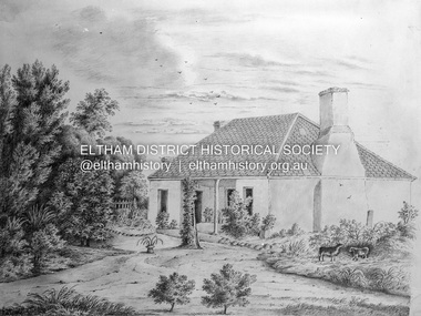 Eltham District Historical Society Inc
Negative - Photograph, Charles Bertie, Sketch; Sweeney's Cottage, Culla Hill, Eltham (n.d.), c.1905
... mill that later was built at Eltham. He took an active interest in the development of the district. At this time travelling people--many of them runaway sailors or convicts--often passed the settlement, and some of them stayed and worked with Sweeney. ...mill that later was built at Eltham. He took an active interest in the development of the district. At this time travelling people--many of them runaway sailors or convicts--often passed the settlement, and some of them stayed and worked with Sweeney. ...In the early 1900s, Mary Sweeney commissioned artist Charles Bertie to paint the main house at Culla Hill. He charged her 5 shillings for the picture and 18 pence for the frame She took this painting with her when she married Michael Carrucan in 1910 and it hung in the Dalton Street farmhouse for many years. At a later time (1960s), the Burstons (the then owners of Culla Hill) had a card printed from the painting. The original sketch was photographed in 1970 for reproduction in the Shire history publication Pioneers & Painters (1971). The very fragile original was kept in the Council strongroom and suffered significant damage to its edges over the years, no doubt it has also yellowed. A comparison of the original as digitised (2022) with the negative taken 50 years earlier also reveals that the left 20% of the sketch has been cut off, probably due to damage. In June 1842 Thomas Sweeney applied to the Superintendent, C.J. La Trobe, asking permission to purchase a portion of the recently surveyed ‘Parish of Nillumbik'. His request was allowed and handed to the sub-treasurer and Land Board. He paid £110 for 110 acres and called the land 'Culla Hill'. He first built a temporary house, a slab hut 12 feet by 10 feet, in which he lived with his wife, an Irish girl whom he had married in 1838. (His first wife had been drowned at Port Jackson.) Some time later he built a permanent residence on the model of a Tipperary farmhouse. It was a rectangular building of hand-made bricks and stone quarried from the Western Hill with a recessed verandah in front, and bore a slate roof. The out-buildings consisted of a detached kitchen, stable and a barn. It was in this house that succeeding generations of Sweeneys were reared. The original slab hut became a washhouse and survived till recent years. 'Culla Hill' became a social centre for the district, church services being held there on various occasions. The first wheat crop in the district was planted by Sweeney who also supplied the first grain for a mill that later was built at Eltham. He took an active interest in the development of the district. At this time travelling people--many of them runaway sailors or convicts--often passed the settlement, and some of them stayed and worked with Sweeney. A tribe of aborigines living on the river below 'Culla Hill' were apparently on good terms with Sweeney, for it is said that they helped him with the building of his house. Very little is known about the aborigines who originally lived in the Eltham district. There must have been many of them; their stone axes, grinding stones, and anvil stones have been found in the gullies around Research and canoe trees and artifacts were found on the Kangaroo Ground hills. Early settlers remembered a tribe that camped on the site of the present railway bridge at Eltham. They held corroborees there and visited settlers for hand-outs of 'flour and bacca’. There was an aboriginal reserve on the Yarra, upstream from Eltham, but most of those who had collected there later went to live on the Pound Reserve at Warrandyte, where the last aborigines in the area finally ended their days. The Pound Reserve, of 1,103 acres, was established at Pound Bend in 1841. The chief protector, George Robinson, and his four assistants, were given instructions to care for the aged and sick, to provide blankets and rations for all who lived there, to train the able-bodied men in agriculture and other trades and to find them jobs. The Yarra blacks, who later came under the protection of William Thomas, have been described as a 'fine race, well made and above the average height'. Thomas Sweeney died on 6 September 1867 and was buried in the Eltham Cemetery. To his wife Margaret and his son John, he left the entire property of 'Culla Hill'. To his other son Patrick, he left 150 acres, including a small two-roomed wooden cottage. He had five daughters: Kate and Margaret (twins) who were born in 1842, Ellen 1846, Annie 1848 and Johanna 1851. John Sweeney farmed 'Culla Hill' until his death in 1909. He had ten children; one of them, Mary, became Mrs M. Carrucan whose son, Mr John Carrucan, still lives at Eltham. 'Culla Hill' passed out of the Sweeneys possession in 1939 and was renamed by its new owners, 'Sweeneys', in memory of its pioneers. - Pioneers & Painters: One Hundred Years of Eltham and its Shire, Alan Marshall 1971, pp10-12 Original colour sketch artwork 4 x 5 inch black and white negative of original colour sketchculla hill, art, charles bertie, drawing, mary carrucan (nee sweeney), sketches, sweeney's cottage -
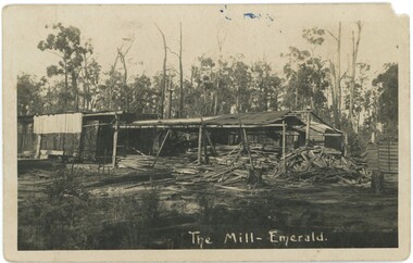 Emerald Museum & Nobelius Heritage Park
Postcard - Postcard of an old sawmill at Emerald
... This postcard is significant because of it is a reminder of the importance of the timber industry during early colonial settlement in the Dandenongs and because it references a local family. it is also part of a collection belonging to a community member who had a close association with a local historical society. There is a separate photo of Emmy's father, James Legg, in the collection. David Moyle Police Emerald Belgrave timber mill ...Timber was the most important early industry in the Dandenongs, including at Emerald. It provided timber for infrastructure as well as for fuel for the rapidly growing city. Some mills were quite small as this one appears to be. The writer 'Emmy' is probably the daughter of James and Emerald (Watson) Legg who were married in Gembrook in 1885, as Emmy references the names of Legg siblings. This and other photographs and postcards came from the estate of David Moyle (1938-2015) who was a police officer in Emerald during late 1960s-early 1970s, and subsequently at Belgrave in the early 1980s. David Moyle was closely associated with the now defunct Sherbrooke Historical Association.This postcard is significant because of it is a reminder of the importance of the timber industry during early colonial settlement in the Dandenongs and because it references a local family. it is also part of a collection belonging to a community member who had a close association with a local historical society. There is a separate photo of Emmy's father, James Legg, in the collection.Postcard of a timber mill at Emerald early 20th century.On front: 'The Mill - Emerald' On back printed: 'POST CARD / Correspondence Address On back handwritten: 'Jim, Maudie, and Emerald / Wishing you all a Bright / and Happy New Year with / best love from your loving / Sister Emmie'david moyle, police, emerald, belgrave, timber mill -
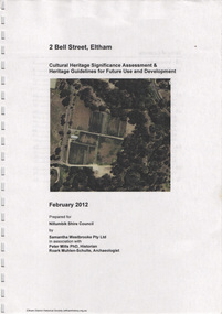 Eltham District Historical Society Inc
Document, Samantha Westbrooke Pty Ltd et al, 2 Bell Street, Eltham: Cultural Heritage Significance Assessment & Heritage Guidelines for Future Use & Development, 2012
... Prepared for Nillumbik Shire Council by Samantha Westbrooke Pty Ltd in association with Peter Mills PhD, Architectural Historian and Roark Muhlen-Schilte, Archaeologist. Covers history of early market gardening in Eltham with the commencement of European settlement in the late 1830s. ...Prepared for Nillumbik Shire Council by Samantha Westbrooke Pty Ltd in association with Peter Mills PhD, Architectural Historian and Roark Muhlen-Schilte, Archaeologist. Covers history of early market gardening in Eltham with the commencement of European settlement in the late 1830s. ...Prepared for Nillumbik Shire Council by Samantha Westbrooke Pty Ltd in association with Peter Mills PhD, Architectural Historian and Roark Muhlen-Schilte, Archaeologist. Covers history of early market gardening in Eltham with the commencement of European settlement in the late 1830s. The site for the village of Eltham was surveyed in 1851 and the Township Plan shows that the property is made up of Lots 7 and 8 which were sold at auction in June 1852 to M. O'Shea. The history of the Bell Street property is closely tied to the West family from the 1860s to 1930s; the earliest rate books for Eltham show William West farming in El;tham in 1864. In the aerly 1930s ownership of the creek side was transferred from the west family to the Fabbro family who shortly afterwards were impaced by the 1934 Diamond Creek flooding. Guido Fabbro relocated the original West home further up the hill and built a new Italianate style modern home in situ. The Fabbro family farmed the property. In 1993/4 Eltham Council acquired the creek-side market garden blocks to the south of 2 Bell Street which was recconceived in 1998 as the Barak Bushland Reserve. The Fabbro house was demolished shortly after and the lots were sold to a developer in 1994. The large steel shed now present on the 2 Bell Street property dates from soon after this sale.26 A4 pages color printcultural heritage significance assessment, peter mills, samantha westbrooke pty ltd, shire of nillumbik, 2 bell street, eltham, market gardening, west family, fabbro family, land use, barak bushland reserve, heritage assessment -
Bendigo Historical Society Inc.
Document - BROADCASTING STATION 3CV, MARYBOROUGH, 2 March, 1956
... settlements. Primary production railway staff. Coal fields Wonthaggi. 1917 a public meeting was convened in an effort to stem the tide of adversity. Mayor George Frost M.L.A. form a Progress Association policy of secondary industry James L Drew rejuvenation was revolutionary Employment and economic security. The first of the industries to be formed in 1918 was the Butter Factory. Thus it was a red letter day for the company in 1925 when the first dividend of 5 percent was paid.1955 dividend of 10 per cent. Operating it's own trucks serviced local dairymen. Maryborough Knitting mills ...Broadcasting Station 3CV, Maryborough. A souvenir of the opening of the New Studios and Offices of Central Victoria Broadcasters Pty Ltd. March 2nd, 1956. Established 1956, offices in Burke Street, opening coincides with the stations 21st birthday, March 2 for the former celebration, October 26 for the latter. Coverage included Bendigo, Ballarat, Daylesford, Castlemaine and Maryborough. 3CV plays active part in assisting charities and hospitals at Maryborough, Daylesford, Maldon and Dunolly. Active Women's Radio Club with branches in country centres adds strength to station's charitable efforts. Opening 3CV's new premises will widen the scope of the station's charitable efforts, and stronger link with Australian Commercial Broadcasting stations. Writer Harold V Nunn writes history of district of Mayborough. Manager Ken J Parker, Central Victoria Broadcasters Pty. Ltd. The Souvenir brochure also covers topics such as: deep lead mining. WWI. Houses being pulled down. New settlements of Mildura. Secondary Industries. Bowenvale, Alma, Majorca, Craigie, Amherst, Adelaide Lead, Havelock, Bet Bet, Bently. Primary production and a railway staff of approximately 150. Maryborough a little town without a future. Coal fields at Wonthaggi. 1917 a public meeting was convened in an effort to stem the tide of adversity. Mayor George Frost, M.L.A., decision to form a Progress Association, a policy of secondary industry was decided upon and committees were appointed, James L Drew much credit is due. Maryborough's move for rejuvenation was revolutionary, because apart from Ballarat, Bendigo and Geelong, it was regarded as so much presumption that industry could be expected to function with success in a country town. Governments were unsympathetic. Maryborough & district people showed determination to succeed and their faith in their town. Employment and economic security provided by the industries outweighed the debt. Maryborough's general position is that it is no longer dependent upon one particular phase of activity. The first of the industries to be formed in 1918 was the Butter Factory. The nearer dairy companies did not take kindly to the prospect of another opposition company taking supplies from their districts, and in the first few years of establishment completion made the going hard for the management. But adopting a conservative policy and placing all profits to reserve I the first six years of operation headway was gradually made. Thus it was a red letter day for the company in 1925 when the first dividend of 5 percent was paid.1955 dividend of 10 per cent. Operating it's own trucks the dairy serviced local dairymen up to 40 miles. Maryborough Knitting mills est. 1923, having transferred from Clunes. Out bid Ballarat and Bendigo to the industry. The mill has what is probably the largest circular underwear plant in the Commonwealth, which is conservatively valued at 198,913 pounds. It produces between four and five million garments each year, worth over one million pounds. The company has established subsidiary mills at Dunolly, Talbot and Avoca. The company also assisted in the establishment of the Interknit Hosiery Co. Ltd., Clunes. The Maryborough Flour Mills is the second oldest of Mayborough's industries. It was built by Mr Cadwallader over 70 years ago. It was later sold to Mr. A Land and then to Jas. Minifie & Co. It had a somewhat 'in-and -out' existence until purchased in 1923 by Messrs. Willersdorf and Forbes, of Eddington. In 1939 the firm began to build silos for the storage of bulk wheat and the present storage capacity is 100,000 bushels. 1944 power was changed from steam to electricity. The mill has an out put of 20 sacks an hour. 1938 a chaff mill was built, and now is regarded as one of the best in Victoria. Its output in one year of approximately 6,800 tons is a State record for a single cutter. During this 30 year period Patience and Nicholson Limited has grown with Maryborough and is now one of the major key industries of Australia. The P&N brand covers precision tools - taps, dies and twist drills - indispensable to the country's economy, and quality is acknowledged equally by an air craft factory in Canada, a dockyard in Thailand, a railway workshop in New Zealand, no less than by our own Australian industries. Maryborough can be proud of the part played by P&N in war when, geared to the needs of the times, it poured countless millions of tools into defence factories and to the armed forces of the Allies, and now in peace when it is providing, hydro-electric undertakings and the manufacture of cars and tractors. From 1858, W Phelan & Sons Pty Ltd has made phenomenal and spectacular growth, becoming incorporated as a private company in 1929. It is without doubt the greatest private development in the history of Maryborough. 1940 joinery manufacture was commenced. The company entered the Ready Built Housing field in `950 - and in 1951 established a factory at Cairns, Northern Queensland to overcome the manufacturing difficulties being experienced due to the shortage of plywood in Victoria. Present activities include: Ready Built Housing Factory, on-site building, a modern joinery, timber yard, drying kilns, etc., and plumbing & electrical & engineering services, a door and panel factory at Cairns, retail hardware store, Melbourne Sales Depot. Hedges & Bell Pty Ltd were est 1945, with a staff of 40 employees are the largest printing firm outside the metropolitan area. The branch of Premier Wireworks is a contribution made by the decentralisation policy of the State.event, official, celebration, broadcasting station 3cv, maryborough. a souvenir of the opening of the new studios and offices of central victoria broadcasters pty ltd. march 2nd, 1956. established 1956, offices in burke street, 21st birthday. coverage bendigo, ballarat, daylesford, castlemaine maryborough. assisting charities and hospitals maldon and dunolly. women's radio club opening 3cv's new premises australian commercial broadcasting stations. writer harold v nunn writes history of district of mayborough. manager ken j parker, central victoria broadcasters pty. ltd. souvenir brochure: deep lead mining. wwi. houses pulled down. new settlements. primary production railway staff. coal fields wonthaggi. 1917 a public meeting was convened in an effort to stem the tide of adversity. mayor george frost, m.l.a., form a progress association, policy of secondary industry, james l drew rejuvenation was revolutionary, employment and economic security. the first of the industries to be formed in 1918 was the butter factory. thus it was a red letter day for the company in 1925 when the first dividend of 5 percent was paid.1955 dividend of 10 per cent. operating it's own trucks serviced local dairymen. maryborough knitting mills est. 1923 largest circular underwear plant in the commonwealth. established subsidiary mills at dunolly, talbot, avoca. interknit hosiery co. ltd., clunes. the maryborough flour mills it was built by mr cadwallader. mr. a land jas. minifie & co. messrs. willersdorf and forbes, build silos for wheat storage capacity is 100, 000 bushels. 1944 power was changed from steam to electricity. 20 sacks an hour. 1938 a chaff mill was built, best in victoria. patience and nicholson limited the p&n precision tools - taps, dies and twist drills. war, geared to the needs of the times, countless millions of tools into defence factories the armed forces of the allies, hydro-electric undertakings and the manufacture of cars and tractors. from 1858, w phelan & sons pty ltd, incorporated 1929. 1940 joinery manufacture. ready built housing field in 1950 - 1951 established a factory at cairns, northern queensland to overcome the manufacturing difficulties being experienced due to the shortage of plywood in victoria. present activities: ready built housing factory, on-site building, a modern joinery, timber yard, drying kilns, etc., and plumbing & electrical & engineering services, a door and panel factory at cairns, retail hardware store, melbourne sales depot. hedges & bell pty ltd were est. 1945, with a staff of 40 employees are the largest printing firm outside the metropolitan area. the branch of premier wireworks is a contribution made by the decentralisation policy of the state. -
 Narre Warren and District Family History Group
Book, Level Crossing Fraser Siding Longwarry - 1878-1978, 1978
... Coming of Railway; Selectors & Land Settlement; Tram Lines and Mills; Longwarry School...Coming of Railway; Selectors & Land Settlement; Tram Lines and Mills; Longwarry School Early settlement and businesses History book for Centenary celebrations - 1878-1978 Level Crossing Fraser Siding Longwarry - 1878-1978 Book ...History book for Centenary celebrations - 1878-1978non-fictionHistory book for Centenary celebrations - 1878-1978early settlement and businesses -
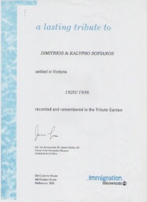 Ithacan Historical Society
Certificate - Immigration Museum Tribute, Dimitrios and Kalypso Sofianos, C 2000s
... The certificate was presented to Nina Mills by the Immigration Museum in recognition of her parents Dimitrios and Kalypso Sofianos whose migration and settlement story has been recorded in the museum Share a Story files. ...The certificate was presented to Nina Mills by the Immigration Museum in recognition of her parents Dimitrios and Kalypso Sofianos whose migration and settlement story has been recorded in the museum Share a Story files. ...The certificate was presented to Nina Mills by the Immigration Museum in recognition of her parents Dimitrios and Kalypso Sofianos whose migration and settlement story has been recorded in the museum Share a Story files. Their names are also featured in the Immigration Museum's Tribute Garden. The Honourable Sir James Gobbo, who was the Governor of Victoria and a Patron of the Immigration Museum, presented the certificate. An A4 scanned copy of a certificate issued from the Immigration Museum. It is printed in blue and black with a marbled pattern down the LHS of the document. immigration., immigration museum, sofianos, kalypso, sofianos, dimitri, tribute garden, nina, mills -
 Warrnambool and District Historical Society Inc.
Document, Indenture A Bostock Esquire to Messrs Aitkin & Bostock( Ernest), 1865
... settlement. They leased and owned vast tracts of land and operated businesses around the district, often associated with the farming industry. This document is dated 5th July 1865 and is an assignment of stock by way of mortgage. Augustus Bostock is the mortgagor with James William Manifold Aitkin and Ernest Bostock as mortgagees. At various times they were involved in running businesses together, in particular the Aitkin and Bostock store and flour mill...settlement. They leased and owned vast tracts of land and operated businesses around the district, often associated with the farming industry. This document is dated 5th July 1865 and is an assignment of stock by way of mortgage. Augustus Bostock is the mortgagor with James William Manifold Aitkin and Ernest Bostock as mortgagees. At various times they were involved in running businesses together, in particular the Aitkin and Bostock store and flour mill ...The Bostock, Manifold and Aitkin families were all pioneering families in the Western District of Victoria almost from the time of settlement. They leased and owned vast tracts of land and operated businesses around the district, often associated with the farming industry. This document is dated 5th July 1865 and is an assignment of stock by way of mortgage. Augustus Bostock is the mortgagor with James William Manifold Aitkin and Ernest Bostock as mortgagees. At various times they were involved in running businesses together, in particular the Aitkin and Bostock store and flour mill. Three of the Bostock men were married to three of the Aitkin sisters. The amount in question is £2157/3/2 and surety is 8000 sheep and their increase, presently running at Coomete. The penciled in details on the document refer to Robert Brand Paterson who was later in business with Aitkin This is one of a number of documents which relate to the Bostock family who were one of the most important pioneering families of the Western District. They owned and leased various properties around Warrnambool and were involved in many aspects of social and business life. The document itself is indicative of its time and provides an insight into the details and terms of such documents at the time.Large grey coloured, lined hand written document over four pages. Folded in four with date and details on one section. Red wax seal on page 3. There are extra entries written in black lead pencil in areas relating to the money and surety of the agreement.Signed by the following George Barber Warrnambool, Thomas Sunderland Deputy Registrar General, and Augustus Bostock. Hingston & Co, Chancery Lane Melbourne hand written in top left hand corner. warrnambool, bostock,augustus bostock james william manifold aitkin,robert brand paterson, coomete, -
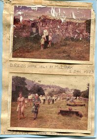 Kiewa Valley Historical Society
Photographs x 2- D Reids home at Mill Park 1973, 2/12/1973
... mill in the district on his Yackandandah run in 1845; his woolclip of 1848 was one of the first to be handled by R. Goldsbrough and was claimed to come from sheep descended from stock imported in the 1820s from George III's flock. Going into politics, he held the Legislative Assembly seat of Murray from October 1859 to May 1862. David Reid was a highly regarded grazier and local politician who was significantly involved in settlement ...David Reid (1820-1906) was a pastoralists and politician. He left school at 16 and after meeting the overlander John Gardiner he decided to look for land south of the Murray River. Equipped by his father with some 500 head of cattle, 2 bullock wagons and teams and 6 assigned servants, he reached the Ovens River on 8 September 1838. David settled at Currargarmonge, near Wangaratta. At the end of 1843 he took up land near Yackandandah. In 1847 he took up a section of the family run of which Woorajay (Wooragee) formed a part. He built the first water driven flour-mill in the district on his Yackandandah run in 1845; his woolclip of 1848 was one of the first to be handled by R. Goldsbrough and was claimed to come from sheep descended from stock imported in the 1820s from George III's flock. Going into politics, he held the Legislative Assembly seat of Murray from October 1859 to May 1862. David Reid was a highly regarded grazier and local politician who was significantly involved in settlement around the Yackandandah area. Photo demonstrates ongoing interest in the local history of the area and its early residents2 colour photographs mounted together on buff card 1. Man and 2 children (unidentified) standing outside the remains of the Reid home. 2 Dec, 1973 2. Group of unidentified people on a tour of the old homestead of D. Reid. 2 Dec, 19731. Handwritten in black ink under photo 'D. Reid's home 1845. At Mill Park. 2 Dec 1973 2. Handwritten in blue ink under photo 'Snapshots Clare Roper"clare roper -
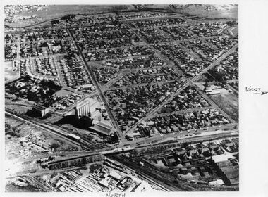 Sunshine and District Historical Society Incorporated
Photograph - Aerial pictures of the Albion & Sunshine district, 1961 & 1994
... Center shows an area of land behind houses between Gunnedah St and Coolamon St This land is locked in by houses of McKays subdivision after WWI for returned soldiers settlement project Top shows Sunshine Golf Course area later known as Glengala 692.02 - Photograph 2 East to west view c 1994 Center Albion State School Houses Darling Flour Mill Sawtooth factory roof built by Sunshine Cabinet Works Center Barclay Reserve McKay factory sites Hampshire Rd Plaza Shopping Centre residential area North Bendigo rail line Myer building formerly Nettlefolds Bunnings Sunshine High School Braybrook Maribyrnong River North Melbourne...Center shows an area of land behind houses between Gunnedah St and Coolamon St This land is locked in by houses of McKays subdivision after WWI for returned soldiers settlement project Top shows Sunshine Golf Course area later known as Glengala 692.02 - Photograph 2 East to west view c 1994 Center Albion State School Houses Darling Flour Mill Sawtooth factory roof built by Sunshine Cabinet Works Center Barclay Reserve McKay factory sites Hampshire Rd Plaza Shopping Centre residential area North Bendigo rail line Myer building formerly Nettlefolds Bunnings Sunshine High School Braybrook Maribyrnong River North Melbourne Photograph Aerial pictures of the Albion & Sunshine district ...sunshine, albion -
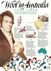 National Wool Museum
Archive - Wool in Australia, 1990s
... Stuart Ascough International Wool Secretariat Victoria Wool Processors Port Phillip Mills Pty Ltd Topmaking career wool industry mills leaflet page 1: Wool in Australia / 1 7 8 8 - 1 8 3 8 / Within 50 years of settlement sheep had moved into / every colony, the annual wool clip was over two / million kg, and wool had become our main export page 2: Wool in Australia / 1 8 3 8 - 1 8 8 8 / The first 100 years saw Australia become the / world's leading producer of wool. ...Part of a collection of books, manuals, photographs, letters and clothing relating to the working life of Stuart Ascough. Stuart's career in the wool industry spanned over 43 years from 1960 to 2003 in various roles including Topmaking Plant Manager at Courtaulds Ltd. in Spennymore, U.K., Operations Manager at Port Phillip Mills in Williamstown Victoria, Marketing Executive, Early Stage Wool Processing at the International Wool Secretariat Melbourne, Australia and General Manager of Victoria Wool Processors Pty. Ltd. in Laverton North, Victoria. Throughout his career Stuart travelled extensively, and in the 1990s worked at many topmaking mills in China on quality improvement projects. He also provided technical advice and training at mills in India, Ukraine, Lithuania, Kyrgyzstan, Russia, Latvia, Byelorussia and other parts of Europe and Asia.Concertina A4 sized leaflet outlining the history of wool in Australia from 1788 to 1988 in four pages with colour graphics and black text.page 1: Wool in Australia / 1 7 8 8 - 1 8 3 8 / Within 50 years of settlement sheep had moved into / every colony, the annual wool clip was over two / million kg, and wool had become our main export page 2: Wool in Australia / 1 8 3 8 - 1 8 8 8 / The first 100 years saw Australia become the / world's leading producer of wool. Our economy's / strength depended on the wool clip. page 3: Wool in Australia / 1 8 8 8 - 1 9 3 8 / By the late 1930's, wool represented over 62% of / the total export value of primary products. Australia's / fine wool was in great demand worldwide. page 4: Wool in Australia / 1 9 3 8 - 1 9 8 8 / In the 50 years leading up to our Bicentenary, / many developments in the sheep and wool / industry have maintained Australia's place / as the leading producer of wool.stuart ascough, international wool secretariat, victoria wool processors, port phillip mills pty ltd, topmaking, career, wool industry, mills, leaflet
