
Showing 551 items matching "plan of warrnambool"
-
 Warrnambool and District Historical Society Inc.
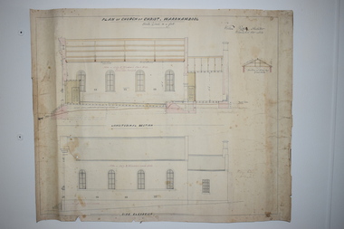
Document, Plan of Church of Christ Warrnambool, 1883
... Plan of Church of Christ Warrnambool... These plans have been drawn up in 1883 by the Warrnambool architect, William Patterson. ...These are two sheets of cream-coloured thick paper with scaled drawings of plan sections of the Church of Christ in Warrnambool. The drawings are in black ink with some sections coloured in. ...‘Plan of Christ Church Warrnambool’...The building still exists but is no longer is use as a church. plans church of christ warrnambool william Kellas harold dawkins warrnambool ‘Plan of Christ Church Warrnambool’ These are two sheets of cream-coloured thick paper with scaled drawings of plan sections of the Church of Christ in Warrnambool. ...These plans have been drawn up in 1883 by the Warrnambool architect, William Patterson. They show six sections of plans for the erection of a Church of Christ at 12 Spence Street Warrnambool. The mason was William Kellas and the builder was Harold Dawkins. Church of Christ adherents began meeting in Warrnambool in 1875 and bought land in Spence Street in 1877. The church was opened in 1885 with visiting pastors until a resident minister, A. J. Fisher, was appointed in 1915. This church was closed early in the 21st century when a new church, Gateway Church of Christ, was opened in Ragland Parade in Warrnambool. These plans are of great interest as original ones of the Church of Christ In Spence Street Warrnambool. The plans have come from the present-day Warrnambool Church of Christ. The building still exists but is no longer is use as a church. These are two sheets of cream-coloured thick paper with scaled drawings of plan sections of the Church of Christ in Warrnambool. The drawings are in black ink with some sections coloured in. Both pages have a black line margin drawn around the edges. The pages are torn at the edges in several places and the sheets are much stained. The sheets have been reinforced at the back (left side) with thick brown paper.‘Plan of Christ Church Warrnambool’plans church of christ warrnambool, william kellas, harold dawkins warrnambool -
 Flagstaff Hill Maritime Museum and Village
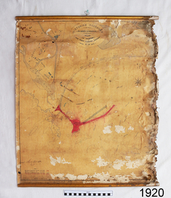
Document - Plan, Victorian Harbours Warrnambool, Victorian Harbours, Warrnambool, Plan to Accompany Sir John Coode's Report, 28-02-1879
... Victorian Harbours, Warrnambool, Plan to Accompany Sir John Coode's Report......plan of warrnambool...The Victorian Government commissioned him to present a plan to complete the Warrnambool Breakwater. His original plan was too expensive so he prepared a revised plan for a shorter structure. ...Plan of Warrnambool Harbour, Port of Warrnambool, dated 28 Feb 1879. ...Stamped "VICTORIAN HARBOURS / WARRNAMBOOL / PLAN / to accompany / SIR JOHN GOODE'S REPORT / DATED 28 FEB 1879" Signature "John Coode"..., Plan to Accompany Sir John Coode's Report Document Plan Australia Victoria Warrnambool Victorian Harbours Warrnambool ...This plan is of great significance to the local history of Warrnambool, in particular the Breakwater and its impact on Warrnambool's maritime and trade history. The plan shows the existing jetties at the Port of Warrnambool, plus the partially erected Breakwater and proposed works to the Breakwater by both the Borough of Warrnambool Surveyor and Sir John Coode. The plan was signed 28th February 1879 by Sir John Coode. The legend at the bottom left describes the existing works and the proposed works. The Warrnambool Breakwater Sir John Coode was a British harbour engineer. He was brought to Melbourne by the Melbourne Harbour Trust to advise on works to improve the Port of Melbourne. The Victorian Government commissioned him to present a plan to complete the Warrnambool Breakwater. His original plan was too expensive so he prepared a revised plan for a shorter structure. The work was completed in 1890. The construction proved to be too short to protect adequately from the weather and didn't allow enough depth for larger vessels to come into port. The decreasing trade was further affected by siltation in the bay due to the breakwater, and the completion of the railway line. The situation of the harbour became a real problem that, by 1910, required continuous dredging. In 1914 the Breakwater was extended but proved to be a failure because the work began to subside and by 1920 about two thirds of the harbour was silted up. Alterations made in the 1920's increased the silting problem and by the 1940's the harbour was no longer used. More alterations were made in the 1950's and 1960's. The Warrnambool Breakwater is registered as a place of significance on the Victorian Heritage Database. This plan of the proposed works for the existing Warrnambool Breakwater is of great significance to the local history of Warrnambool, in particular the Breakwater and its impact on Warrnambool's maritime and trade history. The Warrnambool Breakwater is registered as a place of significance on the Victorian Heritage Database (VHR H2024). It is historically significant to Victoria as one of the most important maritime engineering projects in Victoria in the late 19th century. The Warrnambool Breakwater is of historical significance as one of the most important maritime engineering projects in Victoria in the late nineteenth century. It is evidence of Victoria's nineteenth century investment in regional port infrastructure and the development of Victorian coastal shipping. It is of significance for its association with the English civil engineer Sir John Coode, the most distinguished harbour engineer of the nineteenth century, who was brought to Victoria to advise on works to improve the Port of Melbourne, but was retained by the Government to advise on improvements to the harbours at Portland, Geelong, Port Fairy, and Lakes Entrance, as well as Warrnambool. His projects for Melbourne, Lakes Entrance and Warrnambool were major engineering projects of the nineteenth century. The breakwater is historically significant as a reminder of Warrnambool's early maritime history as a Western District port, and as one of Victoria's major 'outer ports'. While the Warrnambool Breakwater is a demonstration of the engineering skills of the nineteenth century, it also demonstrates the limitations of knowledge relating to sedimentology at the time and the confidence apparent in a number of nineteenth century plans which assumed that natural forces could be overcome or contained by engineering.Plan of Warrnambool Harbour, Port of Warrnambool, dated 28 Feb 1879. Plan shows existing Breakwater and work proposed by both Warrnambool Borough Surveyor and Sir John Coode. Plan has gold coloured quarter-dowel rods top and bottom and a metal ring at the top. Stamped with title. Signed by Sir John Coode.Stamped "VICTORIAN HARBOURS / WARRNAMBOOL / PLAN / to accompany / SIR JOHN GOODE'S REPORT / DATED 28 FEB 1879" Signature "John Coode"flagstaff hill, warrnambool, maritime museum, shipwreck coast, great ocean road, sir john coode, borough of warrnambool surveyor, plan of warrnambool, victorian harbours, warrnambool harbour, warrnambool breakwater, port of warrnambool, vhd vhr h2024, flagstaff hill maritime museum & village, maritime village, map, chart, plan, lady bay, breakwater, jetty, pier, vhr h2024, proposed works, 1879 -
 Warrnambool and District Historical Society Inc.
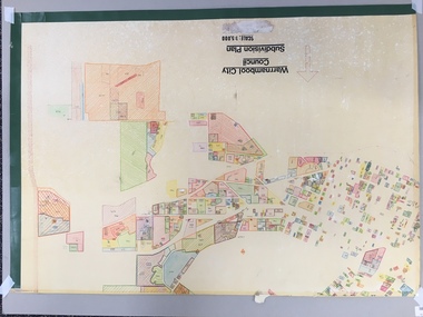
Map, Plans (5) showing Subdivisions of Warrnambool, 1989
... These numbers corresponded to the plan numbers registered in card files and ledgers in the Warrnambool City Council offices. ...Plan Two- Industrial Estate of West Warrnambool; Plan Three – Hospital/Merrivale/ Lake Pertobe areas; Plan Four – North Warrnambool, Wollaston/Brierly areas; Plan Five – Flaxman Street area. ...Plan Two- Industrial Estate of West Warrnambool; Plan Three – Hospital/Merrivale/ Lake Pertobe areas; Plan Four – North Warrnambool, Wollaston/Brierly areas; Plan Five – Flaxman Street area. ...These plans have been drawn by Steve Hester for the Warrnambool City Council to illustrate the allotments in Warrnambool concerned with the subdivisions of 1989. The streets have not been named but there is an indication of the area with the identification of known buildings (eg Hospital) and the plan numbers of each allotment is clearly marked. These numbers corresponded to the plan numbers registered in card files and ledgers in the Warrnambool City Council offices. The scale of the plans was 1 to 5000. These plans are of considerable interest because they show Warrnambool street subdivisions of 1989 in illustrative form. They show how information was collated in the late 1980s before the widespread use of computer digital means to describe and store information.These are five hand-drawn sheets showing plans of sub-divisions in Warrnambool streets in 1989 (Warrnambool City Council material). The plans are multi-coloured (crayons) and show allotments with plan numbers. The first plan has much of the material torn off but the location is known to be in the Russells Creek area. Some of the green tape around the edges is missing. Plans two to five are almost intact and are bound with green tape. Plan Two- Industrial Estate of West Warrnambool; Plan Three – Hospital/Merrivale/ Lake Pertobe areas; Plan Four – North Warrnambool, Wollaston/Brierly areas; Plan Five – Flaxman Street area. ‘Subdivision Plan, Reference Guide, Steve Hester, Oct. 1989’. warrnambool street subdivisions, steve hester, history -
 Warrnambool and District Historical Society Inc.
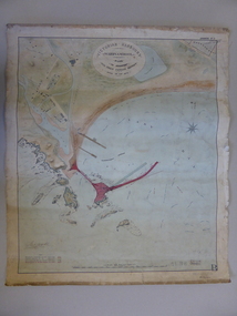
Document - Map, Warrnambool Harbour 1879, 1879
... His original plans for Warrnambool were revised because of cost but then subsequently found to be inadequate and later extended. ...Paper on linen map coloured, and depicting the harbour area of Warrnambool with the proposed breakwater plan in red. It has Victorian Harbours information in oval at top of map. ...In oval at top, “Victorian Harbours Warrnambool plan to accompany Sir John Coode report dated 28th Feb 1879. ...His original plans for Warrnambool were revised because of cost but then subsequently found to be inadequate and later extended. ...This map shows the plans by eminent harbour engineer, Sir John Coode in 1879. Construction of the breakwater commenced in 1884 and was completed in 1890. Coode first visited Australia in 1872 when he commenced work with the Melbourne Harbour Trust to report on ways to improve Melbourne Port. He is considered one of the most eminent harbour engineers of the 19th century. His original plans for Warrnambool were revised because of cost but then subsequently found to be inadequate and later extended. This was not successful either and the harbour continues to have silting problems to this day. The Warrnambool Breakwater is of historical importance to Victoria and as this map depicts the original plans, it too has great historical significance. It is also significant with its association with Sir John Coode, who was one of the most important port engineers of the 19th century. He worked to improve ports along the Victorian coast including Portland, Geelong, Port Fairy and Lakes Entrance. While this map demonstrates the engineering skills of the era, it also reflects the limitations when natural elements are involved. Its Historical importance also lies in the depiction of items on the map which relate to Warrnambool’s early history. Paper on linen map coloured, and depicting the harbour area of Warrnambool with the proposed breakwater plan in red. It has Victorian Harbours information in oval at top of map. It shows depths of some areas.In oval at top, “Victorian Harbours Warrnambool plan to accompany Sir John Coode report dated 28th Feb 1879. Drawing No 2. Scale 500 feet to 1 inch at bottom centre. Sir John Coode signature in bottom left corner. A 33 A on bottom left reversesir john goode, warrnambool harbour map, warrnambool harbour map 1879, port of warrnambool map 1879 -
 Warrnambool and District Historical Society Inc.
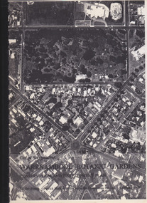
Book, Warrnambool Botanic Garden Masterplan, February 1995
... This is a publication containing a master plan for the Warrnambool Botanic Gardens. It has a section on acknowledgements, a summary, eight chapters, and 14 appendices. ...Front Cover: City of Warrnambool, Warrnambool Botanic Gardens, Conservation and Development Plan, Jill Orr-Young, Patrick Mallon, SF Consultants Pty Ltd, February 1995. ...This is a publication containing a master plan for the Warrnambool Botanic Gardens. It has a section on acknowledgements, a summary, eight chapters, and 14 appendices. ...This Warrnambool Botanic Gardens Study and Report was funded by the National Estate Grants Program of the Australian Heritage Commission and the City of Warrnambool. It was monitored in progress by a Steering Committee consisting of representatives of the Botanic and Public Gardens Advisory Committee, the Warrnambool City Council, Friends of the Warrnambool Botanic Gardens and National Estate Grants Program representatives and community representatives. The Warrnambool Botanic Gardens were first sited close to the Hopkins River in 1859. In 1869 the gardens were relocated to the present day location in Botanic Road. This plan is of some importance as it gives an overview of the history and current condition in 1995 of the Warrnambool Botanic Gardens and draws up a plan for its future development. It is useful for research and for consideration by the City Council today of policy making and further development of the gardens. This is a publication containing a master plan for the Warrnambool Botanic Gardens. It has a section on acknowledgements, a summary, eight chapters, and 14 appendices. The pages are bound with plastic rings, the front cover is plasticized with an aerial photograph of the Botanic Gardens and surrounds and the back cover is lightweight cardboard. The pages contain printed material, fold out maps, sketches and diagrams and many photocopied photographs.Front Cover: City of Warrnambool, Warrnambool Botanic Gardens, Conservation and Development Plan, Jill Orr-Young, Patrick Mallon, SF Consultants Pty Ltd, February 1995. warrnambool botanic gardens, warrnambool -
 Flagstaff Hill Maritime Museum and Village
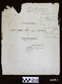
Legal record - Plans and Contract, Arthur H. Cutler, Architect, Warrnambool Town Hall, 1890-1892
... This is a set of documents including three sheets of blueprint plans for the New Town Hall and Offices for Warrnambool, created in 1890 by the Architect Mr Arthur H. ...Set of five documents that includes Plans for the Warrnambool Town Hall, the Contract cover page and a letter from the Architect to the Council. ...Cutler to Mayor and Councilors, Town of Warrnambool 3) Blueprint Sheet 4, Longitudinal Section, and profiles of Liebig Street and Timor Street, Warrnambool Town Hall, 4) Blueprint Sheet 3, First Floor & Balcony Plan, and Roof Plan 5) Blueprint Sheet 2, Ground Floor Plan, Warrnambool Town Hall 6) Contract, 26 June 1890, marked (Draft Copy Tow Hall Contract), Between Mayor, Councillors and Rate Payers, and William Kellas, Contractor Warrnambool Town Hall Legal record Plans and Contract Arthur H. ...This is a set of documents including three sheets of blueprint plans for the New Town Hall and Offices for Warrnambool, created in 1890 by the Architect Mr Arthur H. Cutler of Melbourne. The Contract was signed by the Town Mayor for Warrnambool, Mr William Simpson on May 7th 1890. Also, a Council copy of the Contract dated 26 June 1890, with the signatures and diagram where the two official stamps would be placed. The Foundation Stone was laid the following year by the next Mayor, John Hyland on February 24th 1891. The contractor for the building was granted to W. Kellas (William) of Warrnambool. The Town Hall and Offices were built on the corner of Liebig and Timor Streets in Warrnambool. On March 20th 1983 the new Performing Arts Centre was opened y the Mayor, Councillor R w Andreson, on the same site. The new building incorporates the 1890 Town Hall building. The plans, contracts, documents and various references to people on the documents are significant to the history of the City of Warrnambool and its community. The Warrnambool Town Hall building is also significant for the many community events held there over the decades after it was built. Appreciation for the significance of the almost century-old Town Hall building is demonstrated by its inclusion in the new Performing Arts Centre.Set of five documents that includes Plans for the Warrnambool Town Hall, the Contract cover page and a letter from the Architect to the Council. The Contract cover page and the Letter are hand written on cream-coloured paper with a waxy finish, with watermarks. 1) Contract Cover Page, 5th May 1890, Specification of the New Town Hall and Offices at Warrnambool. 2) Letter, 29th January 1892, from Architect Arthur H. Cutler to Mayor and Councilors, Town of Warrnambool 3) Blueprint Sheet 4, Longitudinal Section, and profiles of Liebig Street and Timor Street, Warrnambool Town Hall, 4) Blueprint Sheet 3, First Floor & Balcony Plan, and Roof Plan 5) Blueprint Sheet 2, Ground Floor Plan, Warrnambool Town Hall 6) Contract, 26 June 1890, marked (Draft Copy Tow Hall Contract), Between Mayor, Councillors and Rate Payers, and William Kellas, ContractorWatermarks on handwritten pages [horizontal lines], "36" "BUSBRIDGE'S / LOFT DRIED" Contract cover page, Oval stamp "CUTLER - 281 COLLINS ST. E. MELBOURNE - ARCHITECT " (other crossed out text) Handwritten script "This is the specifications referred to in our agreement" "Dated this 7th day of May A.D. 1890" Signed "W. Simpson Mayor" "Arthur H. Cutler Architect", [two Witnesses' signatures and others] Letter from Arthur Cutler, handwritten, has his address "472 Chancery Lane, Melbourne" CONTRACT of 26 June 1890: "The Mayor, Councillors and Rate Payers of Warrnambool" "William Kellas of Warrnambool" "Signed William Simpson, Maoyorr" "R F Kennedy, Councillor" "Wm Kellas" with diagrams where the round Common Seal and square Stamp would be applied.warrnambool, flagstaff hill, warrnambool, flagstaff hill maritime museum, maritime village, shipwreck coast, great ocean roaad, warrnamboo town hall, warrnambool council offices, mayor william simpson, arthur h cutler, architect, civic centre, town hall, performing arts centre, mayor john hyland, william kellas, mayor r w anderson, r f kennedy, contract -
 Flagstaff Hill Maritime Museum and Village
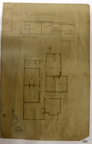
Document - Plan, Pilots Quarters Warrnambool
... warrnambool...shipwrecked-coast...flagstaff-hill...flagstaff-hill-maritime-museum...maritime-museum...shipwreck-coast...flagstaff-hill-maritime-village...plan...Warrnambool’s Tourist Guide of 1888 advises that “At the Port of Warrnambool there are two Leading Lighthouses. A licensed sea pilot, Captain Drewett, is stationed at the Port.” In 1915 plans...Plan of Pilots Quarters, Warrnambool. Printed and handwritten plan shows house, garage, out buildings and maid's room. ...The Pilot’s quarters are connected to a time when access to Warrnambool’s Port was important to the colonial settlers for income and supplies. flagstaff hill warrnambool shipwrecked-coast flagstaff-hill flagstaff-hill-maritime-museum maritime-museum shipwreck-coast flagstaff-hill-maritime-village plan pilot's quarters warrnambool pilot and harbourmaster's quarters warrnambool pilot and harbour master's quarters Warrnambool port of Warrnambool Department of Public Works Victoria Lady Bay Lighthouses Warrnambool Ports and Harbours light keeper "PILOTS QUARTERS WARRNAMBOOL" "Department of Public works, Melbourne, Victoria I.P.K. , 11.3.15" Plan of Pilots Quarters, Warrnambool. ...Warrnambool was officially made a Port of Entry in 1855 and by the 1870s had became the dominant port in the Western District. Sadly, due to an increasing problem with silting in the harbour, by the 1890s only small vessels could navigate the harbour. Men with the position of Pilot and Harbourmaster in Warrnambool were employed by the government to enforce government regulations and to help guide vessels safely into the port of Lady Bay, which was difficult to navigate. Some of the Pilots and Harbour Masters of Warrnambool were – - Captain Christopher Gwatkin, the first Harbourmaster for Warrnambool (1857 - his death in 1859). - Captain Helpman was Warrnambool’s second Harbourmaster 1859-1869 - James Nicol was Harbourmaster in Warrnambool for a time, including 1906 (b. 1840 – d. 1926) - Thomas Smith Drewett (1853 - 15-3-1905) past Captain of the Helen Nicoll, Pilot and Harbourmaster of Warrnambool. Warrnambool’s Tourist Guide of 1888 advises that “At the Port of Warrnambool there are two Leading Lighthouses. A licensed sea pilot, Captain Drewett, is stationed at the Port.” In 1915 plans for the Pilot’s Quarters were drawn up for the Department of Public Work. It was at that time, when personnel was short due to the First World War, that apparently the Pilot and Harbourmaster was also responsible for maintaining the light (lighthouse). The new Pilot and Harbourmaster’s house would be built on the site at 88 Merri Street, overlooking Lady Bay and right beside the Flagstaff and the Lady Bay Upper Lighthouse. Other Pilot and Harbourmasters were - - James Menzies was the Pilot and Harbourmaster at Warrnambool in 1929 . In 1932, he was appointed to the position of Acting Secretary to the Warrnambool Harbour Board. A hundred or so years later Flagstaff Hill Maritime Village has fully renovated the former Harbourmaster’s quarters, changed the name to Lighthouse Lodge, and is now allowing guests to stay in the home, which is still neighbour to the operational Lady Bay Lighthouses, now over 150 years old. The association of the old Pilot and Harbourmaster’s Quarters (currently renamed as Lighthouse Lodge) with the Port of Warrnambool, and its maritime activities, is historically significant. The Pilot’s quarters are connected to a time when access to Warrnambool’s Port was important to the colonial settlers for income and supplies. Plan of Pilots Quarters, Warrnambool. Printed and handwritten plan shows house, garage, out buildings and maid's room. The plan's lower left corner has an official stamp and text beside the stamp. Department of Public Works, Melbourne, Victoria, March 11th, 1915. "PILOTS QUARTERS WARRNAMBOOL" "Department of Public works, Melbourne, Victoria I.P.K. , 11.3.15"flagstaff hill, warrnambool, shipwrecked-coast, flagstaff-hill, flagstaff-hill-maritime-museum, maritime-museum, shipwreck-coast, flagstaff-hill-maritime-village, plan, pilot's quarters warrnambool, pilot and harbourmaster's quarters warrnambool, pilot and harbour master's quarters warrnambool, port of warrnambool, department of public works victoria, lady bay lighthouses, warrnambool ports and harbours, light keeper -
 Warrnambool and District Historical Society Inc.
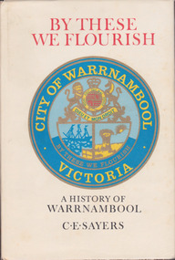
Book, C. E. Sayers, By These We Flourish A History of Warrnambool, 1969
... This is a hard cover book with a sepia photograph on the cover and a cream-coloured dust cover with a colour image of the City of Warrnambool logo. Endpapers have a black and white 1840s sketch of a Plan of Township and Warrnambool Bay. ...This is a hard cover book with a sepia photograph on the cover and a cream-coloured dust cover with a colour image of the City of Warrnambool logo. Endpapers have a black and white 1840s sketch of a Plan of Township and Warrnambool Bay. ...History of Warrnambool to 1969This is a hard cover book with a sepia photograph on the cover and a cream-coloured dust cover with a colour image of the City of Warrnambool logo. Endpapers have a black and white 1840s sketch of a Plan of Township and Warrnambool Bay. There are 21 chapters and 16 pages of black and white photographs. There is a Foreword by Harold Stephenson, an introduction by the author, a Table of Contents, an Index, Appendices and lists of Warrnambool Councillors. non-fictionHistory of Warrnambool to 1969history of warrnambool book, ‘by these we flourish’, c e sayers, warrnambool -
 Warrnambool and District Historical Society Inc.
Documents, Atlas Automatic Fire Services Pty Ltd, Woollen Mill, late 20th century
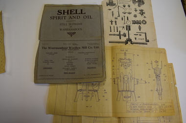
... .1 A sheet of white paper showing a sketch plan in black of the Warrnambool Woollen Mill with three areas coloured pink, yellow and blue .2 the same as .1 except that there are no shaded areas. .3 A sheet of lightweight card with black and yellow printing and a diagram of a machine ...Warrnambool Woollen Mill History of Warrnambool Onkaparinga Woollen Company Dunlop company Fire Plan For Insurance Purposes Atlas Automatic Fire Services Pty Ltd .1 A sheet of white paper showing a sketch plan in black of the Warrnambool Woollen Mill with three areas coloured pink, yellow and blue .2 the same as .1 except that there are no shaded areas. .3 A sheet of lightweight card with black and yellow printing and a diagram of a machine Woollen Mill Documents Atlas Automatic Fire Services Pty Ltd ...These items are from the Warrnambool Woollen Mill and relate to the fire protection services operating at the factory in the late 20th century. The Warrnambool Woollen Mill was commenced as a local public company and opened in 1910 in South Warrnambool with the first manager, John Bennett. During World War Two there were 700 employees at the mill due to wartime demand. In 1958 the factory became the first in Australia to manufacture electric blankets. In 1968 the mill was purchased by the Dunlop company and in 1982 Dunlop sold out to Onkaparinga Woollen Company which was taken over by Macquarie Worsteds and became known as Warrnambool Textiles. When Macquarie Worsteds ceased operations in Warrnambool the Smith Family managed the factory on behalf of the owners, the Warrnambool City Council. In 2000 the Woollen Mill closed and the site has been sold and developed as a housing estate.These items are of minor interest as mementoes of the Warrnambool Woollen Mill and will be added to the Woollen Mill collection in the Historical Society archives. .1 A sheet of white paper showing a sketch plan in black of the Warrnambool Woollen Mill with three areas coloured pink, yellow and blue .2 the same as .1 except that there are no shaded areas. .3 A sheet of lightweight card with black and yellow printing and a diagram of a machine Fire Plan For Insurance Purposes Atlas Automatic Fire Services Pty Ltd warrnambool woollen mill, history of warrnambool, onkaparinga woollen company, dunlop company -
 Warrnambool and District Historical Society Inc.
Map, Victorian Railway W'bool No1 & No2, 1897
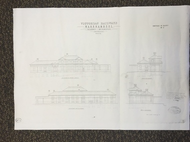
... These two sheets show the 1897 plans drawn up by the Victorian Railways for the erection of the Warrnambool Railway Station building. ...These are two architect’s plans and drawings of the Warrnambool Railway Station building (1897). ...The coming of the railway was a significant event in Warrnambool’s history and did much to make the port and shipping a less viable proposition. warrnambool railway station buildings ‘Victorian Railways, Warrnambool, Station Buildings, Scale 8 feet to one inch, Contract No. 6379B (Nos. 1 and 2)’ These are two architect’s plans and drawings of the Warrnambool Railway Station building (1897). ...These two sheets show the 1897 plans drawn up by the Victorian Railways for the erection of the Warrnambool Railway Station building. It is a two-storey building still existing today. The railway came to Warrnambool in 1890 and they must have used temporary buildings for seven years before this railway building was erected. It had offices, booking counter and public facilities on the ground floor and housing for the Station Master on the first floor. The building erected was a typical design for country town railway stations and many of similar design were erected in the 1880s and 90s. These plans are important because they show clearly the design of the Warrnambool Railway Station buildings when they were first erected in the 1890s.They will be very useful for researchers. The coming of the railway was a significant event in Warrnambool’s history and did much to make the port and shipping a less viable proposition.These are two architect’s plans and drawings of the Warrnambool Railway Station building (1897). The drawings are black and white and the first plan shows the ground floor plan and the first floor plan and the outbuildings. The second plan shows drawings of the building with its elevation to the platform and its elevation to Merri Street. There are two stamps of the Railways Department, Melbourne. These are copies, not originals. ‘Victorian Railways, Warrnambool, Station Buildings, Scale 8 feet to one inch, Contract No. 6379B (Nos. 1 and 2)’warrnambool, railway station buildings -
 Flagstaff Hill Maritime Museum and Village
Artwork, other - A religious print and almanac, Australasian Church of Christ, 1892
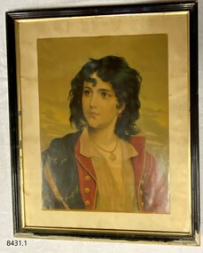
... Churches of Christ in Victoria began with the arrival of the Ingram and Picton families from England who established regular meetings in Prahran and officially constituted a congregation in 1855. In Warrnambool plans were drawn up in 1883 for the erection of a Church of Christ at 12 Spence Street. ...Churches of Christ in Victoria began with the arrival of the Ingram and Picton families from England who established regular meetings in Prahran and officially constituted a congregation in 1855. In Warrnambool plans were drawn up in 1883 for the erection of a Church of Christ at 12 Spence Street. ...This religious almanac with biblical imagery listed the Churches of Christ in Australasia and scripture readings for a calendar year of 1892. The almanac was produced and updated annually to reflect current information. The Churches of Christ in Australia is a Reformed Restorationist denomination. Congregations in South Australia, Victoria and New South Wales were established by individuals who travelled to these colonies to pursue employment opportunities, elsewhere in Australia Churches of Christ congregations were established as missionary initiatives. Churches of Christ in Victoria began with the arrival of the Ingram and Picton families from England who established regular meetings in Prahran and officially constituted a congregation in 1855. In Warrnambool plans were drawn up in 1883 for the erection of a Church of Christ at 12 Spence Street. The church was opened in 1885 with visiting pastors until a resident minister, A. J. Fisher, was appointed in 1915. This church was closed early in the 21st century when a new church, Gateway Church of Christ, was opened in Ragland Parade in Warrnambool. A rare survival of social and spiritual ephemera related to the Christian worship throughout Australia during the late nineteenth century. Portrait of a religious female figure wearing a naval type of coat and pendent around her neck. On the rear of the frame is an 1892 Australasian Church of Christ Almanac for suggested scripture readings. One of a pair.flagstaff hill, warrnambool, maritime museum, 1892, almanac, scripture readings, australiasian church of christ, church, religion, christianity -
 Flagstaff Hill Maritime Museum and Village
Artwork, other - A religious print and almanac, Australasian Church of Christ, 1892
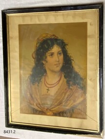
... Churches of Christ in Victoria began with the arrival of the Ingram and Picton families from England who established regular meetings in Prahran and officially constituted a congregation in 1855. In Warrnambool plans were drawn up in 1883 for the erection of a Church of Christ at 12 Spence Street. ...Churches of Christ in Victoria began with the arrival of the Ingram and Picton families from England who established regular meetings in Prahran and officially constituted a congregation in 1855. In Warrnambool plans were drawn up in 1883 for the erection of a Church of Christ at 12 Spence Street. ...This religious almanac with biblical imagery listed the Churches of Christ in Australasia and scripture readings for a calendar year of 1892. The almanac was produced and updated annually to reflect current information. The Churches of Christ in Australia is a Reformed Restorationist denomination. Congregations in South Australia, Victoria and New South Wales were established by individuals who travelled to these colonies to pursue employment opportunities, elsewhere in Australia Churches of Christ congregations were established as missionary initiatives. Churches of Christ in Victoria began with the arrival of the Ingram and Picton families from England who established regular meetings in Prahran and officially constituted a congregation in 1855. In Warrnambool plans were drawn up in 1883 for the erection of a Church of Christ at 12 Spence Street. The church was opened in 1885 with visiting pastors until a resident minister, A. J. Fisher, was appointed in 1915. This church was closed early in the 21st century when a new church, Gateway Church of Christ, was opened in Ragland Parade in Warrnambool. A rare survival of social and spiritual ephemera related to the Christian worship throughout Australia during the late nineteenth century. Portrait of a religious female figure wearing a simple dress with a crucifix around her neck. On the rear of the frame is an 1892 Australasian Church of Christ Almanac for suggested scripture readings. One of a pair.flagstaff hill, warrnambool, maritime museum, 1892, almanac, scripture readings, australiasian church of christ, church, religion, christianity -
 Flagstaff Hill Maritime Museum and Village
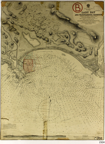
Document - Navigation Chart, Admiralty Office, Lady Bay and Warrnambool Harbour, 1893
... Warrnambool...Flagstaff Hill Maritime Museum & Village...Maritime Museum...Maritime Village...shipwreck coast...Map...chart...Navigation chart...plan...The Victorian Government had commissioned Sir John Coode, a British harbour engineer, to present a plan to complete the Warrnambool Breakwater but his original plan was too expensive. ...The Victorian Government had commissioned Sir John Coode, a British harbour engineer, to present a plan to complete the Warrnambool Breakwater but his original plan was too expensive. ...This navigation cart of Lady Bay and Warrnambool Harbour was originally surveyed in 1870 but this version includes the update for magnetic variation in 1893. Since the printing of the chart several annotations have been added. These include an additional stamp dated 15-8-1910, a handwritten comment across the top of the page dated August 1910, and another handwritten comment regarding the ‘Proposed Extension of Dock’ dated 19-2-1925, plus connected drawings, notes and figures. The 1925 proposal on this chart may have been a reaction to the Royal Commission of 1923, when the damaged stonework on the seaward side of the Warrnambool Breakwater, caused by the action of the sea, was the subject of enquiry. A conference between the Public Works, Water Commission and the Harbour Trust concluded that it would less costly to make repairs to prevent further damage rather than replaced the damage portion of the wall. A contract was raised in late 1924 to deposit rubble on the damaged side of the breakwater to minimise the Southern Ocean’s destructive action and work had started by August 1925. The Breakwater construction had begun in 1874 and was completed in 1890. The Victorian Government had commissioned Sir John Coode, a British harbour engineer, to present a plan to complete the Warrnambool Breakwater but his original plan was too expensive. He prepared a revised plan for a shorter structure. The construction proved to be too short to protect adequately from the weather and didn't allow enough depth for larger vessels to come into port. The decreasing trade was further affected by siltation in the bay due to the breakwater, and the completion of the railway line. The situation of the harbour became a real problem by 1910 and required continuous dredging. In 1914 the Breakwater was extended but proved to be a failure because the work began to subside and by 1920 about two thirds of the harbour was silted up. Alterations made in the 1920's increased the silting problem and by the 1940's the harbour was no longer used. More alterations were made in the 1950's and 1960's. This chart is significant for its strong connection to the maritime history of Warrnambool Harbour and Lady Bay and the Warrnambool Breakwater. The Warrnambool Breakwater is registered as a place of significance on the Victorian Heritage Database (VHR H2024). The Warrnambool Breakwater is one of the most important late 19th century maritime engineering projects in Victoria and significant in the development of Victorian coastal shipping. It is also significant for its connection with British harbour engineer, Sir John Coode. The chart is a historical record of structures existing in 1893; the Warrnambool Jetties, Warrnambool Breakwater in Lady Bay, the leading lights (lighthouses), streets, roads, bridges and many buildings. It also shows the lay of the land and seabed. Navigation Chart: Lady Bay and Warrnambool Harbour, Australia - South Coast - Victoria. Surveyed by Nav. Lieut. H.J. Stanley, R.N., 1870. Updated for Magnetic Variation, 1893. The rectangular chart is printed on heavy cream paper. Stamps are shaped rectangular, oval and round. Around the Breakwater and Jetty area are handwritten notes, dotted and joined lines, numbers and signatures, and shading of red and green. The chart shows the surrounds of Warrnambool Harbour, Lady Bay, the Breakwater and Jetty, roads, bridges and the streets in Warrnambool. It has sounding details, and angles of line from the leading lights.Stamp, rectangular, including "AUG 1910" Stamp, double oval " - - - -CHART" Stamp, hand drawn, red circle, with "B" inside Hand written note "22-8-1910 - - - - - of surveying C. Ca - - - request of 15-8-10 [initials] " Notes and lines in red pen, including a grid of sounding numbers: "1300" "1050" "1200" "Possible Extension of Dock" "19-2-25" "Dock Dredged to 20 Ft" Notes and lines in blue pen "Extension of Dock to accommodate vessels drawing 20 Feet" and "Light not visible south of this line" Red dots (4) with yellow highlight at both leading lights, breakwater and jettyflagstaff hill, warrnambool, flagstaff hill maritime museum & village, maritime museum, maritime village, shipwreck coast, map, chart, navigation chart, plan, lady bay, warrnambool harbour, port of warrnambool, breakwater, jetty, pier, dock extension, proposed extension, vhr h2024, 1870, 1893, 1910, 1925, warrnambool town late 1800s, warrnambool streets late 1800s royal commission, 1923, public works, water commission, harbour trust, victorian harbours, sir jon coode -
 Flagstaff Hill Maritime Museum and Village
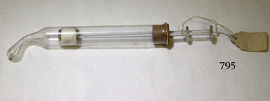
Equipment - Syringe
... planned with Dr Ryan’s assistants several days in advance. Dr Angus gained experience in using the X-ray machine there during his time as assistant to Dr Ryan. When Dr Angus bought into the Nelson Street premises in Nhill he was also appointed as the Nhill Hospital’s Honorary House Surgeon 1933-1938. His practitioner’s plate from his Nhill surgery is now mounted on the doorway to the Port Medical Office at Flagstaff Hill Maritime Village, Warrnambool...planned with Dr Ryan’s assistants several days in advance. Dr Angus gained experience in using the X-ray machine there during his time as assistant to Dr Ryan. When Dr Angus bought into the Nelson Street premises in Nhill he was also appointed as the Nhill Hospital’s Honorary House Surgeon 1933-1938. His practitioner’s plate from his Nhill surgery is now mounted on the doorway to the Port Medical Office at Flagstaff Hill Maritime Village, Warrnambool ...In 1821 the French otologist Jean Marc Itard irrigated the ear canal to remove hard wax, by using a syringe prototype designed for enemas which was made from tin and brass. This glass and cork ear syringe was manufactured by the Ambson Company in the United Kingdom, about eighty years afterwards. Its lightweight properties would have been ideal for application to the sensitive regions of the ear canal. https://www.racgp.org.au/the-racgp/history/the-racgp-museum-collection/syringes/ambson-ear-syringe Otology is a branch of medicine which studies normal and pathological anatomy and physiology of the ear (hearing and vestibular sensory systems and related structures and functions) as well as their diseases, diagnosis and treatment. Otologic surgery generally refers to surgery of the middle ear and mastoid related to chronic otitis media, such as tympanoplasty, or ear drum surgery, ossiculoplasty, or surgery of the hearing bones, and mastoidectomy. Otology also includes surgical treatment of conductive hearing loss, such as stapedectomy surgery for otosclerosis. https://en.wikipedia.org/wiki/Otology The ear syringe was donated to Flagstaff Hill Maritime Village by the family of Doctor William Roy Angus, Surgeon and Oculist. It is part of the “W.R. Angus Collection” includes historical medical equipment, surgical instruments and material once belonging to Dr Edward Ryan and Dr Thomas Francis Ryan, (both of Nhill, Victoria) as well as Dr Angus’ own belongings. The Collection’s history spans the medical practices of the two Doctors Ryan, from 1885-1926 plus that of Dr Angus, up until 1969. ABOUT THE “W.R.ANGUS COLLECTION” Doctor William Roy Angus M.B., B.S., Adel., 1923, F.R.C.S. Edin.,1928 (also known as Dr Roy Angus) was born in Murrumbeena, Victoria in 1901 and lived until 1970. He qualified as a doctor in 1923 at University of Adelaide, was Resident Medical Officer at the Royal Adelaide Hospital in 1924 and for a period was house surgeon to Sir (then Mr.) Henry Simpson Newland. Dr Angus was briefly an Assistant to Dr Riddell of Kapunda, then commenced private practice at Curramulka, Yorke Peninsula, SA, where he was physician, surgeon and chemist. In 1926, he was appointed as new Medical Assistant to Dr Thomas Francis Ryan (T.F. Ryan, or Tom), in Nhill, Victoria, where his experiences included radiology and pharmacy. In 1927 he was Acting House Surgeon in Dr Tom Ryan’s absence. Dr Angus had become engaged to Gladys Forsyth and they decided he further his studies overseas in the UK in 1927. He studied at London University College Hospital and at Edinburgh Royal Infirmary and in 1928, was awarded FRCS (Fellow from the Royal College of Surgeons), Edinburgh. He worked his passage back to Australia as a Ship’s Surgeon on the on the Australian Commonwealth Line’s T.S.S. Largs Bay. Dr Angus married Gladys in 1929, in Ballarat. (They went on to have one son (Graham 1932, born in SA) and two daughters (Helen (died 12/07/1996) and Berenice (Berry), both born at Mira, Nhill ) According to Berry, her mother Gladys made a lot of their clothes. She was very talented and did some lovely embroidery including lingerie for her trousseau and beautifully handmade baby clothes. Dr Angus was a ‘flying doctor’ for the A.I.M. (Australian Inland Ministry) Aerial Medical Service in 1928 . Its first station was in the remote town of Oodnadatta, where Dr Angus was stationed. He was locum tenens there on North-South Railway at 21 Mile Camp. He took up this ‘flying doctor’ position in response to a call from Dr John Flynn; the organisation was later known as the Flying Doctor Service, then the Royal Flying Doctor Service. A lot of his work during this time involved dental surgery also. Between 1928-1932 he was surgeon at the Curramulka Hospital, Yorke Peninsula, South Australia. In 1933 Dr Angus returned to Nhill and purchased a share of the Nelson Street practice and Mira hospital (a 2 bed ward at the Nelson Street Practice) from Dr Les Middleton one of the Middleton Brothers, the current owners of what previously once Dr Tom Ryan’s practice. Dr Tom and his brother had worked as surgeons included eye surgery. Dr Tom Ryan performed many of his operations in the Mira private hospital on his premises. He had been House Surgeon at the Nhill Hospital 1902-1926. Dr Tom Ryan had one of the only two pieces of radiology equipment in Victoria during his practicing years – The Royal Melbourne Hospital had the other one. Over the years Dr Tom Ryan had gradually set up what was effectively a training school for country general-practitioner-surgeons. Each patient was carefully examined, including using the X-ray machine, and any surgery was discussed and planned with Dr Ryan’s assistants several days in advance. Dr Angus gained experience in using the X-ray machine there during his time as assistant to Dr Ryan. When Dr Angus bought into the Nelson Street premises in Nhill he was also appointed as the Nhill Hospital’s Honorary House Surgeon 1933-1938. His practitioner’s plate from his Nhill surgery is now mounted on the doorway to the Port Medical Office at Flagstaff Hill Maritime Village, Warrnambool. When Dr Angus took up practice in the Dr Edward and Dr Tom Ryan’s old premises he obtained their extensive collection of historical medical equipment and materials spanning 1884-1926. A large part of this collection is now on display at the Port Medical Office at Flagstaff Hill Maritime Village in Warrnambool. In 1939 Dr Angus and his family moved to Warrnambool where he purchased “Birchwood,” the 1852 home and medical practice of Dr John Hunter Henderson, at 214 Koroit Street. (This property was sold in1965 to the State Government and is now the site of the Warrnambool Police Station. and an ALDI sore is on the land that was once their tennis court). The Angus family was able to afford gardeners, cooks and maids; their home was a popular place for visiting dignitaries to stay whilst visiting Warrnambool. Dr Angus had his own silk worm farm at home in a Mulberry tree. His young daughter used his centrifuge for spinning the silk. Dr Angus was appointed on a part-time basis as Port Medical Officer (Health Officer) in Warrnambool and held this position until the 1940’s when the government no longer required the service of a Port Medical Officer in Warrnambool; he was thus Warrnambool’s last serving Port Medical Officer. (Masters of immigrant ships arriving in port reported incidents of diseases, illness and death and the Port Medical Officer made a decision on whether the ship required Quarantine and for how long, in this way preventing contagious illness from spreading from new immigrants to the residents already in the colony.) Dr Angus was a member of the Australian Medical Association, for 35 years and surgeon at the Warrnambool Base Hospital 1939-1942, He served with the Australian Department of Defence as a Surgeon Captain during WWII 1942-45, in Ballarat, Victoria, and in Bonegilla, N.S.W., completing his service just before the end of the war due to suffering from a heart attack. During his convalescence he carved an intricate and ‘most artistic’ chess set from the material that dentures were made from. He then studied ophthalmology at the Royal Melbourne Eye and Ear Hospital and created cosmetically superior artificial eyes by pioneering using the intrascleral cartilage. Angus received accolades from the Ophthalmological Society of Australasia for this work. He returned to Warrnambool to commence practice as an ophthalmologist, pioneering in artificial eye improvements. He was Honorary Consultant Ophthalmologist to Warrnambool Base Hospital for 31 years. He made monthly visits to Portland as a visiting surgeon, to perform eye surgery. He represented the Victorian South-West subdivision of the Australian Medical Association as its secretary between 1949 and 1956 and as chairman from 1956 to 1958. In 1968 Dr Angus was elected member of Spain’s Barraquer Institute of Barcelona after his research work in Intrasclearal cartilage grafting, becoming one of the few Australian ophthalmologists to receive this honour, and in the following year presented his final paper on Living Intrasclearal Cartilage Implants at the Inaugural Meeting of the Australian College of Ophthalmologists in Melbourne In his personal life Dr Angus was a Presbyterian and treated Sunday as a Sabbath, a day of rest. He would visit 3 or 4 country patients on a Sunday, taking his children along ‘for the ride’ and to visit with him. Sunday evenings he would play the pianola and sing Scottish songs to his family. One of Dr Angus’ patients was Margaret MacKenzie, author of a book on local shipwrecks that she’d seen as an eye witness from the late 1880’s in Peterborough, Victoria. In the early 1950’s Dr Angus, painted a picture of a shipwreck for the cover jacket of Margaret’s book, Shipwrecks and More Shipwrecks. She was blind in later life and her daughter wrote the actual book for her. Dr Angus and his wife Gladys were very involved in Warrnambool’s society with a strong interest in civic affairs. He had an interest in people and the community They were both involved in the creation of Flagstaff Hill, including the layout of the gardens. After his death (28th March 1970) his family requested his practitioner’s plate, medical instruments and some personal belongings be displayed in the Port Medical Office surgery at Flagstaff Hill Maritime Village, and be called the “W. R. Angus Collection”.The W.R. Angus Collection is significant for still being located at the site it is connected with, Doctor Angus being the last Port Medical Officer in Warrnambool. The collection of medical instruments and other equipment is culturally significant, being an historical example of medicine from late 19th to mid-20th century. Dr Angus assisted Dr Tom Ryan, a pioneer in the use of X-rays and in ocular surgery.Glass ear syringe. Has cork stopper at top and cotton wrapped at base of plunger. Has a curved end.None.flagstaff hill, warrnambool, shipwrecked-coast, flagstaff-hill, flagstaff-hill-maritime-museum, maritime-museum, shipwreck-coast, flagstaff-hill-maritime-village, otology, ears, ear syringe, deafness, ear wax -
 Flagstaff Hill Maritime Museum and Village
Oar, early 20th century
... WARRNAMBOOL could be seen faintly on the lifeboat before it was restored. It was during the restoration that Flagstaff Hill's boat builder discovered the 'plaque' inside the hull. A copy of the blueprint plans...WARRNAMBOOL could be seen faintly on the lifeboat before it was restored. It was during the restoration that Flagstaff Hill's boat builder discovered the 'plaque' inside the hull. A copy of the blueprint plans ...This oar is from the Lifeboat Warrnambool, which is on sit at Flagstaff Hill Maritime Village. The construction of the lifeboat ‘Warrnambool’ began 15th September 1909 and was completed almost 12 months later, 1st September 1910. It was built at the Government Dockyard in Williamstown, Victoria, along the lines designed by the Great Britain’s Royal Lifeboat Institution, and included whaleback decks fore and aft, mast and centreboard, and rudder and tiller hung from the sternpost. It could be propelled by both sail and oar. At that time Captain Ferguson was Chief Harbour Master and Mr Beagley was foreman boat builder. Mr Beagley built the lifeboat with his fellow workmen. The boat was described as “… a fine piece of workmanship and does credit to her builders and designers…” It had all the latest improvements in shape, disposition of weight and watertight compartments, and it had space for a large number of people in addition to the crew. It appears that 'H Meiers' whose signature was on the plaque that was found concealed in the hull, was involved with the building of the lifeboat. His signature and the dates of the start and finish of the boat’s construction are pencilled on the raw timber 'plaque' found in the hull in the early 1990’s when the lifeboat was being restored. It is interesting that the ‘Melbourne Directory’ of 1911, published by Sands and MacDougal, lists McAuley and Meiers, boat builders, Nelson Place foreshore, between Pasco and Parker Streets, Williamstown, (Victorian Heritage Database, ‘Contextual History, Maritime Facilities’), It is quite possibly the business of the person whose name is inscribed on the lifeboat plaque. Flagstaff Hill’s documentation also mentions that the keel was laid at ‘Harry Myers, boat builders, Williamstown, Melbourne’ – the name ‘Myers’ can also be spelled ‘Meiers’, which could be the same person as the Meiers in “McAuley and Meiers” (as mentioned in genealogy lines of Myers). The new lifeboat, to be named ‘Warrnambool’ was brought to town by train and launched at the breakwater on 1st March 1911 using the Titan crane (the old lifeboat built in 1858, was then returned to Melbourne in 1911). This new lifeboat was stationed at Warrnambool in a shed located at the base of the Breakwater, adjacent to the slipway. A winch was used to bring it in and out of the water. The lifeboat ‘Warrnambool’ was similar in size to the old lifeboat but far superior in design, build and sea-going qualities such as greater manoeuvrability. The ‘self-righting, self-draining’ design was “practically non-capsizeable” and even if the boat overturned it would right itself to an even keel and the water would drain away. The hull was built of New Zealand Kauri, using double diagonal planking, laid in two layers at right angles, with a layer of canvas and red lead paint between the timbers to help seal the planking. It has “… plenty of freeboard, high watertight spaces between the deck and bottom… through which pipes lead…” The backbone timbers were made of Jarrah. The lifeboat Warrnambool was one of several rescue boats used at Port Fairy and Warrnambool in early 1900's. In late 1914 the Warrnambool lifeboat and crew were used to help find what was left of the tragic wreckage of the Antares, and were able to discover the body of one of the crewmen, which they brought back to Warrnambool. Between 1951 and 1954 the lifeboat was manned under the guidance of Captain Carrington. He held lifeboat practice each month on a Sunday morning, to comply with the Ports and Harbour’s request that lifeboats be manned by a strong and competent crew, ready for action in case of emergency. In the early 1960’s it ended its service as a lifeboat and was used in Port Fairy as a barge to help dredge the Moyne River, bolted to the Port Fairy lifeboat. Flagstaff Hill obtained the Warrnambool in 1975. In 1984 it was on display at Flagstaff Hill Maritime Village, Warrnambool. On 23rd May 1990 she was lifted from the water and placed in a cradle for restoration. The name ‘WARRNAMBOOL could be seen faintly on the lifeboat before it was restored. It was during the restoration that Flagstaff Hill's boat builder discovered the 'plaque' inside the hull. A copy of the blueprint plans has the name “V.E.E. Gotch” printed on it. His advertisement in Footscray’s ‘Independent’ newspaper of Saturday 11th May 1901 states he is “Principal and Skilled member (Naval Architect) to the Court of Marine Inquiry of Victoria and holds classes for naval architectural drawing and arithmetic.” The oar is significant for its association with the lifeboat WARRNAMBOOL, which is significant for its half century service to the local community as a lifesaving vessel. She was also used to help retrieve the body of a shipwrecked crew member of the ANTARES. Large wooden oar, shaped two handgrip with tapering shaft to large flattened blade, (2) copper reinforcing strips on blade. Sweep oar is from the Lifeboat Warrnambool. flagstaff hill, warrnambool, shipwrecked-coast, flagstaff-hill, flagstaff-hill-maritime-museum, maritime-museum, shipwreck-coast, flagstaff-hill-maritime-village, oar, lifeboat warrnambool, sweep oar -
 Flagstaff Hill Maritime Museum and Village
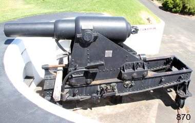
Weapon - Cannon, 1866
... (Conservation Management Plan for Victorian Guns and Cannon, South Western Victoria, May 2008, ref W/F/05) The Warrnambool Garrison has been added to the Victorian Heritage Register H1250 “for its intact battery and guns, a strong reminder of Victoria’s wealth and determination to protect itself from the perceived threat of invasion in the 1880’s.” ...In the years following the Crimean War (1854-1857J) there was a great concern in the Colony that Imperial Russia would attempt an invasion. Coastal defences in the colony of Victoria were greatly strengthened by the Government as a result. Warrnambool was originally protected by cannons at Cannon Hill, approximately 1 kilometer west of the Flagstaff Hill Fortifications. These cannons included two 1866 guns, both 80 Pound Rifled Muzzle Loaders (RML) purchased by Victoria’s Colonial Government. They were part of a shipment of 26 such guns sent from England in December 1866. They are registered as No. 23 (80cwt-2qr-0lbs) - Gun 1, and No.13 (81cwt-1qr-12lbs) - Gun 2. They were cast at the Royal Gun Factory, Woolwich Arsenal, in 1866 and have a 6.3 inch bore. Both barrels carry the Royal Cypher of Queen Victoria, Insignia of the Royal Engineers, within the Garter and Motto surmounted by the Crown, with the Royal Cypher of Queen Victoria within the Garter (letters in centre “VR”, motto “HONI SOIT QUI MAL Y PENSE”, "Shame be to him who thinks evil of it."). The guns were originally supplied with wooden carriages. (The Royal Arsenal at Woolwich, England, was established eleven years after the Restoration of King Charles II. It was the principal supplier of armaments to the British and Empire Governments. At the height of its operations during World War One the factory covered 1300 acres and employed very nearly 80,000 workers. Woolwich was the Headquarters of the Royal Artillery since the raising of that Regiment in 1716. The Arsenal was closed in the late 1960’s.) These two cannons were transferred to the Warrnambool Garrison Artillery Battery Fortifications erected at Flagstaff Hill in 1887 as part of Victoria’s Coastal Defences. The original wooden carriages were subsequently replaced with the present iron garrison carriages in 1888. They are a “C” pivot. The ‘racers’ or curved track set into the floor of the gun emplacement (which enabled the guns to be traversed more quickly) are as specified for guns up to 10 inch, being of wrought iron 2.78 inches wide. A temporary third gun, now no longer on Flagstaff Hill’s site, was a 5 inch Rifled Breech Loading (BL) Armstrong gun mounted on an Elswick hydro pneumatic disappearing carriage It was faster to load and fire than the 80 pound RMLs and its arrival spelt the end of the older 80 pound guns’ useful life, apart from being used for practice sessions. The 5 inch BL gun was the main defensive weapon of the Warrnambool Battery until the Battery was downgraded in importance and the gun was recalled to Melbourne in 1910. The State of Victoria took over the ownership of the guns at the time of Australian Federation in 1901. In about 1901/1902 the Garrison Battery was converted to the Warrnambool Battery of the Australian Field Artillery (No 4 Field Battery). It was equipped with 4.7 inch naval guns mounted on field carriages. They were now a mobile unit but continued to use the Warrnambool Garrison area at Flagstaff Hill for practice. When the Fortifications were declared obsolete, the two 80 Pounder RML were relocated to Cannon Hill in 1910. On the outbreak of World War One the 4.7 inch guns were recalled to Melbourne, and the Battery was disbanded. Most of the personnel probably re-enlisted in the local 4th Australian Light Horse Regiment. The two 80 Pounder RML were moved back to the Fortifications in 1973. They were both fully restored by Army First Year Apprentices at the Ordinance Factory in Bendigo in time for the centenary year of the fortifications in 1987. The guns are capable of firing 80 pound (32.3kg) armour piercing exploding shells 3.65kms out to sea. They were original manned by volunteers before a paid Garrison was established. Now the Guns are again fired by volunteers on Special Event days. Since restoration the Gun Number 1 had been fired on a regular basis but Gun Number 2 hadn’t been fired since the mid 1990’s. In April 2015 Gun Number 2 was serviced in preparation for the firing of both cannons on the ANZAC Centenary commemorations on April 25th 2015. Other guns from the original Cannon Hill location were obsolete by the time the 1887 Warrnambool Garrison Artillery Battery was built. These guns are (1) a 32 Pounder Muzzle Loading Smooth Bore (SB) cast in 1813 at the famous Carron Foundry, number 80837 and now located in the Warrnambool Botanic Gardens (2) a 68 Pounder Muzzle Loading Smooth Bore cast in 1861 at the equally august Low Moor Foundry, number 10310 and now located on the lawn area at the entrance to Flagstaff Hill Maritime Village. Both of these guns are mounted on their original wooden garrison carriages. There are only seven 32 Pounder SB made by Carron and fifteen 68 Pounder SB made at Low Moor known to exist in the State of Victoria. Funding was received to repair Cannon No.2 and its iron carriage. After completion, both Cannon No 1 and No. 2 were 'fired' in a public re-enactment on April 4th, 2026. (Conservation Management Plan for Victorian Guns and Cannon, South Western Victoria, May 2008, ref W/F/05)The Warrnambool Garrison has been added to the Victorian Heritage Register H1250 “for its intact battery and guns, a strong reminder of Victoria’s wealth and determination to protect itself from the perceived threat of invasion in the 1880’s.” The City of Warrnambool is one of several custodians of a collection of artillery pieces of heritage significance at a state, national and international level. These pieces are directly related to the defence of south-west Victoria in the 19th century. The care and preservation come under the Heritage Act 1995. Cannon. 80 Pound Rifled Muzzle Loading (RML) Gun on iron carriage and slide, installed in the Battery at Flagstaff Hill’s Fortifications. Made in 1866 at the Royal Gun Factory (R-G-F), Woolich, England. Gun Reg No 13. Flagstaff Hill Garrison Gun 2 (Gun No. 2). Insignia of the Royal Engineers, and the weight of the gun, stamped on top of the gun’s barrel. There is a brass plate on the side of the gun with the details of 1987 restoration.Stamped into the metal on top of the barrel, Insignia of the Royal Engineers; Garter and Motto “HONI SOIT QUI MAL Y PENSE”, surmounted by the Crown, with the Royal Cypher of Queen Victoria “VR” within the Garter. Also stamped on top of the gun are 2 inward pointing arrows above the weight ”81-1-12”. Brass plate “RESTORATION / BY / FIRST YEAR / APPRENTICES / ORDANANCE FACTORY / BENDIGO 1987”flagstaff hill, warrnambool, shipwrecked coast, flagstaff hill maritime museum, maritime museum, shipwreck coast, flagstaff hill maritime village, great ocean road, colonial defences, victoria’s coastal defences, warrnambool fortification, warrnambool garrison battery, warrnambool volunteer corps, ordinance, armaments, cannon hill fortifications, 4th australian light horse regiment, no 4 field battery, 80 pound cannon rifled muzzle loaders (rml), victorian colonial government, royal gun factory england, woolwich arsenal, royal cypher of queen victoria, garrison gun -
 Flagstaff Hill Maritime Museum and Village
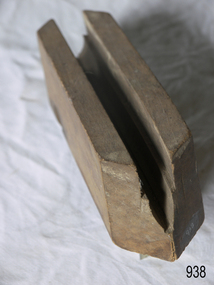
Tool - Sash Window Template, Late 19th to first quarter of the 20th century
... The template allowed the carpenter to mark accurately a channel that was then planed and the Mitre to join the bars. flagstaff hill warrnambool shipwrecked-coast flagstaff-hill flagstaff-hill-maritime-museum maritime-museum shipwreck-coast flagstaff-hill-maritime-village wooden ovalo sash template ovalo sash template template sash template sash templet window sash tool None Wooden Ovalo sash template with two screws each side. ...A window sash is a type of moveable window frame that can slide, usually vertically. Unlike a window frame built into the wall, a sash allows glass window panes to slide up and down. The sashes fit inside a track that runs along another window frame attached to the house. Lead weights traditionally counterbalanced sashes, but today they are counterbalanced by springs. The traditional sash window is double-hung; this means it has two sashes that can both slide along a vertical track. However, some sash windows have a single moveable sash, and sashes may slide horizontally. A sash usually contains panels of glass, called lights. The lights are traditionally held together by a grid of bars. The sash window was developed in 17th century England and allowed for greater airflow. The sash window has had a significant impact on western architecture, used in nearly every style of English domestic architecture since the late 17th century. The subject item is a template used by the carpenter to mark or scribe the vertical track in which to window will slide up and down.An item used when sash windows were made by hand from the 17th to the early 20th century. The template allowed the carpenter to mark accurately a channel that was then planed and the Mitre to join the bars.Wooden Ovalo sash template with two screws each side. It has slot along length and has 45 degree bevelled edge each end.Noneflagstaff hill, warrnambool, shipwrecked-coast, flagstaff-hill, flagstaff-hill-maritime-museum, maritime-museum, shipwreck-coast, flagstaff-hill-maritime-village, wooden ovalo sash template, ovalo sash template, template, sash template, sash templet, window sash, tool -
 Flagstaff Hill Maritime Museum and Village
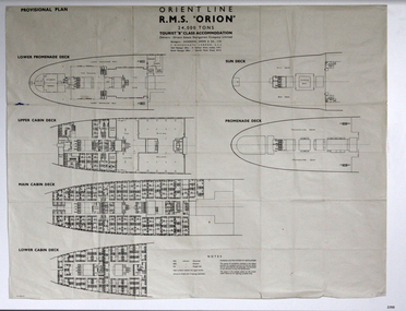
Plan - Ship Plan, Orient Steam Navigation Company, Orient Line, RMS Orion, ca. 1934
... Warrnambool...Maritime Museum...Maritime Village...Great Ocean Road...Shipwreck Coast...RMS ORION...Plan...plan for the RMS Orion is significant for its connection with the vessel. The ship was a leader, with several 'firsts'; the first Orient Line ship to be built with a single funnel since 1902, and the first to be painted in the Orient Line's livery, with a corn-coloured hull. It was the first liner to use chromium and bakelite materials for the surfaces throughout the ship, which provided greater resistance to the sea. It was also the first British ship to be fitted with air conditioning. Flagstaff Hill Flagstaff Hill Maritime Museum and Village Warrnambool ...The Orient Steam Navigation Company Limited launched the Ocean Liner RMS Orion in 1934 and it remained in operation until 1963. The twin screw steamship was built to carry first class and tourist class passengers, over 1100 in all, plus almost 500 crew from Europe to Australia in comfort. The ship had a single funnel and a single mast. During WWII the vessel served as a troop carrier. The ventilation system noted on the plan, Punkah Louvre System, was designed for heating fresh air ventilation in buildings, ships and railroads. The system originated from Thermotank in Glasgow, Scotland. The ship plan for the RMS Orion is significant for its connection with the vessel. The ship was a leader, with several 'firsts'; the first Orient Line ship to be built with a single funnel since 1902, and the first to be painted in the Orient Line's livery, with a corn-coloured hull. It was the first liner to use chromium and bakelite materials for the surfaces throughout the ship, which provided greater resistance to the sea. It was also the first British ship to be fitted with air conditioning.Plan: printed provisional line drawing of the Orient line vessel "R.M.S. Orion". Inscriptions are printed on the plan. There are diagrams of six decks included in the plan. The ship is built for tourist "B" accommodation. The plan's Notices include details of the cabins including wardrobes, drawers, hinged seats, mattresses and bunk numbers. It also notes that there is a Punkah-Louvre System of Ventilation.Printed on the plan: "PROVISIONAL PLAN" "LOWER PROMENADE DECK" "UPPER CABIN DECK" "MAIN CABIN DECK" "LOWER CABIN DECK" "SUN DECK" "PROMENADE DECK" "ORIENT LINE / R.M.S. "ORION" / 24,000 TONS / TOURIST "B" CLASS ACCOMMODATION" "Owners: Orient Steam Navigation Company Limited"' "Managers : ANDERSON, GREEN & CO. LTD" "7 BISHOPS GATE, LONDON, E.C.2" "Chief Passenger Office : 14 Cockspur Street, London, S.W.1" "Branch Passenger Office : 1 Australia House, Strand, W.C.2" "notices"flagstaff hill, flagstaff hill maritime museum and village, warrnambool, maritime museum, maritime village, great ocean road, shipwreck coast, rms orion, plan, ship plan, provisional plan, orient line, orient ship, vissel orion, class b passenger accommodation, punkah louvre system of ventilation, deck plan, ship ventilation, ship floor plan, orient steam navigation company limited, anderson green & co ltd, steamship, ocean liner, war ship, troop carrier -
 Flagstaff Hill Maritime Museum and Village
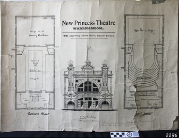
Plan
... Plan Architects of the New Princess Theatre, Kepler Street, Warrnambool, also the prospectus of the Princess Theatre Company....flagstaff hill warrnambool shipwrecked-coast flagstaff-hill flagstaff-hill-maritime-museum maritime-museum shipwreck-coast flagstaff-hill-maritime-village princess theatre kepler street princess theatre company Plan Architects of the New Princess Theatre, Kepler Street, Warrnambool, also the prospectus of the Princess Theatre Company. ...Plan Architects of the New Princess Theatre, Kepler Street, Warrnambool, also the prospectus of the Princess Theatre Company.flagstaff hill, warrnambool, shipwrecked-coast, flagstaff-hill, flagstaff-hill-maritime-museum, maritime-museum, shipwreck-coast, flagstaff-hill-maritime-village, princess theatre, kepler street, princess theatre company -
 Flagstaff Hill Maritime Museum and Village
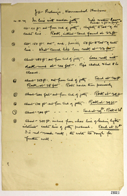
Document - Report, Jet Probings, Warrnambool Harbour, 16-10-1929
... Warrnambool Jetty and Lady Bay. The report gives figures for the depth and consistency of the water and seabed at a particular point in time and can be used to compart with similar figures taken at different times. The results could determine plans ...This report lists the depths of water and the consistency of the seabed surrounding the Warrnambool Harbour in October 1929, The information, often referred to as 'soundings', was obtained by Jet Probing,. In earlier days a lead line was used to perform a similar task. The author of the document is unknown. Jet Probing is a method used for underwater archaeology, cable installation and coastal engineering. A jet probe is a machine that produces a strong jet of water that penetrates the layers of sediment on the seabed, determining their depth, thickness and consistency. It provides a survey of the seabed and can be used as an aid to engineering design and construction. The report mentions lining up with the wooden jetty, the end of the breakwater and the leading lights. It mentions sand, loose rock and rock. It tells of stopping work due to the water being too rough, the pipe choking, difficulty in connecting pipes, and pipe joint breaking as it tried to get through the sand, The report in the document is significant for its connection with the Warrnambool Harbour, Warrnambool Breakwater, Warrnambool Jetty and Lady Bay. The report gives figures for the depth and consistency of the water and seabed at a particular point in time and can be used to compart with similar figures taken at different times. The results could determine plans for future engineering works.Report, titled 'Jet Probings, Warrnambool Harbour'. Two pages of cream coloured paper with hand written notes in pen and ink. Report covers three days of Jet Probings, with resulting figures and comments, for the depths of the surroundings of the Warrnambool Harbour. The report is in point form, with some underlining. Dates of recordings are 14-10-29, 15-10-29 and 16-10-29. (1929) The situation of the harbour had become a real problem by 1910 and required continuous dredging. In 1914 the Breakwater was extended but proved to be a failure because the work began to subside and by 1920 about two thirds of the harbour was silted up. Alterations made in the 1920's increased the silting problem. The soundings and Jet Probings were done after the Royal Commission of 1923, when the damaged stonework on the seaward side of the Warrnambool Breakwater, caused by the action of the sea, was the subject of enquiry. A conference between the Public Works, Water Commission and the Harbour Trust concluded that it would less costly to make repairs to prevent further damage rather than replaced the damage portion of the wall. A contract was raised in late 1924 to deposit rubble on the damaged side of the breakwater to minimise the Southern Ocean’s destructive action and work had started by August 1925. By the 1940's the harbour was no longer used. More alterations were made in the 1950's and 1960's. document, depth, warrnambool harbour, 1929, soundings, jet probe, jet probing, seabed, map of seabed, underwater engineering, warrnambool jetty, warrnambool breakwater, breakwater upgrade, leading lights, chart the harbour, flagstaff hill, warrnambool, flagstaff hill maritime museum & village, maritime museum, maritime village, shipwreck coast, lady bay, port of warrnambool, breakwater, jetty, pier, vhr h2024, royal commission, 1923, public works, water commission, harbour trust, victorian harbours -
 Flagstaff Hill Maritime Museum and Village
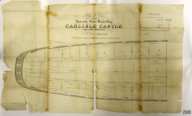
Plan
... warrnambool...shipwrecked-coast...flagstaff-hill...flagstaff-hill-maritime-museum...maritime-museum...shipwreck-coast...flagstaff-hill-maritime-village...'Carlisle Castle...plan...flagstaff hill warrnambool shipwrecked-coast flagstaff-hill flagstaff-hill-maritime-museum maritime-museum shipwreck-coast flagstaff-hill-maritime-village 'Carlisle Castle plan Plan of cabins of the river built ship 'Carlisle Castle' Plan ...Plan of cabins of the river built ship 'Carlisle Castle'flagstaff hill, warrnambool, shipwrecked-coast, flagstaff-hill, flagstaff-hill-maritime-museum, maritime-museum, shipwreck-coast, flagstaff-hill-maritime-village, 'carlisle castle, plan -
 Flagstaff Hill Maritime Museum and Village
Photograph
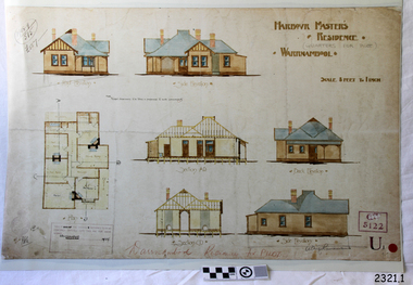
... Photographs of Warrnambool Harbour Masters Cottage 1909 original plans...flagstaff hill warrnambool shipwrecked-coast flagstaff-hill flagstaff-hill-maritime-museum maritime-museum shipwreck-coast flagstaff-hill-maritime-village warrnambool harbour masters cottage harbour masters cottage Photographs of Warrnambool Harbour Masters Cottage 1909 original plans Photograph Photograph ...Photographs of Warrnambool Harbour Masters Cottage 1909 original plansflagstaff hill, warrnambool, shipwrecked-coast, flagstaff-hill, flagstaff-hill-maritime-museum, maritime-museum, shipwreck-coast, flagstaff-hill-maritime-village, warrnambool harbour masters cottage, harbour masters cottage -
 Flagstaff Hill Maritime Museum and Village
Document
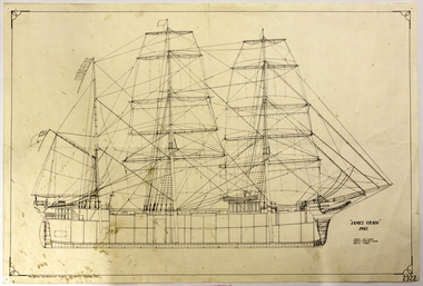
... warrnambool...shipwrecked-coast...flagstaff-hill...flagstaff-hill-maritime-museum...maritime-museum...shipwreck-coast...flagstaff-hill-maritime-village...Document...Plans of the James Craig...plan...flagstaff hill warrnambool shipwrecked-coast flagstaff-hill flagstaff-hill-maritime-museum maritime-museum shipwreck-coast flagstaff-hill-maritime-village Document Plans of the James Craig plan Reproduction of Plans of the James Craig,1903 Document ...Reproduction of Plans of the James Craig,1903flagstaff hill, warrnambool, shipwrecked-coast, flagstaff-hill, flagstaff-hill-maritime-museum, maritime-museum, shipwreck-coast, flagstaff-hill-maritime-village, document, plans of the james craig, plan -
 Flagstaff Hill Maritime Museum and Village
Plan
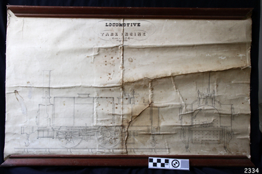
... flagstaff hill warrnambool shipwrecked-coast flagstaff-hill flagstaff-hill-maritime-museum maritime-museum shipwreck-coast flagstaff-hill-maritime-village locomotive tank engine a. kerr Plan of locomotive tank engine drawn by A. ...Plan of locomotive tank engine drawn by A. Kerr 1852. This plan is attached to canvas, and has wooden rails, top and bottom.flagstaff hill, warrnambool, shipwrecked-coast, flagstaff-hill, flagstaff-hill-maritime-museum, maritime-museum, shipwreck-coast, flagstaff-hill-maritime-village, locomotive tank engine, a. kerr -
 Flagstaff Hill Maritime Museum and Village
Document - Plans, Lighthouse Keeper's Quarters Warrnambool, 1858-1909
... *Nov. 1858 – ‘Details Lighthouse Keepers Quarters No. 2 Warrnambool’ (2375.05)* Public Works Office Melbourne. The plan shows the foundations, joists and eaves. ...Plans for the Lighthouse Complex in Warrnambool, including Lighthouses, Keeper's Quarters and Stores. ...Office of Public Works Melbourne. 4/3/9 [1909] - Additions and Repairs, Lighthouse Quarters, Warrnambool, General Plan. Department of Public Works Melbourne. ...SIGNED "Croft" "15A" on reverse [no date] - Lighthouse Quarters Warrnambool, Additions and Alterations. "9A" on reverse Plans for the Lighthouse Complex in Warrnambool, including Lighthouses, Keeper's Quarters and Stores. ...The set of seven 1858 plans shows proposed plans for the original Lighthouse Complex that was built on Middle Island in 1858-1859. The whole complex was then transferred to Flagstaff Hill in 1871. The plan, dated 1909, is for proposed additions and repairs to the Quarters at Flagstaff Hill. The plan 'Alterations and Additions' shows alternate plans for changes to the quarters at the Flagstaff Hill location. This plan has no date. The Complex comprised the Lighthouse, the Lighthouse Keepers’ Quarters, the Store (now called the Chart Room) and a Privy, which was not included in these plans. The Keeper’s bluestone Quarters was a cottage divided into two compartments, one for each keeper and his family. The bluestone Store was divided into three; a store, a workshop an oil store (or office). The Privy comprised of a small building also divided into two separate, back-to-back toilets, one for each Keeper and his family. The Flagstaff Hill Keeper's Quarters have had extensions and additions at various times, and these have also been removed at various other times. THE PLANS - *Dec. 1858 (12/58) ‘Lighthouse Keepers Quarters No.2 Warrnambool’ (2375.01)* Public Works Office Melbourne – Front and Back elevations, sections, and floor plan. The drawing shows timber walls. [The floor plan is the closest plan to the current building, however, the walls are timber in this plan.] *Nov. 1858 – No.3 ‘Lighthouse Keepers Quarters Warrnambool’ (2375.02)* Office of Public Works, Melbourne – Back and End elevations and section through. The drawing shows stone walls. One side; Senior Keeper’s bedroom, living room and kitchen with storeroom. Another side; is the Assistant’s bedroom, living room and storeroom. *Nov. 1858 - No.4 ‘Lighthouse Stores Warrnambool’ (2375.03)* Office of Public Works – Front, Side and end elevations, centre section. The drawing shows stone walls. *Nov. 1858 – No.4, ‘Lighthouse Stores No. 2 Warrnambool’ (2375.04)* Office of Public Works – Front, side and end elevations, centre section. The drawing shows timber walls. *Nov. 1858 – ‘Details Lighthouse Keepers Quarters No. 2 Warrnambool’ (2375.05)* Public Works Office Melbourne. The plan shows the foundations, joists and eaves. The drawing shows timber walls. (Nov. 1858 – ‘No.4 ‘Lighthouse No. 2 – Warrnambool’ (2375.06)* Public Works Melbourne (Part of the paper is missing). This plan shows an octagonal tower, internal stairs, a balcony landing, and a weather vane on top. *November 1858 – No. 1, ‘Lighthouse – Warrnambool’ (2375.07)* Office of Public Works Melbourne. This plan shows a round tower, including the stairs, windows on the tower and the weather vane on the top. *4/3/9 [1909] – ‘Additions and Repairs, Lighthouse Quarters, Warrnambool, General Plan’ (2375.8)* Department of Public Works Melbourne’s official stamp is signed by Croft. It shows the floor plans of the Store, Upper Lighthouse and the Quarters. The Store building has three sections; a Store, Work-Shop and Office, with an internal wall between them and separate entries. The Quarters are divided into two dwellings. The Senior Keeper’s side on the left has fireplaces in two of the three bedrooms and there is a pantry and wash house. The Assistant’s side has no fireplaces in the bedrooms and there’s no pantry or washhouse. These plans include proposed changes to the buildings. The Senior Keeper’s Quarters would have a partition on bedroom 2, a bath with plumbing and drainage, a wall moved and a built-in side porch. The Store would also have a built-in porch. The undated plan 'Additions and Alterations' (2375.9) shows alternative arrangements for water tanks, plumbing and such. WARRNAMBOOL'S LADY BAY LIGHTHOUSES- In the 1800s ships sailing from England to Australia began to use Bass Strait as a faster route to Melbourne. Small navigation errors led to many tragic shipwrecks. From 1848 lighthouses were operating along Victoria’s southern coast as a guide for sailors. Coastal towns such as Warrnambool grew and the exchange of trade and passengers were of great benefit. However, the uncertain weather changes, relatively shallow waters and treacherous, hidden rocky reefs were not suitable for a Harbour and in the 1840s and 1850s there were many shipwrecks in the area, with some even stranded in its Lady Bay harbour. A jetty was built in 1850 and a flagstaff to guide seafarers was placed up high on what became known now as Flagstaff Hill. In November 1857 the Victorian Government recommended that Warrnambool Harbour had beacons and two lighthouses to guide vessels into and out of the Harbour safely. The white light of the Middle Island lighthouse was to be used for the first time on September 1, 1859. The red light of the Beach Lighthouse, a wooden obelisk structure, was first operated on March 25, 1860, but in 1868 this light was ‘discontinued’ due to it being too low. Melbourne’s Department of Public Works decided to relocate the Middle Island Lighthouse Complex - Lighthouse, Keeper’s Quarters, Privy, Store Room and even water tanks - to Flagstaff Hill. The lower obelisk was shortened, and a protruding gallery, railing, and external ladder were added, as well as the light from the Beach Lighthouse. A green guiding light was erected on the end of the jetty. The transfer of the Complex began in March 1871. Each shaped stone of the lighthouse was carefully numbered, removed then reassembled on Flagstaff Hill. In 1872 the well was sunk behind the Lighthouse Keeper’s Cottage. The Keepers and families had left Middle Island in April and moved to Flagstaff Hill in October 1871. Vessels entering Lady Bay align the Upper and Lower Lighthouse towers during the day and the lights at night. The Upper Lighthouse is a round tower, the Lower Light is square. The Lighthouses were categorised as harbour lights rather than coastal lights, so they remain under the control of the Victorian Government’s Ports and Harbours section. The lights were originally powered by oil, then acetylene gas, later by electricity, and then converted to solar power in 1988. In 1993 the solar panel was replaced by a battery charger. A decision was made in 1936 to replace the lighthouses’ lights with unattended lights that no longer required Keepers and Assistants. At least 29 Keepers had attended to the lighthouse from its opening in 1859 to when the last official Lightkeepers left In April 1916. The Warrnambool Harbour Board rented out the Quarters from 1916 to 1936. The Board closed down but the rentals continued with other unknown landlords. In the 1970s the Flagstaff Hill Planning Board was set up under the chairmanship of John Lindsay. The Board was to make recommendations to the Warrnambool City Council regarding the use of the buildings and the rest of the Crown Land on the site. The Flagstaff Hill Maritime Village opened in 1975 and began renovating the Cottage in stages, during which time evidence of a 1920s fire was found in the eastern section of the cottage. Additions of a porch on the west and a washroom on the east were made in the 1980s. The western part of the building is now a Shipwreck Museum and the east has returned to a late 19th-century Lighthouse Keeper’s cottage and includes the screen made by Assistant Lighthouse Keeper Thomas Hope during one of his two periods of service there. THE LIGHTHOUSE KEEPERS Lighthouse Keepers were responsible for keeping their Lighthouse’s lights shining at night. They kept a lookout for passing vessels and changes in weather. They were expected to clean, polish and maintain the equipment and buildings. They kept regular and detailed records of who was on watch, and the time the light was lit, trimmed and extinguished. They kept a journal about other events that occurred. They keep regular, accurate Meteorological Logs. It was expected that they were competent in Morse code signalling. They would be called to help in times of disasters and shipwrecks, and to give official statements about these events. Many Lighthouse Keepers also volunteered as members of the lifeboat crew. The Lady Bay lighthouses were officially classified as small, so the Keepers had the official titles of Senior Assistant Lighthouse Keeper and Assistant Lighthouse Keeper. They were employed by the Public Service and paid rent to live in the Lighthouse Quarters. They were compulsorily retired at the age of 60, with most receiving a superannuation payment. Despite their time-consuming duties, there was time to follow hobbies and crafts such as growing vegetables, playing musical instruments, making models of buildings including lighthouses, and crafting furniture pieces. An example of a keeper’s skills is the carved fire screen made by /assistant Keeper Thomas Hope in the early 20th century and displayed in the Lighthouse Keeper’s cottage at Flagstaff Hill. The last occupants of the Middle Island Complex were Senior Keeper Robert Deverell, his Assistant Keeper, Andrew Farncombe, and their families. They all became the first occupants at the Lady Bay Lighthouse Keepers’ Quarters on Merri Street. The Warrnambool Lighthouse Complex plans are the origin of what is now the Lady Bay Lighthouse Complex. They are a record of the people, process and departments involved in bringing the complex into fruition. The plans are significant to the Complex, which is now listed on the Victorian Heritage Register, H1520, for being of historical, scientific (technological) and architectural significance to the State of Victoria. The Complex is significant as an example of early colonial development. The plan are significant for their connection with the important navigational function of the Lighthouses, a function still being performed to this day. The plans are also significant as an example of a product from the Public Works Department in Victoria in the mid-to-late 19th century. The structures built to these plans still stand strong. Plans for the Lighthouse Complex in Warrnambool, including Lighthouses, Keeper's Quarters and Stores. Seven of the plans are on thin fragile paper, one is on thicker, stronger paper. The drawings have been made in pens coloured red and black. They originate from Public Works in Melbourne. Seven were drawn in 1858, one in 1904, the other is not dated.Dec. 1858 - Lighthouse Keepers Quarters No.2 Warrnambool. Public Works Office Melbourne. Nov. 1858 - No.3 ‘Lighthouse Keepers Quarters Warrnambool. Public Works Office Melbourne. Nov. 1858 - No.4 ‘Lighthouse Stores Warrnambool. Office of Public Works. Nov. 1858 - No.4, ‘Lighthouse Stores No. 2 Warrnambool. Office of Public Works. Nov. 1858 - Details Lighthouse Keepers Quarters No. 2 Warrnambool. Public Works Office Melbourne. Nov. 1858 - No.4 ‘Lighthouse No. 2 – Warrnambool. Public Works Melbourne. Nov. 1858 - No. 1, Lighthouse - Warrnambool. Office of Public Works Melbourne. 4/3/9 [1909] - Additions and Repairs, Lighthouse Quarters, Warrnambool, General Plan. Department of Public Works Melbourne. SIGNED "Croft" "15A" on reverse [no date] - Lighthouse Quarters Warrnambool, Additions and Alterations. "9A" on reverseflagstaff hill, warrnambool, lighthouse keeper's cottage, lighthouse residence, lighthouse, plans, public works, melbourne, flagstaff hill maritime museum, maritime museum, shipwreck coast, flagstaff hill maritime village, chart room, quarters, privy, middle island, beach lighthouse, obelisk, lighthouse keeper, assistant keeper, lighthouse complex, lady bay, lady bay complex, keepers, upper lighthouse, lower lighthouse, ports and harbours, cottage, harbour board, flagstaff hill planning board, meteorological record, robert deverell, andrew farncombe, warrnambool port, warrnambool harbour, residence, alterations, repairs, department of works, light keeper -
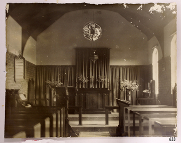 Flagstaff Hill Maritime Museum and Village
Photograph - Historical, religious, mid-20th century
... Warrnambool and District Base Hospital, which was undergoing multi-storey expansion in the late 1960s and early 1970s. The hospital’s Manager/Secretary was eager to see the historic window installed in a suitable place. The church, or chapel, was designed by a local architectural draftsman in collaboration with the Flagstaff Hill Planning...Warrnambool and District Base Hospital, which was undergoing multi-storey expansion in the late 1960s and early 1970s. The hospital’s Manager/Secretary was eager to see the historic window installed in a suitable place. The church, or chapel, was designed by a local architectural draftsman in collaboration with the Flagstaff Hill Planning ...This photograph records the interior of St Nicholas Seamen's Church at 139 Nelson Place, Williamstown, Victoria, which was purchased and furnished around 1943. The furniture and furnishings are now part of the St. Nicholas Seamen's Church collection. HISTORY of the Missions to Seamen: - DETAILED HISTORY of the Missions to Seamen: - The Missions to Seamen is an Anglican (Church of England) charity that has served the world’s seafarers since 1856. It was inspired by the work of Rev. John Ashley, who, 20 years earlier, had pioneered a ministry to seafarers in the Bristol Channel in Great Britain. When Ashley retired, others continued the work, founding the Missions to Seamen. It adopted a Flying Angel as its symbol, inspired by a verse from the Bible in Revelation 14. Today, over 200 world ports have Missions to Seamen centres and chaplains. A Missions to Seamen’s Club warmly welcomes sailors of all colours, creeds and races and provides a wide range of facilities. The Missions to Seamen organisation changed its name to the Mission to Seafarers in 2000, continuing to include Missions to Seamen clubs in Victoria’s cities of Melbourne, Portland, Geelong and Hastings. Flagstaff Hill’s St Nicholas’ Seamen’s Church is named after its namesake from Williamstown, Victoria, which began in 1857. Bishop Perry opened the first Sailors’ Church there, known as ‘Bethel’, on an old hulk floating in Hobson’s Bay, Port of Melbourne. In 1860, a Sailors’ Rest started operating from rented premises in Williamstown. In 1878, the Sailors’ Church moved into an old Wesleyan chapel in Ann Street. By the end of that year, they managed to purchase the building, which they had already refurbished. In 1883, they affiliated with the Victorian Seamen’s Mission. A few years later, in 1906, the building had to be demolished because it was no longer safe. While they raised funds for a new building, the Sailors’ Rest temporarily moved to premises in front of Customs House in Nelson Place. Around this time, in 1906, the Ladies Harbour Lights Guild was formed in Australia to support and raise funds for the Mission to Seamen organisation in Melbourne. Two of the most significant ladies of the Guild were founding members Ethel Godfrey and Alice Sibthorpe. During the Mission's time at Siddeley Street, Melbourne, the activities of the Guild raised funds for the Mission to Seamen's Chapel at their new, and still current, premises in Flinders Street, Melbourne, opened in 1917. The Guild continued its important work until the 1960s. In 1908, the Williamstown Mission had enough money to purchase the former Mascotte skating rink on Thompson Street, Williamstown. In August of that year, they were inaugurated into the Victorian Missions to Seamen. They continued at that venue for a few decades. In 1943, the former ES&A Bank building at 139 Nelson Place, Williamstown, was purchased to become the new Mission to Seamen’s Club. On May 6th, 1944, it was officially opened, described as a ‘distinctive little building’. Funds had previously been raised for the building and furnishing of the chapel at the rear. The chapel was named St Nicholas’ Seamen’s Church, after St Nicholas, fourth-century bishop and patron saint of sailors. Services were held on Wednesdays and Sundays. The church was supported by the Williamstown Lightkeepers’ Auxiliary, newly founded by Mrs Ethel Margaret Musther in 1943, as well as the Harbour Lights Guild and the League of Soldiers’ and Sailors’ Friends. The Williamstown Mission to Seamen’s Church operated until 1966, when large international ships no longer used the Port of Williamstown. The Commonwealth Government then leased the premises. In the formative years of Flagstaff Hill Maritime Village, the Advisory Board decided to include a Missions to Seamen Chapel and Recreation Room in its village. The Missions organisation was a significant feature of ports during the late 1800s and early 1900s, the period that the Village represents. They often erected Missions to house social and worshipful activities for seamen. Flagstaff Hill’s curator, Mr Ken Marshman, approached the Melbourne Board of Management of Missions to Seamen regarding the Williamstown branch. Consequently, the Board permitted the furnishings of the Williamstown chapel to be transferred to Flagstaff Hill Maritime Village. A provision of the transfer was that the Victoria Missions to Seamen be recognised, that the items would remain as a collection, and that the chapel would be called St Nicholas Seamen’s Church and conduct Divine services. The donation was approved on 21st May 1979. Flagstaff Hill's St. Nicholas Seamen's Church: - The idea behind Flagstaff Hill’s Missions to Seamen’s Church was partly driven by the offer of Stained Glass Memorial Windows that originated from the Warrnambool and District Base Hospital, which was undergoing multi-storey expansion in the late 1960s and early 1970s. The hospital’s Manager/Secretary was eager to see the historic window installed in a suitable place. The church, or chapel, was designed by a local architectural draftsman in collaboration with the Flagstaff Hill Planning Board and was constructed by Mr Leon Habel. The designers hoped that the church would be used for formal worship such as weddings, funerals, and multi-denominational special services like war commemorations. The design is inspired by the ‘Missions to Seamen’ buildings in Portland and the Port of Melbourne. The furniture and furnishings were placed as accurately as possible according to photographs of the Williamstown St Nicholas Seamen’s Church and with assistance from local clergy. The Recreation Room was furnished and arranged on advice from experienced members of the Missions to Seamen organisation. A framed document in the building recognises the donor of the furnishings, Victoria Missions to Seamen, and includes the names of some original donors and their donated item/s. The building’s design incorporates local features such as Warrnambool sandstone, which was no longer commercially available but was procured from demolished buildings and uniformly cut to use as a veneer over the stronger Mt. Gambier stone. Also, traditional green American roofing slate was used, sourced from the 1908 local shipwreck “Falls of Halladale” by Flagstaff Hill volunteer divers. The bell tower includes a bell believed to be from a local shipwreck. Additional furnishings were acquired locally, along with several items donated by Warrnambool residents. Light fittings in both rooms were assembled to simulate 19th-century gas light fittings. The stained-glass window at the back of the church is a memorial to Dr Connell, a well-respected member of the Warrnambool community. It was originally installed in 1928 in the main building of Warrnambool Hospital. The St Nicholas’ Seamen’s Church at Flagstaff Hill was officially opened by His Worship the Mayor, Cr. John Lindsay, on Sunday, 11th October 1981. The event included a service of thanksgiving conducted by the Warrnambool Ministers Fraternal. Since then, the Chapel has been the historic venue for many weddings. This photograph is significant through its association with the St Nicholas' Mission to Seamen Church in Williamstown, Melbourne, established in 1857. The building in the photograph is the former English, Scottish and Australian Bank (ES&A bank), also known as the Mission to Seamen. It is listed on the Victorian Heritage Database for having local historic and aesthetic interest. Photograph of St Nicholas Seamen's Church, Williamstown. Sepia photograph. The photograph shows the inside of the Chapel of Mission to Seamen, including organ, pews and other furniture and furnishings. There is a circular stained glass window high on the back wall depicting a sailor at the helm of a ship and a man standing behind him and pointing the way - "Christ Showing The Helmsman The Way". A Sanctuary Light is suspended from the ceiling. The Sanctuary chars are visible. This shows the St Nicholas Seamen's Church in Williamstown, the furnishings and furniture of which is now part of the St Nicholas Seamen's Church Collection’.flagstaff hill, warrnambool, shipwrecked-coast, flagstaff-hill, flagstaff-hill-maritime-museum, maritime-museum, shipwreck-coast, flagstaff-hill-maritime-village, st nicholas mission to seamen's church williamstown, mission to seamen williamstown, mission to seamen victoria, st nicholas mission to seamen, chapel window, christ showing the helmsman the way, stained glass window, st nicholas seamen's church, religion, religious service, sailor's rest, ladies harbour light guild -
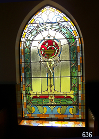 Flagstaff Hill Maritime Museum and Village
Artwork, other - Window, circa 1928
... Planning Board, led to its installation in its present position in St Nicholas Seamen’s Church and the memorial plaque was later installed beside the window. St NICHOLAS SEAMEN’S CHURCH, Anglican Church Flagstaff Hill’s Mission to Seamen was opened in 1981. Its conception was partly motivated by the offer of Stained Glass Memorial Windows from the local Warrnambool...Planning Board, led to its installation in its present position in St Nicholas Seamen’s Church and the memorial plaque was later installed beside the window. St NICHOLAS SEAMEN’S CHURCH, Anglican Church Flagstaff Hill’s Mission to Seamen was opened in 1981. Its conception was partly motivated by the offer of Stained Glass Memorial Windows from the local Warrnambool ...This religiously themed window is situated in the western (weather) wall of the St. Nicholas Mission to Seamen’s Church building in the Flagstaff Hill Maritime Village. It was crafted circa 1928. ABOUT THE WINDOW This window, once known as the Dr Connell Memorial Window, was a feature of an external wall adjacent to the Women’s Children’s Wards of Warrnambool Hospital. Honorary Doctors had played a significant role in the operation of the hospital between the years 1900 to 1939. One of these doctors was Dr. Connell, who passed away in 1928. The green glass plaque is also a registered object in Flagstaff Hill's Collection. Its inscription dedicates the window to Dr. Connell. The inscription reads: “A tribute to Egbert John Connell M.B.B.S. who for 30 years rendered devoted and valuable service to this institution. Obiit April 4th 1928 A.D." A paragraph in the book ‘A History of the Warrnambool Base Hospital’ by Forth and Yule describes the role of the Honorary Doctors - “At the start of the period the senior-part time medical officer was replaced by the junior resident medical officer and control of beds and the right to operate were given to the honorary medical officers...and these men dominated the Warrnambool medical world in the years before the Second World War.” Dr. Connell leased ‘Ambleside’, 192 Koroit Street, in the early 20th century, following Dr Teed who had previously run his medical practice there. In 1914 Dr Connell purchased the property and continued his private practice there until his death in 1928. He also took a prominent part in hospital work, both as physician and surgeon, and often acted as spokesmen for the Honorary Doctors. According to colleague Dr. Horace Holmes’ subsequent notes, it was after the close of the First World War, and the following years of the world-wide pneumonic influenza epidemic, that Dr. Connell himself contracted pneumonia and died. His family and friends then recognised his work by gifting the memorial window in his honour to the Hospital. By the mid-1970s the old wards at the hospital had been replaced and there was no obvious place for the window. Discussions between the previous and past Hospital managers, the Anglican Diocese, and Flagstaff Hill Planning Board, led to its installation in its present position in St Nicholas Seamen’s Church and the memorial plaque was later installed beside the window. St NICHOLAS SEAMEN’S CHURCH, Anglican Church Flagstaff Hill’s Mission to Seamen was opened in 1981. Its conception was partly motivated by the offer of Stained Glass Memorial Windows from the local Warrnambool and District Base Hospital, which was undergoing multi-storey development in the late 1960’s and early 1970’s. The Manager/Secretary at the time was keen to see the historical windows installed in an appropriate location. The chapel was designed by a local architectural draftsman in conjunction with members of the Planning Board of Flagstaff Hill, and built by Mr Leon Habel. The vision of the designers included the hope that the church be used for formal worship such as weddings and funeral, and for multi-denominational special services such as War commemorations. The design is based on the ‘Mission to Seamen’ buildings in both Portland and Port Melbourne. These types of buildings were often erected to house social and worshipful activities for seamen. The materials used in the building include sandstone recycled from nineteenth-century buildings demolished in Warrnambool and American slate tiles retrieved from the 1908 wreck of the FALLS OF HALLADALE. Most of the chapel furnishings came from the Williamstown Missions to Seamen, which was consecrated in 1946 but later decommissioned. These artefacts range from the altar cloth to the hymn board and include a visually stunning round stained glass widow called ‘Christ Guiding the Helmsman’. However the provenance of this particular artefact, large western window, is local. This stained glass memorial window is of local, historical and social significance, linking local history and heritage with one of Warrnambool's doctors, Dr. Egbert John Connell (d. 1928), who gave 30 years of dedicated, medical service to the local citizens.Stained glass leadlight window in Gothic arched metal frame with six horizontal reinforcing rods. Image depicts a golden flat-bowled baptismal font on a slender stand with foliage proceeding from it. The image is internally framed by a Roman arch of coloured glass and surrounding rectangular and breaking-wave shapes. (The window was previously known locally as the Dr. Connell Memorial Window and a plaque dedicated to Dr. Connell is catalogued separately. See Context notes for details.)flagstaff hill, warrnambool, shipwrecked coast, flagstaff hill maritime museum, maritime museum, shipwreck coast, flagstaff hill maritime village, great ocean road, chapel window, stained glass window, warrnambool and district base hospital, st nicholas mission to seamen’s church, williamstown mission to seamen, dr egbert connell, ambleside warrnambool, leon habel builder, falls of halladale slate, memorial window, commemorative window, dr connell -
 Flagstaff Hill Maritime Museum and Village
Book - Reference Religious Ideology, Charles Taze Russell, Millennial Dawn Vol 1 The Plan of the Ages, 1905
... warrnambool...shipwrecked-coast...flagstaff-hill...flagstaff-hill-maritime-museum...maritime-museum...shipwreck-coast...millennial dawn vol 1 the plan...(For more information on the Pattison Collection see item 3678 Flagstaff Hill collections) https://victoriancollections.net.au/items/5580c7e72162f114d8b758db flagstaff hill warrnambool shipwrecked-coast flagstaff-hill flagstaff-hill-maritime-museum maritime-museum shipwreck-coast millennial dawn vol 1 the plan of the ages book Religious Works Watch Tower Bible & Tract Society Charles Taze Russell Jehova Witness Bible Studies Millennial Dawn, Vol. 1 (The Plan of the Ages) was published in 1905 by the Watch Tower Bible & Tract Society and is a central text in the history of modern American millenarianism. ...Millennial Dawn, Vol. 1 (The Plan of the Ages) was published in 1905 by the Watch Tower Bible & Tract Society and is a central text in the history of modern American millenarianism. The subject book was originally published in 1886 under the title The Plan of the Ages, and later re-titled The Divine Plan of the Ages as part of the Studies in the Scriptures series. Volume 1 lays out the foundational theological framework of Charles Taze Russell's religious movement. The book argues that God operates through distinct chronological "dispensations" or ages, such as the Patriarchal Age, the Jewish Age, and the Gospel Age, leading up to the "Millennial Age". Its primary themes include the harmonising of the scriptures while attempting to systematically reconcile Old and New Testament prophecies.Millennial Dawn Vol 1 (The Plan of The Ages) Author: Charles Taze Russell Publisher: Watch Tower Bible & Tract Society. Allegheny, PA USA 1905 Date: 1905 Further Information: Blue hard cover book with white text to lettering and front board edge pattern designnon-fictionMillennial Dawn, Vol. 1 (The Plan of the Ages) was published in 1905 by the Watch Tower Bible & Tract Society and is a central text in the history of modern American millenarianism. The subject book was originally published in 1886 under the title The Plan of the Ages, and later re-titled The Divine Plan of the Ages as part of the Studies in the Scriptures series. Volume 1 lays out the foundational theological framework of Charles Taze Russell's religious movement. The book argues that God operates through distinct chronological "dispensations" or ages, such as the Patriarchal Age, the Jewish Age, and the Gospel Age, leading up to the "Millennial Age". Its primary themes include the harmonising of the scriptures while attempting to systematically reconcile Old and New Testament prophecies.flagstaff hill, warrnambool, shipwrecked-coast, flagstaff-hill, flagstaff-hill-maritime-museum, maritime-museum, shipwreck-coast, millennial dawn vol 1 the plan of the ages, book, religious works, watch tower bible & tract society, charles taze russell, jehova witness, bible studies -
 Flagstaff Hill Maritime Museum and Village
Tool - Wood Sample, Before 1878
... The collection is also historically significant for its association with the LOCH ARD, which was one of the worst and best known shipwrecks in Victoria’s history. flagstaff hill warrnambool shipwrecked coast flagstaff hill maritime museum maritime museum shipwreck coast flagstaff hill maritime village great ocean road loch line loch ard captain gibbs eva carmichael tom pearce glenample station mutton bird island loch ard gorge nineteenth-century souveniring shipwreck scavenging loch line sailing ships wood sample The inscription on the paper reads: “A [p]iece of w[r]ec[k] of the Loch Ard wrecked near Sherbroke River”. A length of hardwood timber, planed ...On a piece of paper subsequently glued near one end of its curved upper face, this length of planed and polished hardwood timber bears the inscription: “A [p]iece of w[r]ec[k] of the Loch Ard wrecked near Sherbroke River”. The timber is carefully worked with rich dark colouring and a uniformly moulded design, suggesting that it was part of a fitting or furnishing that was publicly visible and prominent. If the artefact is what it is declared to be, then it is possible that it formed part of the ship’s railings or companionway stairs. The LOCH ARD was a 1,693 ton, 3 masted barque, built on the Clyde in 1873. In an age of increasing competition for the emigrant passenger trade from steam-driven vessels, special attention was paid to her wooden furnishings and fittings. The Loch Line owners prided themselves on their attractive, distinctively painted, sailing ships. Below decks, where cargo and third class passengers were stowed, was made of iron. But everything above deck, and on show to the saloon and second class passengers, was carved and varnished timber. Captain Daish’s 1878 report for the ship’s underwriters notes “a quantity of general Cargo washed up in a confused mass” in the cove and “a number of Cases, Casks and Bales; also deals and boards floating about in some of the gorges” further west of the shipwreck. Contemporary newspaper accounts also reported a large quantity of cargo and timber washed ashore in the days following the LOCH ARD shipwreck, adding “but those were speedily removed by persons who came down from Port Campbell, Scott’s Creek and other places with carts and pack horses”. The appearance and good condition of this wood artefact, and the aged patina and dated hand-writing style of its pasted on inscription, support the suggestion that it was ‘souvenired’ from the floating debris of the LOCH ARD at or near the 1878 date of its foundering off Mutton Bird Island. HISTORY OF THE LOCH ARD The LOCH ARD belonged to the famous Loch Line which sailed many ships from England to Australia. Built in Glasgow by Barclay, Curdle and Co. in 1873, the LOCH ARD was a three-masted square rigged iron sailing ship. The ship measured 262ft 7" (79.87m) in length, 38ft (11.58m) in width, 23ft (7m) in depth and had a gross tonnage of 1693 tons. The LOCH ARD's main mast measured a massive 150ft (45.7m) in height. LOCH ARD made three trips to Australia and one trip to Calcutta before its final voyage. LOCH ARD left England on March 2, 1878, under the command of Captain Gibbs, a newly married, 29 year old. She was bound for Melbourne with a crew of 37, plus 17 passengers and a load of cargo. The general cargo reflected the affluence of Melbourne at the time. On board were straw hats, umbrella, perfumes, clay pipes, pianos, clocks, confectionary, linen and candles, as well as a heavier load of railway irons, cement, lead and copper. There were items included that intended for display in the Melbourne International Exhibition in 1880. The voyage to Port Phillip was long but uneventful. At 3am on June 1, 1878, Captain Gibbs was expecting to see land and the passengers were becoming excited as they prepared to view their new homeland in the early morning. But LOCH ARD was running into a fog which greatly reduced visibility. Captain Gibbs was becoming anxious as there was no sign of land or the Cape Otway lighthouse. At 4am the fog lifted. A man aloft announced that he could see breakers. The sheer cliffs of Victoria's west coast came into view, and Captain Gibbs realised that the ship was much closer to them than expected. He ordered as much sail to be set as time would permit and then attempted to steer the vessel out to sea. On coming head on into the wind, the ship lost momentum, the sails fell limp and LOCH ARD's bow swung back. Gibbs then ordered the anchors to be released in an attempt to hold its position. The anchors sank some 50 fathoms - but did not hold. By this time LOCH ARD was among the breakers and the tall cliffs of Mutton Bird Island rose behind the ship. Just half a mile from the coast, the ship's bow was suddenly pulled around by the anchor. The captain tried to tack out to sea, but the ship struck a reef at the base of Mutton Bird Island, near Port Campbell. Waves broke over the ship and the top deck was loosened from the hull. The masts and rigging came crashing down knocking passengers and crew overboard. When a lifeboat was finally launched, it crashed into the side of LOCH ARD and capsized. Tom Pearce, who had launched the boat, managed to cling to its overturned hull and shelter beneath it. He drifted out to sea and then on the flood tide came into what is now known as LOCH ARD Gorge. He swam to shore, bruised and dazed, and found a cave in which to shelter. Some of the crew stayed below deck to shelter from the falling rigging but drowned when the ship slipped off the reef into deeper water. Eva Carmichael had raced onto deck to find out what was happening only to be confronted by towering cliffs looming above the stricken ship. In all the chaos, Captain Gibbs grabbed Eva and said, "If you are saved Eva, let my dear wife know that I died like a sailor". That was the last Eva Carmichael saw of the captain. She was swept off the ship by a huge wave. Eva saw Tom Pearce on a small rocky beach and yelled to attract his attention. He dived in and swam to the exhausted woman and dragged her to shore. He took her to the cave and broke open case of brandy which had washed up on the beach. He opened a bottle to revive the unconscious woman. A few hours later Tom scaled a cliff in search of help. He followed hoof prints and came by chance upon two men from nearby Glenample Station three and a half miles away. In a state of exhaustion, he told the men of the tragedy. Tom returned to the gorge while the two men rode back to the station to get help. By the time they reached LOCH ARD Gorge, it was cold and dark. The two shipwreck survivors were taken to Glenample Station to recover. Eva stayed at the station for six weeks before returning to Ireland, this time by steamship. In Melbourne, Tom Pearce received a hero's welcome. He was presented with the first gold medal of the Royal Humane Society of Victoria and a £1000 cheque from the Victorian Government. Concerts were performed to honour the young man's bravery and to raise money for those who lost family in the LOCH ARD disaster. Of the 54 crew members and passengers on board, only two survived: the apprentice, Tom Pearce and the young woman passenger, Eva Carmichael, who lost all of her family in the tragedy. Ten days after the LOCH ARD tragedy, salvage rights to the wreck were sold at auction for £2,120. Cargo valued at £3,000 was salvaged and placed on the beach, but most washed back into the sea when another storm developed. The wreck of LOCH ARD still lies at the base of Mutton Bird Island. Much of the cargo has now been salvaged and some was washed up into what is now known as LOCH ARD Gorge. Cargo and artefacts have also been illegally salvaged over many years before protective legislation was introduced. One of the most unlikely pieces of cargo to have survived the shipwreck was a Minton porcelain peacock - one of only nine in the world. The peacock was destined for the Melbourne International Exhibition in 1880. It had been well packed, which gave it adequate protection during the violent storm. Today, the Minton peacock can be seen at the Flagstaff Hill Maritime Museum in Warrnambool. From Australia's most dramatic shipwreck it has now become Australia's most valuable shipwreck artefact and is one of very few 'objects' on the Victorian State Heritage Register. The Loch Ard wreck is of state significance – Victorian Heritage Register S417. However there is a lack of documented provenance that limits the interpretive value of this piece of timber (for example, its potential to interpret nineteenth century souveniring and scavenging from shipwrecks along the south west coast of Victoria). Flagstaff Hill’s collection of artefacts from LOCH ARD is significant for being one of the largest collections of artefacts from this shipwreck in Victoria. It is significant for its association with the shipwreck, which is on the Victorian Heritage Register (VHR S417). The collection is significant because of the relationship between the objects, as together they have a high potential to interpret the story of the LOCH ARD. The LOCH ARD collection is archaeologically significant as the remains of a large international passenger and cargo ship. The LOCH ARD collection is historically significant for representing aspects of Victoria’s shipping history and its potential to interpret sub-theme 1.5 of Victoria’s Framework of Historical Themes (living with natural processes). The collection is also historically significant for its association with the LOCH ARD, which was one of the worst and best known shipwrecks in Victoria’s history. A length of hardwood timber, planed and varnished to smooth finish on three sides, with two unfinished tongues protruding from each end (one broken off), possibly from the wreck of the LOCH ARD. The front or upper face is moulded and routed to a regular, linear (skirting board type) design along its entire length, the two sides flat planed. One side contains two inserted dowel rods that have been broken off. The bottom face has not been finished to the same standard. The sample is good quality wood that has retained its density and weight and shows no evidence of having been submerged in seawater for any length of time. Glued on to the upper face of the length of timber near the right hand end is a deteriorated square of paper bearing an inscription. The paper, peeling back and with torn edges, is stuck over an original wood stain but under a subsequent layer of varnish. The faded ink words are indecipherable where paper is missing, but written carefully in an old fashioned cursive script.The inscription on the paper reads: “A [p]iece of w[r]ec[k] of the Loch Ard wrecked near Sherbroke River”. flagstaff hill, warrnambool, shipwrecked coast, flagstaff hill maritime museum, maritime museum, shipwreck coast, flagstaff hill maritime village, great ocean road, loch line, loch ard, captain gibbs, eva carmichael, tom pearce, glenample station, mutton bird island, loch ard gorge, nineteenth-century souveniring, shipwreck scavenging, loch line sailing ships, wood sample -
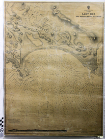 Flagstaff Hill Maritime Museum and Village
Document - Navigation Chart, Admiralty Office, Lady Bay and Warrnambool Harbour, 03/04/1871
... The Warrnambool Breakwater is registered as a place of significance on the Victorian Heritage Database (VHR H2024). A copy of the same chart was used to plan several submissions for future changes to the jetty and breakwater. ...This Chart titled “Lady Bay and Warrnambool Harbour” was surveyed by Nav. Lieut. H.J. Stanley, of Britain's Royal Navy, in 1870 and printed in April 1871. The chart was made before the Warrnambool Breakwater was built (construction had begun in 1874 and was completed in 1890). The chart includes Directions for entering Lady Bay, Warrnambool Harbour. These are "Vessels entering Warrnambool Harbour must bring the Red Light in sight and steer in with it in line with the upper white Light bearing North, until the Green Light on the Jetty is opened, when steer towards it and anchor. The best anchorage is in 2 ¼ fms [fathoms)] of water, about a cable from ledge off Breakwater rock. Or where convenient, according to draught of water, only endeavouring to anchor as close as possible to Breakwater rock. It is not safe to enter or leave the Harbour in south westerly or Southerly gales.” This chart is significant for its strong connection to the maritime history of Warrnambool Harbour and Lady Bay, and eventually to the Warrnambool Breakwater. The Warrnambool Breakwater is registered as a place of significance on the Victorian Heritage Database (VHR H2024). A copy of the same chart was used to plan several submissions for future changes to the jetty and breakwater. The chart is a historical record of structures existing in 1870; the Warrnambool Jetties, Lady Bay, the leading lights (lighthouses), streets, roads, bridges and many buildings. It also shows the lay of the land and seabed.Canvas chart of Australia, South Coast, Victoria Title: Lady Bay and Warrnambool Harbour Surveyed by Nav. Lieut. H.J. Stanley, R.N., 1870. Magnet Variation, 1870 Published April 3, 1871, by the Admiralty, London. Directions for vessels entering Warrnambool Harbour are printed on the chart. The chart has a lacquer or seal over it.Top of chart has logo "HYDROGRAPHER OFFICE" "Price Eighteen Pence". "Engraved by Edward Weller" Along bottom of Chart: “London… Published at the Admiralty, 3rd April 1871, under the Superintendence of Rear Admiral G.H. Richards, F.R.S. Hydrographer, Corrections July 71” Bottom of chart “Australia South Coast Victoria Lady Bay and Warrnambool Harbour. 2494”flagstaff hill, warrnambool, chart of lady bay warrnambool 1870, warrnambool harbour, cartography, navigation, warrnambool breakwater, 1871, australia – south coast / victoria, lady bay, 1870, nav. lieut. h.j. stanley, r.n, directions for entering warrnambool harbour, hydrographer office, rear admiral g.h. richards, edward weller, port of warrnambool, flagstaff hill maritime museum & village, maritime museum, maritime village, shipwreck coast, map, chart, navigation chart, admiralty chart, breakwater, jetty, pier, vhr h2024
