
Showing 1642 items matching " first national"
-
 Eltham District Historical Society Inc
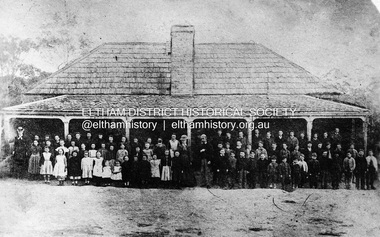
Negative - Photograph, Eltham State School No. 209, Dalton Street, Eltham, c.1990 (1864)
... This was the first State School building which was built in 1856 and replaced with a new building in 1875 after the stone walls collapsed outwards. Published in Nillumbik Maii; Edition 20, 13 Sep Harry Gilham notes: - Believed to be the National School at Eltham on the Dalton Street site 1857-1874 - £220 cost; £110 National Board and £110 local patrons - 40' (38'6") x 16' x 10' walls - David Clark Head Teacher and Catherine Clark, Sewing Mistress - Its building materials came from the western edge of the site where sandstone removed is still evident and children are protected from the site by the fences of 1994 of wire mesh and palings beside the residence - School had 7' verandah added in 1861 - Clarks used half the building as a residence from 1857-1866 when enrollments required use of the whole building - The Clarks moved to then Shoestring residence in Metery Road adjacent to the end of the school oval...This was the first State School building which was built in 1856 and replaced with a new building in 1875 after the stone walls collapsed outwards. Published in Nillumbik Maii; Edition 20, 13 Sep Harry Gilham notes: - Believed to be the National School at Eltham on the Dalton Street site 1857-1874 - £220 cost; £110 National Board and £110 local patrons - 40' (38'6") x 16' x 10' walls - David Clark Head Teacher and Catherine Clark, Sewing Mistress - Its building materials came from the western edge of the site where sandstone removed is still evident and children are protected from the site by the fences of 1994 of wire mesh and palings beside the residence - School had 7' verandah added in 1861 - Clarks used half the building as a residence from 1857-1866 when enrollments required use of the whole building - The Clarks moved to then Shoestring residence in Metery Road adjacent to the end of the school oval catherine clarke class photo dalton street david george clark eltham eltham state school no. 209 school group national school Film - Agfa Ortho 25 Roll of 35mm Black and White negative film, 3 strips, (2 of 14 frames) Eltham State School No. 209, Dalton Street, Eltham Negative Photograph ...Negative copy of copy by Yeoman and Co. of original c.1864 photograph. The first Eltham State School building with school group. David Clarke (Head Teacher) and his sister, Catherine are standing in the centre of the group. Built with stone walls and wooden shingles on the roof. This was the first State School building which was built in 1856 and replaced with a new building in 1875 after the stone walls collapsed outwards. Published in Nillumbik Maii; Edition 20, 13 Sep Harry Gilham notes: - Believed to be the National School at Eltham on the Dalton Street site 1857-1874 - £220 cost; £110 National Board and £110 local patrons - 40' (38'6") x 16' x 10' walls - David Clark Head Teacher and Catherine Clark, Sewing Mistress - Its building materials came from the western edge of the site where sandstone removed is still evident and children are protected from the site by the fences of 1994 of wire mesh and palings beside the residence - School had 7' verandah added in 1861 - Clarks used half the building as a residence from 1857-1866 when enrollments required use of the whole building - The Clarks moved to then Shoestring residence in Metery Road adjacent to the end of the school ovalRoll of 35mm Black and White negative film, 3 strips, (2 of 14 frames)Film - Agfa Ortho 25catherine clarke, class photo, dalton street, david george clark, eltham, eltham state school no. 209, school group, national school -
 Eltham District Historical Society Inc
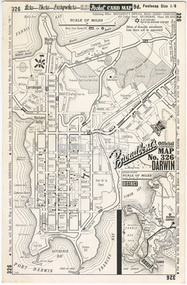
Document - Folder, Survey Maps and Technical Drawings
... First Edition, 4 Miles to 1 Inch, Royal Australian Survey Corps, 1950 19. Survey Map: Yea, Victoria, Sheet 7923-I, Edition 1, Series R-754, 1:50,000, Royal Australian Survey Corps, 1961 20. World Aeronautical Chart: Darwin (3109), ICAO 1: 1,000,000, Division of National...First Edition, 4 Miles to 1 Inch, Royal Australian Survey Corps, 1950 19. Survey Map: Yea, Victoria, Sheet 7923-I, Edition 1, Series R-754, 1:50,000, Royal Australian Survey Corps, 1961 20. World Aeronautical Chart: Darwin (3109), ICAO 1: 1,000,000, Division of National ...alan gardiner collection, maps -
 Glen Eira Historical Society
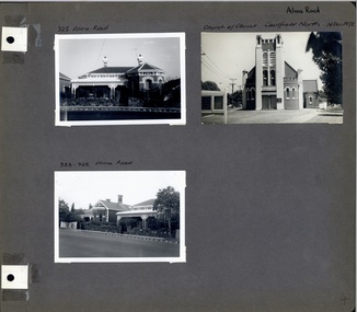
Album - Album page, Alma Road, circa 1972
... first photo on page has been mis-labelled as this house is 323 Alma Road. It follows that third photo label should be 325-323 Alma Road (reading left to right). This album was created in approximately 1972 as part of a project by the Caulfield Historical Society to assist in identifying buildings worthy of preservation. The album is related to a Survey the Caulfield Historical Society developed in collaboration with the National...first photo on page has been mis-labelled as this house is 323 Alma Road. It follows that third photo label should be 325-323 Alma Road (reading left to right). This album was created in approximately 1972 as part of a project by the Caulfield Historical Society to assist in identifying buildings worthy of preservation. The album is related to a Survey the Caulfield Historical Society developed in collaboration with the National ...This photograph is part of the Caulfield Historical Album 1972 but first photo on page has been mis-labelled as this house is 323 Alma Road. It follows that third photo label should be 325-323 Alma Road (reading left to right). This album was created in approximately 1972 as part of a project by the Caulfield Historical Society to assist in identifying buildings worthy of preservation. The album is related to a Survey the Caulfield Historical Society developed in collaboration with the National Trust of Australia (Victoria) and Caulfield City Council to identify historic buildings within the City of Caulfield that warranted the protection of a National Trust Classification. Principal photographer thought to be Trevor Hart, member of Caulfield Historical Society. Most photographs were taken between 1966-1972 with a small number of photographs being older and from unknown sources. All photographs are black and white except where stated, with 386 photographs over 198 pages. Church of Christ, 514 Dandenong Rd, Caulfield https://vhd.heritagecouncil.vic.gov.au/places/43594 The Dandenong Road Church of Christ has regional importance as a landmark building along the Dandenong Road. It successfully addresses its triangular site by placing the belltower at the apex, deploying Romanesque and Gothic elements freely and to dramatic effect, heightened by the symbolism of the Cross (compare Robert Haddon's St Stephens in Balaclava Road of 1926).Page 4 of Photograph Album including three black and white photographs of properties on Alma Road. Two photographs are in the top half of the page and the third is in the bottom left hand side.Handwritten in black pen: Alma Road [top right of page] / 325 Alma Road [above top left photograph] / Church of Christ Caulfield North 14 Dec 1972 [above top right photograph] / 323-325 Alma Road [above bottom left photograph] / 4 [bottom right]caulfield north, trevor hart, alma road, houses, churches, church of christ caulfield north, dandenong road, bell towers, romanesque architectural style, gothic architectural style, bi-chromatic brickwork, cast iron work, verandahs, victorian architectural style -
 Glen Eira Historical Society
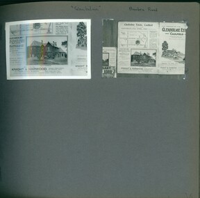
Album - Album page, Glenholme, Bambra Road, Circa 1972
... National Trust Classification. Principal photographer thought to be Trevor Hart, member of Caulfield Historical Society. Most photographs were taken between 1966-1972 with a small number of photographs being older and from unknown sources. All photographs are black and white except where stated, with 386 photographs over 198 pages. This polychrome brick and slate-roofed mansion was built by John Hart in 1871. Later owned by James McDougall (partner in Sands and McDougall; director of the first...National Trust Classification. Principal photographer thought to be Trevor Hart, member of Caulfield Historical Society. Most photographs were taken between 1966-1972 with a small number of photographs being older and from unknown sources. All photographs are black and white except where stated, with 386 photographs over 198 pages. This polychrome brick and slate-roofed mansion was built by John Hart in 1871. Later owned by James McDougall (partner in Sands and McDougall; director of the first ...This photograph is part of the Caulfield Historical Album 1972, showing an advertisement for the 21/04/1923 Glenholme Estate sale through real estate agents Knight and Harwood. This album was created in approximately 1972 as part of a project by the Caulfield Historical Society to assist in identifying buildings worthy of preservation. The album is related to a Survey the Caulfield Historical Society developed in collaboration with the National Trust of Australia (Victoria) and Caulfield City Council to identify historic buildings within the City of Caulfield that warranted the protection of a National Trust Classification. Principal photographer thought to be Trevor Hart, member of Caulfield Historical Society. Most photographs were taken between 1966-1972 with a small number of photographs being older and from unknown sources. All photographs are black and white except where stated, with 386 photographs over 198 pages. This polychrome brick and slate-roofed mansion was built by John Hart in 1871. Later owned by James McDougall (partner in Sands and McDougall; director of the first Caulfield horse tram company). Later again, it became a psychiatric hospital; demolished c1923.Page 36 of Photograph Album with two photographs of Glenholme Estate advertisements.Handwritten: "Glenholme" Bambra Road [top] / 36 [bottom right]trevor hart, caulfield north, bambra road, glenholme, advertisements, glenholme estate, knight and harwood, real estate agents, maps, polychrome bricks, slate roofs, john hart, james mcdougall, psychiatric hospitals -
 Glen Eira Historical Society
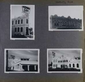
Album - Album page, Glen Huntly Road, Circa 1972
... National Trust Classification. Principal photographer thought to be Trevor Hart, member of Caulfield Historical Society. Most photographs were taken between 1966-1972 with a small number of photographs being older and from unknown sources. All photographs are black and white except where stated, with 386 photographs over 198 pages. trevor hart caulfield north glen huntly road elsternwick hotels elsternwick hotel shops glenhuntly road Hand written: Glen Huntly Road [top right] / 62 [bottom right] Page 62 of Photograph Album with three photographs (one landscape and two portrait) of the Elsternwick Hotel exterior (front, rear and side); plus one of the first floor exteriors for 5 adjacent shops on Glen Huntly Road. ...This photograph is part of the Caulfield Historical Album 1972. This album was created in approximately 1972 as part of a project by the Caulfield Historical Society to assist in identifying buildings worthy of preservation. The album is related to a Survey the Caulfield Historical Society developed in collaboration with the National Trust of Australia (Victoria) and Caulfield City Council to identify historic buildings within the City of Caulfield that warranted the protection of a National Trust Classification. Principal photographer thought to be Trevor Hart, member of Caulfield Historical Society. Most photographs were taken between 1966-1972 with a small number of photographs being older and from unknown sources. All photographs are black and white except where stated, with 386 photographs over 198 pages.Page 62 of Photograph Album with three photographs (one landscape and two portrait) of the Elsternwick Hotel exterior (front, rear and side); plus one of the first floor exteriors for 5 adjacent shops on Glen Huntly Road.Hand written: Glen Huntly Road [top right] / 62 [bottom right] trevor hart, caulfield north, glen huntly road, elsternwick, hotels, elsternwick hotel, shops, glenhuntly road -
 Glen Eira Historical Society
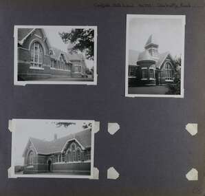
Album - Album page, Caulfield State School, No 773, Glen Huntly Road, Circa 1972
... National Trust Classification. Principal photographer thought to be Trevor Hart, member of Caulfield Historical Society. Most photographs were taken between 1966-1972 with a small number of photographs being older and from unknown sources. All photographs are black and white except where stated, with 386 photographs over 198 pages. From: Glen Eira Heritage Management Plan (1996) by Andrew Ward and Associates Caulfield State School No. 773 is important at the State level as the first ...This photograph is part of the Caulfield Historical Album 1972. This album was created in approximately 1972 as part of a project by the Caulfield Historical Society to assist in identifying buildings worthy of preservation. The album is related to a Survey the Caulfield Historical Society developed in collaboration with the National Trust of Australia (Victoria) and Caulfield City Council to identify historic buildings within the City of Caulfield that warranted the protection of a National Trust Classification. Principal photographer thought to be Trevor Hart, member of Caulfield Historical Society. Most photographs were taken between 1966-1972 with a small number of photographs being older and from unknown sources. All photographs are black and white except where stated, with 386 photographs over 198 pages.From: Glen Eira Heritage Management Plan (1996) by Andrew Ward and Associates Caulfield State School No. 773 is important at the State level as the first of similar designs for small schools prepared by the Education Department under H.R. Bastow at Little Bendigo (1878), Glen Waverley (1880), Ascot (1882), Sandringham (1885) and Carlsrich (1892)·. It is a representative example of the Department's Gothic Revival designs, distinguished, however, by the semicircular treatment of the master's office, which compares with Portland (1879), Queensberry St Carlton (1880) and Footscray (1881). It has local significance as the earliest surviving Government School in Caulfield and as a centre for education from 1877, comparing with St. Mary's Jubilee School (qv) of 1887. The Caulfield State School of 1877, the horse tramway of 1889 and subsequently the electric trams were all events confirming the importance of Glenhuntly Road and the fledgling community of "Camden Town" wherein the City's commercial centre has its origins.Page 68 of Photograph Album with three exterior photographs (two portrait and one landscape) of one side of Caulfield State School with a fourth photo missing from the page.Hand written: Caulfield State School No. 773 Glenhuntly Road [top right] / 68 [bottom right] trevor hart, glen huntly road, caulfield state school, caulfield primary school, gothic revival, schools, caulfield south, arched window, tower, 1870's, camden town, red brick, curved windows, terracotta tiles, master's office, education, primary school, glenhuntly road, h r bastow -
 Glen Eira Historical Society
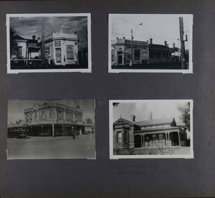
Album - Album page, Kambrook Road, Circa 1972
... National Trust Classification. Principal photographer thought to be Trevor Hart, member of Caulfield Historical Society. Most photographs were taken between 1966-1972 with a small number of photographs being older and from unknown sources. All photographs are black and white except where stated, with 386 photographs over 198 pages. First...National Trust Classification. Principal photographer thought to be Trevor Hart, member of Caulfield Historical Society. Most photographs were taken between 1966-1972 with a small number of photographs being older and from unknown sources. All photographs are black and white except where stated, with 386 photographs over 198 pages. First ...This page of photographs is part of the Caulfield Historical Album 1972. This album was created in approximately 1972 as part of a project by the Caulfield Historical Society to assist in identifying buildings worthy of preservation. The album is related to a Survey the Caulfield Historical Society developed in collaboration with the National Trust of Australia (Victoria) and Caulfield City Council to identify historic buildings within the City of Caulfield that warranted the protection of a National Trust Classification. Principal photographer thought to be Trevor Hart, member of Caulfield Historical Society. Most photographs were taken between 1966-1972 with a small number of photographs being older and from unknown sources. All photographs are black and white except where stated, with 386 photographs over 198 pages. First 2 images: milkbar and residence corner Kambrook and Balaclava Roads ie south west corner - building named Airdrie 3rd image: https://vhd.heritagecouncil.vic.gov.au/places/43737 - re 26 Kambrook Road and 345 Balaclava Road corner building ie south east corner: A prominently situated two-storeyed complex of late Victorian buildings consisting of "Wybar's Buildings" occupying the Balaclava Road/ Kambrook Road corner and the "Caulfield Bakery" facing Kambrook Road, separated by a driveway from a single storeyed shop. The main building has a comer splay and balustraded parapet with curved pediments, the words "Wybar's Buildings 1887" having been obliterated but "Caulfield Bakery 1887" with the characteristic wheatsheaf surviving in raised cement work. The walls are stuccoed and richly ornamented with bracketed cornices and keystones with masks extending to the Bakery. The main building is further distinguished by the Masonic symbol of the mason's dividers in the pediment whilst the upper level of the bakery is in overpainted brickwork. The single storeyed shop incorporates the bracketed cornice and consoles characteristic of the main buildings and is in other respects a utilitarian structure. 4th image: https://vhd.heritagecouncil.vic.gov.au/places/42415 (on 24/01/2021) - 196 Kambrook Road An imposing late Victorian poly-chrome brick asymmetrical villa with corner verandah and projecting west facing wing with faceted window bay to the facade. Body bricks are red and relieved by cream and black brick banding and by cream bricks to the bracketed eaves. The fretted barge with king post treatment and timber posted verandah are unique in the Municipality and unusual in the metropolitan area and demonstrate an understated appreciation of the emerging Queen Anne mode.345 Balaclava and 26 Kambrook Roads HO91 - City of Glen Eira https://vhd.heritagecouncil.vic.gov.au/places/43737 (on 24/01/2021) "Wybar's Buildings" at the corner of Balaclava Road and Kambrook Road are important as a prominent late Victorian commercial development incorporating a variety of activities including a bakery and possibly a coffee palace, the latter understood to be unique within the municipality, but characteristic of the period. It is a rare complex of its type in Caulfield and is important also as evocative evidence of the late Victorian Land Boom and the creation of a small now defunct commercial centre at this location by the George Wybrow. 196 Kambrook Road HO122 - City of Glen Eira https://vhd.heritagecouncil.vic.gov.au/places/42415 "Glencoe" is situated at no. 196 Kambrook Road, Caulfield North and was built for the boot manufacturer, Robert Bruce Mair, in 1888. It is of historic and aesthetic significance. It is historically significant (Criterion A) as the home of an inner suburban industrialist, notable a boot manufacturer, demonstrating the attraction of Caulfield as a residential location for the manufacturers of the metropolis during the late Victorian Boom period. It is aesthetically significant (Criterion E) as a very early example of a Queen Anne influenced late Victorian villa, comparing at the State level with ''Woodlands'' (1888), North Essendon, generally acknowledged to be one of Australia's earliest houses to fully exploit this emerging style. The ornamental timberwork is especially expressive of the new architectural fashion and compares with the house at 33 Clarence Street, Elsternwick (1888-89).Page 105 of Photograph Album with two photographs of a milk bar and attached residence, one older photograph of Wybar's Building and another photograph of a house on Kambrook Road (all are landscape).Handwritten: 196 KAMBROOK ROAD / 1970 - GAFFNEY MRS S.M. [under bottom right photo] / 100 [bottom left]trevor hart, kambrook road, victorian style, caulfield north, parapets, wybar's buildings 1887, caulfield bakery 1887, architectural features, painted bricks, balaclava road, george wybrow, shops, milk bars, airdrie, polychrome bricks, verandahs, queen anne architectural style, houses, glencoe, robert mair -
 Glen Eira Historical Society
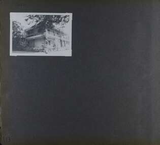
Album - Album page, Bureel (Kooyong Road), Circa 1972
... National Trust https://vhd.heritagecouncil.vic.gov.au/places/65648 This is a large and substantially intact example of the grand villas of nineteenth century Melbourne. The bulk of the house most probably was built in 1866-1868 for Francis John Sidney Stephen, a prominent and highly regarded Melbourne solicitor and a member of an illustrious legal family. Stephen conducted a lucrative private practice and in 1845 was appointed first ...This photograph is part of the Caulfield Historical Album 1972. This album was created in approximately 1972 as part of a project by the Caulfield Historical Society to assist in identifying buildings worthy of preservation. The album is related to a Survey the Caulfield Historical Society developed in collaboration with the National Trust of Australia (Victoria) and Caulfield City Council to identify historic buildings within the City of Caulfield that warranted the protection of a National Trust Classification. Principal photographer thought to be Trevor Hart, member of Caulfield Historical Society. Most photographs were taken between 1966-1972 with a small number of photographs being older and from unknown sources. All photographs are black and white except where stated, with 386 photographs over 198 pages. From: Glen Eira Heritage Management Plan 1996 by Andrew Ward In 1856, John Allee, a builder from Brighton, purchased C.A. 37 on the south-west corner of Glenhuntly and Kooyong Roads. The land comprised just over 45 acres. By 1863, Francis John Sidney Stephen, a lawyer and cousin of J. Wilberforce Stephen, owned most of lot 37. By 1866, Stephen had a built a "small mansion" named ''Burreel". It was a brick house and Stephen lived there until 1882. By 1884, Mrs Buxton of Hillside Terrace, East Melbourne, had purchased the property. Richard Buxton, a gentleman was listed as occupant and the house described as "brick, eight rooms". NAV was £300. Richard Buxton continued residency in 1887 however in 1888, George Allen, music seller, became occupant. At that time the house had thirteen rooms on twenty-three acres of land. Twelve people lived there and NAV was £920. In 1900, Daniel Luxton, stock and sharebroker and the Honourable John Taverner, M.H.A. leased the property. Fourteen people lived there. Mrs Buxton continued as owner. By 1910, ownership had passed to Mrs Mary Neate, who converted the house to a nursing home. The land had been subdivided by 1913 and sold by ''Buxtons Estate". Burreel Avenue, Baxter, Buxton and Hoddle Streets were created. "Burreel" was rated to Burreel Avenue and stood on lot 13 with frontages to Burreel Avenue and Kooyong Road of 198' and 214'. The house had ten rooms. NAV was £60. Mary Neate, a nurse, continued as owner/ operator of ''Burreel" nursing home in 1927. At that time there were sixteen rooms and fourteen residents. NAV was £100. Mrs Neat remained there until 1947. In 1948, the house was turned into apartments. In the 1980's, the Alexander family purchased it and restored it to a private residence.Burreel 331 Kooyong Road, ELSTERNWICK VIC 3185 - Property No B4950 National Trust https://vhd.heritagecouncil.vic.gov.au/places/65648 This is a large and substantially intact example of the grand villas of nineteenth century Melbourne. The bulk of the house most probably was built in 1866-1868 for Francis John Sidney Stephen, a prominent and highly regarded Melbourne solicitor and a member of an illustrious legal family. Stephen conducted a lucrative private practice and in 1845 was appointed first solicitor to the City of Melbourne; a position he held until his death in 1895. He took an active part in the development of Caulfield and was Shire President in 1874 and 1877. He was a resident at Burreel from 1868 to 1882. The house has evolved in stages, the rear wings possibly remaining from a house built during the 1850s. The existing ornate cast iron verandah was probably built between 1882 and 1888 during the residence of Richard Buckhurst Buxted, a notable boom period auctioneer and real estate agent. George Allan, the founder of Allan's music store, was another important occupier from 1888 to 1991. Bureel's essentially residential quality has been retained and the interior has been well preserved. The significance of this building does not rest in any single unusual outstanding architectural feature, or in its association with a particularly prominent member of society in the past, but rather in the consistent integrity of both the interior and exterior, which results in the survival of an outstanding example of this type of residential building and its associations with two notable citizens. Classified:11/08/1990Page 113 of photograph album with 1 photograph of Burreel in its garden.Handwritten: Bureel [top left] / 113 [bottom left]trevor hart, caulfield, caulfield north, kooyong road, thomas king, mansion, 1860's, bureel, burreel, francis john sidney stephen, city of melbourne, shire president, 1850's, verandah, nursing home, john allee, ornamented corner stones, new orleans manner, plaster rendered, mrs luxton, vincent willis, alexander family, victorian architectural style, ornate cast iron work, lawyers, brick houses, richard buxton, richard buckhurst buxton, george allen, george leavis allan, allans music, daniel luxton, john taverner, mary neate, buxtons estate, land subdivision, mary neat, gardens -
 Waverley RSL Sub Branch
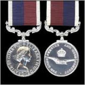
R.A.A.F. Long Service Medal
... This medal ceased to be awarded in Australia in 1975 when it was replaced by the National Medal (and sbsequently the DFSM and DLSM) in the Australian system of honours and awards. http://www.heritagemedals.com.au/medals-1/service-long-service/air-force-long-service-and-good-conduct-medal.html History of the RAAF Dental Branch It took six years following the formation of the RAAF in 1921 for the first Dental Clinic to be established at Point Cook, Victoria. ...Awarded to Alan Bowers (A236814) who was a R.A.A.F. dental mechanic who serverd during WWII including service in Darwin, and then continued in the R.A.A.F. for some years after the end of WWII The Royal Australian Air Force (and all Commonwealth Air Forces) Long Service and Good Conduct Medal: Awarded to NCOs and ORs of the RAAF (RAF, RCAF etc) for 15 years service. A cupro-nickel plated medal, the obverse features the sovereign's head, the reverse features the crown and eagle emblem of the RAAF (and RAF). Officers are eligible for the award provided they have served a minimum 12 years in the ranks. The riband is dark blue and maroon with white edges. This medal ceased to be awarded in Australia in 1975 when it was replaced by the National Medal (and sbsequently the DFSM and DLSM) in the Australian system of honours and awards. http://www.heritagemedals.com.au/medals-1/service-long-service/air-force-long-service-and-good-conduct-medal.html History of the RAAF Dental Branch It took six years following the formation of the RAAF in 1921 for the first Dental Clinic to be established at Point Cook, Victoria. On 10th June 1927 Flying Officer James Carl Rosenbrock commenced work as an RAAF Dental Officer for the FlyingTraining School at Point Cook. As personnel numbers were still relatively small, Rosenbrock was also responsible for the dental care of all Victorian RAAF units, which involved treating members at 1AD Laverton, as well as Air Force Headquarters at Victoria Barracks in Melbourne. As Army Dental Officers were currently caring for RAAF personnel at Richmond, NSW, the Senior Dental Officer of the 3rd Military District in Victoria (SDO 3MD) requested through the military board that a similar arrangement be established, where that the newly appointed RAAF Dentist provide part time dental services to the Army units stationed at Queenscliff. This was seen as an effective reciprocal arrangement, with both units having a Dental Officer in attendance for, in total, around 3-4 weeks a year. Rosenbrock continued to serve as the sole RAAF Dental Officer until the middle of 1933, when the Air Board asked for his service to be terminated following ‘behaviour unbecoming of a RAAF officer'. He had borrowed several sums of money, of around 40 Pounds or so, from junior ranks on base (as well as from the Regimental Sergeant Major) and had failed to pay the money back. He was replaced by a fellow Victorian, FLGOFF Norman Henry Andrews, on the 18th Sep 1933, who went on to become our first Director of Dental Services, and was instrumental in establishing the organisations and conditions of the Branch that are still present today. Through a fair amount of persistence and hard work on the part of Norman Andrews, the RAAF Dental Branch began to expand from 1937, with the introduction of 2 additional positions, at RAAF station Richmond, and at the FlyingTraining School at Point Cook. This gave the RAAF 3 uniformed Dental Officers, which was expanded to 5 in the months leading up to WW2. 4 of these Dental Officers were based in Victoria and 1 at Richmond, with the other two RAAF units being cared for by the Army (as in the case of Pearce in WA) or by civilians (as in Darwin). With the sudden increase in RAAF personnel required at the outbreak of WW2, the number of RAAF Dental Officers increased dramatically, from 5 in 1939, 28 in 1940, 64 in 1941, 147 in 1942, 193 in 1943, 219 in 1944, and peaking at 227 in 1945. RAAF Dental Officers were required to work in a variety of locations, both in and out of Australia. Between 1940 and 1942 a massive construction programme occurred, with new dental clinics being established around Australia. Priority was given to aircrew training units in order to get these personnel dentally fit for operational deployment, but Dental Officers could equally find themselves posted to recruit depots, fixed stations, medical clearance stations, mobile dental sections, and RAAF and civilian hospitals. RAAF Dental Officers were posted to the large dental centres at Ascot Vale (Vic) and Bradfield Park (NSW) when first appointed, where they received military and clinical training, before being deployed to their needed location. Mobile Dental Units When Japan entered the war in 1941, the rapid deployment of troops to northern operational areas with less than ideal dental fitness was extremely high. As a result, the RAAF deployed a range of mobile dental units, either alone or with medical sections, to support the increasing number of isolated deployed personnel within Australia and overseas. There were three types of mobile unit used: a. Mobile Dental Unit – relied on using either a semi-trailer to get around or by building a surgery directly on to the truck chassis, and installing hydraulic chairs, units, x-rays, and laboratory equipment. They were able to move around between small units, such as RAAF radar stations, where they could plug into the local power supply and work immediately. b. Transportable Dental Units – used for stops of longer duration, where field equipment was carried in panniers from one unit to another by road or rail and housed in whatever accommodation was available at the destination. They were often carried within Australia on Tiger Moths and Dakota aircraft. c. Itinerant Dental Units – in some areas, the dental equipment was installed at the RAAF unit and the Dental Officer and their staff would travel from unit to unit, using the equipment available at each location. RAAF Dental BadgeAs the war developed in Europe, it soon became obvious that the RAF Dental support was not capable of supporting the increasing numbers of RAAF aircrew that were being sent for service with the RAF, with only enough Dental Officers available to provide one to every 2000 men ( instead of the preferred 1 to 600). As a result, the RAAF provided a mobile dental unit, fitted out in a caravan and pulled by a Ford V8 Coupe, to travel around England in support of RAAF personnel at various squadrons. Some degree of tact was needed to ensure that the RAF did not take this as a comment on the treatment they were providing, but it proved successful in maintaining a satisfactory state of dental fitness in RAAF personnel, and a second mobile unit was soon dispatched. They were also set up with a laboratory on board as well as the surgery, which was a major difference between the RAF and RAAF, as the RAF did not provide dentures for their troops (the RAAF would, providing they had served for 6 years). In 1943 the RAF was no longer able to provide Dental support to Australian troops in the Middle East, which resulted in the need for a transportable dental unit to be deployed from Australia. It functioned in a similar manner to the RAF, by moving from one squadron to another. It served in the Middle East and Africa, from Cairo across North Africa, to Italy, and eventually back to England to treat returned prisoners of war. GPCAPT Norman Andrews The growth and development of the RAAF Dental Branch owes a debt to one man in particular, GPCAPT Norman Andrews. As the second RAAF Dental Officer to enlist on 18 Sep 1933, Andrews became the principal architect of the structure and organisation of the RAAF Dental Branch leading up to and during WW2. Until early 1940, the RAAF Dental Branch was administered by the Director of Medical Services (Air), which placed it under the control of the Army Medical staff. The Army would provide their Inspector of Dental Services for advice whenever needed. In April 1940, the RAAF Medical service separated from the Army, resulting in the control of the RAAF Dental Branch shifting back to the RAAF. Andrews became the first Director of Dental Services, when the position was created in 1943 as recognition of the higher profile the Dental Branch was now playing in the RAAF Medical service. Until this time, Andrews's title had been as the Dental Staff Officer to the RAAF Medical Service. Andrews was responsible for the establishment of the war-time structure of the Dental service, establishing new dental centres at all major bases, creating mobile and transportable dental units, ensuring the continual growth of the Branch, maintaining professional development of staff through the establishment of a professional journal, and by organising renowned lecturers to speak at RAAF bases. He also believed in visiting as many dental units as possible to see for himself what conditions were like and to talk first-hand to staff in remote units. His itinerary during the war years, both in and out of Australia, shows a large number of trips in a variety of modes of transport in order to reach remote areas where units were serving. He was promoted to GPCAPT in July 1944, as the numbers of Dental Officers soon peaked at 227 towards the end of the war (1 GPCAPT, 9 WGCDRs, 60 SQNLDRs, and 157 FLTLTs). After the war, with the reduction in RAAF personnel required in uniform, the Dental Branch also reduced its numbers significantly. By 1947 there were only 18 Dental Officers serving (many part-time), with 1 GPCAPT, 1 WGCDR, 10 SQNLDRs, and 6 FLTLTs, and only 13 by 1950. With the decrease in Branch personnel numbers, the ‘powers to be' saw fit to reduce the Director of Dental Service rank to WGCDR, and as a result Norman Andrews found that in order to continue serving in the RAAF he would have to wear a reduced rank. This appears to have been a contributing factor in his decision to discharge at the relatively early age of 43 and accept an administrative job as Director of the Victorian Government's School Dental Service. Norman Andrews holds the proud honour of being the founder of the RAAF Dental Branch, which during the war was instrumental in educating servicemen of the importance of dental health and maintaining the dental fitness of troops in a variety of areas. Dental Orderlies (Assistants) The dental orderly mustering was first introduced in 1937. Until that time, medical orderlies were assigned to assist the Dental officer with their duties. As early as 1931 it had been noted by both RAAF and Army Dental Officers working in Victoria and Richmond that a lot of the troubles they were having would be solved by appointing a permanent Dental Orderly. Often they would find that the medical orderly they were assigned was a different one each day, and as a result the administration and work in general was very inefficient. By 1937, with the increase in Dental Officers to 3, it was realised that a Dental Orderly mustering needed to be created. Dental Mechanics/Technicians Before WW2, dental laboratory work was provided by civilian laboratories, as most RAAF units were stationed around metropolitan areas. At this time, service personnel were still required to pay for their own dentures, unless they had served for six years or had their dentures damaged during performance of their duties. In July 1940, mainly in response to the development of more remote RAAF dental units and the increasing demand for dental prostheses, the Dental Mechanic mustering was established. Unfortunately there was a very limited pool of civilian dental mechanics to recruit from, and as a result the RAAF set up a training school at Laverton (which was later moved to Ascot Vale) in June 1941 which conducted an intensive 6 month course in Dental mechanics. Dental mechanics were quickly in demand. In all fixed and mobile dental units at least 1 Mechanic was supplied for each Dental Officer, and indeed the RAAF supplied Dental Mechanics throughout all its deployments, something the RAF were unwilling, or unable, to do. Two grades of dental mechanic existed: the Senior Mechanic (with the rank of NCO), who was competent in all phases of laboratory work; and the Junior Mechanic, who could only handle routine work and not more advanced denture work. The progression to Senior required a further trade test in techniques including setting up, clasp-forming, casting and backing teeth. During the course of the War, two special courses were held for Mechanics. The first, directed at senior mechanics so that they could instruct others, was in 1942 when Acrylic Resin was first introduced as a denture base material, as an alternative to the current option of vulcanite. Later, towards the end of the War, a ‘refresher' course was provided for those that had served for the greatest period of time in order to allow them retraining in techniques that they had not practised during their service and which were common in civilian life. This included cast base dentures, crowns and bridges, partial dentures, and retainers. Towards the end of the War, a course was held with WAAAF trainees to train them as Mechanics. However, as the War was soon to end they never had the opportunity to progress within the mustering to become Senior Mechanics. The RAAF Dental Branch has survived 75 years of turbulence, with reviews of its viability occurring regularly every few years from as early as 1937. The Branch continues to provide excellent service to the ADF community and, despite reduced manpower, will continue to play an important role in Air Force Health operations. http://www.defence.gov.au/health/about/docs/RAAFDental.pdf40cm cupro-nickel plated medal, the obverse features the sovereign's head, the reverse features the crown and eagle emblem of the RAAF (and RAF). A23814 BOWERS.A. A. F.r.a.a.f long service medal, r.a.a.f good conduct, r.a.a.f. dental service medal -
 Waverley RSL Sub Branch
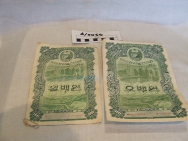
Korean Currency and N.A.T.O. Forces Notes
... The first note put in circulation by the Bank of Korea in 1950 was printed in Japan by the National Printing Bureau (国立印刷局). ...The first note put in circulation by the Bank of Korea in 1950 was printed in Japan by the National Printing Bureau (国立印刷局). ...Used during Korean War Won (1947-) Main article: North Korean won After the division of Korea, North Korea continued using the Korean yen for 2 years until the Central Bank of the Democratic People's Republic of Korea was established on December 6, 1947 and a new currency was issued. It was at the time pegged at par to the Soviet ruble. It was revalued at a rate of one hundred to one in February 1959 and new won were issued. In the following years the won faced some devaluation, caused by the subsequent devaluation and redenomination of the Soviet ruble. From 1978 to 2001, the North Korean government maintained an iconic rate of 2.16 won to the US dollar; since then banks in the country exchange at rates closer to the black market rate. However, rampant inflation has been eroding the North Korean wŏn's value to such an extent that currently it is believed to be worth about the same as the South Korean wŏn. In any case, the U.S. dollar and other currencies are still worth more in North Korean wŏn on the black market than officially. South Korean currencies[edit] Won (1945-1953)[edit] Main article: South Korean won (1945) Following the end of the division of Korea, the won was introduced to replace the Korean yen. The won was subdivided in 100 jeon. The first banknotes were issued by the Bank of Joseon in denominations ranging from 5 jeon to 100 won. In 1950 the currency management switched to the Bank of Korea and new notes were then issued, mostly with higher denominations. The first note put in circulation by the Bank of Korea in 1950 was printed in Japan by the National Printing Bureau (国立印刷局). The next year the Korea Minting and Security Printing Corporation was created and took over as printer of South Korean currency. At the time of the introduction in 1945 the won was pegged to the Japanese yen at a rate of 1 won = 1 yen. In October of the same year the anchor currency got change to the US dollar at a rate of 15 won = 1 dollar. Toward the end of the Korean War the won was devaluated at 6000 won = 1 dollar. Following that the hwan was introduced as the new currency at a rate of 1 hwan = 100 won. Hwan (1953-1962)[edit] Main article: South Korean hwan Due to devaluation of the won the hwan was introduced on February 15, 1953 at the rate of 1 hwan = 100 won. It was subdivided in 100 jeon, but they were never used. New banknotes in denominations between 10 and 1000 hwan were issued. Starting in 1959, 10 and 50 hwan coins were also issued to replace the lower denomination notes. Those were the first circulating coins in South Korea. Due to the short notice of the change in currency, the first series of the new notes was commissioned from the United States Government Printing Office. The notes were released in five denominations, all with an identical design. Some replacement notes with a more suited Korean theme were later issued, starting with the 100 hwan just a month later. The hwan suffered from inflation as well. At its introduction, it was pegged to the United States dollar at 1 dollar = 60 hwan, but toward the end of its life it was devaluated at 1 dollar = 1250 hwan. In 1962, the won was reintroduced at the rate of 1 won = 10 hwan. The 10 and 50 hwan coins were kept in circulation until March 22, 1975.5 Currency notes issued by Korean Government and R.A.A.F. denominations of 100, 100 Won and 1 shilling国立印刷局, currency korea, money korea, money korean war -
 Eltham District Historical Society Inc
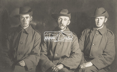
Postcard, L-R: Charlie Harris, Shelley Harris, Robert Harris, c. August 1915, 1915
... National Park 1936 'LIFE OF SERVICE', Advertiser (Hurstbridge, Vic. : 1922 - 1939), 19 June, p. 3. , viewed 03 Oct 2018, http://nla.gov.au/nla.news-article56842659 His brother Charlie Harris is on the far left. Their sister was Mrs H. Thomson. AIF, Charles (Charlie) Thomas Harris, Charles Thomas Harris, Charlie Harris, First ..."Best wishes on the eve of his departure for the war from your old tennis mate, Private Robert Harris, No. 2073, 8th Reinforcements, 24th Battalion" Private Robert Jubilee Harris, printer of Kangaroo Ground, on the far right, was the son of Robert Charles Harris, printer and former editor of the Evelyn Observer which preceded the Advertiser. He embarked at Melbourne 26 August 1915 bound for Gallipoli and was killed in France, 19 July 1916. https://www.awm.gov.au/collection/P10238019 In the middle is his Uncle, Shelley Harris who later in life was the Ranger at Kinglake National Park 1936 'LIFE OF SERVICE', Advertiser (Hurstbridge, Vic. : 1922 - 1939), 19 June, p. 3. , viewed 03 Oct 2018, http://nla.gov.au/nla.news-article56842659 His brother Charlie Harris is on the far left. Their sister was Mrs H. Thomson.Digital file only - scanned by EDHS from item on loan aif, charles (charlie) thomas harris, charles thomas harris, charlie harris, first world war, honour roll, kangaroo ground, letters, lew howard collection, robert jubilee harris, shelley harris, william shelley harris, ww1 -
 Bendigo Military Museum
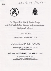
Pamphlet - COMMEMORATIVE PLAQUE 1997, C.1997
... This was followed the "ODE, Last Post, One minutes Silence, Reveille and The National Anthem. As far as records available the Camp was first set up on 17.6.1940 with an Advance Party. ...This was followed the "ODE, Last Post, One minutes Silence, Reveille and The National Anthem. As far as records available the Camp was first set up on 17.6.1940 with an Advance Party. ...The Tom Flood Sports Centre was originally called The Bendigo Show Grounds. This plaque was unveiled by the City of Greater Bendigo & the Bendigo RSL Sub Branch to Commemorated the venue as a "Training Camp" during WW2. Order of Service was, Welcome, Mr Alan Holmes (President Bendigo RSL) Introduction of Recruits & Others associated with the Camp. A brief history of the Camp and Anecdotes was read by Mr Alan Holmes. Presentation and unveiling of the Plaque by Cr Barry Ackerman, Mayor City of Greater Bendigo. The wording: "Commemorating this site as an Australian Imperial Force Training Camp during WW2. "To the following Corps we pay Tribute" "10th AIF Training Depot" "Australian Army Medical Corps" "Australian Army Ordnance Corps" "Australian Army Service Corp". "Australian Electrical and Mechanical Engineers" Prayer of Thanksgiving & Commemoration by; Rev J. South. This was followed the "ODE, Last Post, One minutes Silence, Reveille and The National Anthem. As far as records available the Camp was first set up on 17.6.1940 with an Advance Party. The last Troops left there on 30.4.1943 for Ingleburn NSW, the Camp was vacated in May 1943. Pamphlet white paper, A4 folded making 4 pages, all print in black.On the front, "This Commemorative Plaque was unveiled at the Tom Flood Sports Centre Park Road Bendigo Sunday 27th April 1997"brsl, smirsl, plaque, tom flood, training camp -
 Bendigo Military Museum
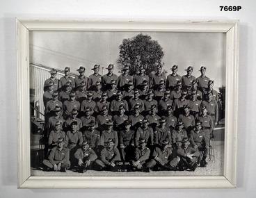
Photograph - FRAMED PHOTOGRAPH, C. June1969
... National Service 23/4/1969. Recruit Training 20 Platoon D Coy Puckapunyal. Photo in the collection re Peter Ball, refer Cat No 4704 for service/other details. Platoon names, surname only, some first...National Service 23/4/1969. Recruit Training 20 Platoon D Coy Puckapunyal. Photo in the collection re Peter Ball, refer Cat No 4704 for service/other details. Platoon names, surname only, some first ...Photograph re 16th Intake National Service 23/4/1969. Recruit Training 20 Platoon D Coy Puckapunyal. Photo in the collection re Peter Ball, refer Cat No 4704 for service/other details. Platoon names, surname only, some first names added. Back row. Russell, Rennie, Carter, Henning, McMurrich, Golding, McLeay, Span, Musgrave, Tinney, Pitt. Fifth row. Flowers, McNair, Coates, Raco (Sam), Moon, Albert, DeJong, Taylor, Morgan, Burrows, Culp. Fourth Row. Wakeling, Fuller (Bob), Melbourne, Guistino, Thorpe, Forbes (Wayne), Alexander, Tirrell (Roger) Ellingham, Bloom, Freeman. Third row. Johnson, Watts, Tellis, Rankin, Whatmough, Goldsmith, Kopke, Thomas (Courtney), Darker, Lonergan. Second row. Russo, Cpl Brabrowsky, Cpl Eather, Cpl Richards, 2nd Lt Boag, Cpl Logan, Cpl Beasley, Robertson, Thompson. Front row. Dann, Hore, Ball (Peter), Luke (David), Clay, Missing. Sgt Simms, O'Donnell, Roberts, McHenry, Harris, Johns, Maher, Parmenta. Served in Vietnam later that is known. Henning, Fuller, Forbes, Thomas, Ball, Luke, Johns. Cpls Eather, Richards & Beasley had already served in Vietnam'. Thorpe served in Malaya later. Black and white photo of 20th Platoon, D Company. Six (6) rows of soldiers in uniform posed on the Parade Ground in front of building at Puckapunyal on 7th June 1969. Photo is in a white frame (wooden) with a glass front. Brown cardboard backboard with built in stand stapled to back.On back written "16th Intake" x "8 x6".puckapunyal, training, photograph, 20th platoon -
 Bendigo Military Museum
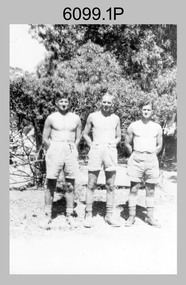
photograph - Fortuna - 1st Year of Army Occupation in Bendigo, 1942
... National Security Act of 1939, took possession of the house, the old battery buildings and the fifteen acres of grounds. Under Warrant Officer J. Trist’s direction, over fifty Parks and Works tradesmen completed building works necessary to accommodate the Survey Corps’ military, map making and printing requirements. The building program was still under way when the first...National Security Act of 1939, took possession of the house, the old battery buildings and the fifteen acres of grounds. Under Warrant Officer J. Trist’s direction, over fifty Parks and Works tradesmen completed building works necessary to accommodate the Survey Corps’ military, map making and printing requirements. The building program was still under way when the first ...This is a set of 17 photographs taken during the first year of Army occupation at Fortuna, Bendigo in 1942. The photos provide an insight into the preparatory work performed on the Fortuna Villa and surrounding buildings, by the Working Party 5th Army Troop and Ordnance Training Depot, before its occupation by personnel from LHQ Cartographic Company, Royal Australian Survey Corps. The annotation on the back of Photos .9P and .10P is misspelt. The correct spelling is ‘Nell Gwynne’. The poppet head of the Central Nell Gwynne mine is still an iconic landmark in Bendigo, lying just down the road from the poppet head lookout at Victoria Hill. The Central Nell Gwynne was the premier mine of Bendigo's 1930s mining revival and is of high historical value, due to the extensive and relatively intact features which remain at the site. The annotation on the back of Photo .17P is incorrect. The location of HQ 5th Army Troop was ‘Reynard St, Coburg.’ By late 1941 as Japan extended its control throughout Indo-China, resolving the accommodation problem of AHQ Cartographic Company located in Melbourne became more urgent. The steady Japanese advance made the bombing of Melbourne no longer a remote possibility, and in accordance with a general policy of dispersion, the Deputy Chief of the General Staff, Major General Sidney Rowell instructed Major William Sarll, in the interests of security of plant and to provide against possible damage of air attack, to investigate suitable safer inland accommodation for AHQ Cartographic Company. Major Sarll inspected many properties before finding one that would meet the requirements of the Cartographic Company. In late 1941, he came to inspect Fortuna, a rambling old mansion with about fifteen acres of ground in central Bendigo. Initially there was no intention to occupy the site beyond the end of the war, although Major Sarll's report to the Director of Survey noted many advantages in moving the Company to Bendigo. Major General Rowell quickly approved the selection of Fortuna before other authorities, which were investigating the evacuation of school children, could get in ahead of the Cartographic Company. On 23 March 1942, the Commonwealth of Australia, under the provisions of the National Security Act of 1939, took possession of the house, the old battery buildings and the fifteen acres of grounds. Under Warrant Officer J. Trist’s direction, over fifty Parks and Works tradesmen completed building works necessary to accommodate the Survey Corps’ military, map making and printing requirements. The building program was still under way when the first officer, Lieutenant Ralph Westgarth, arrived in May 1942 with the advance party which received and positioned all equipment as it came up from Melbourne in semi-trailers. Once the equipment was installed the rest of the Cartographic Company completed its shift to Bendigo by 11th June 1942. The first year of the Survey Corps’ occupation of Fortuna is covered in more detail with additional historic photographs, in pages 17-22 of Valerie Lovejoy’s book 'Mapmakers of Fortuna – A history of the Army Survey Regiment’ ISBN: 0-646-42120-4.This is a set of 17 photographs taken during the first year of Army Occupation at Fortuna, Bendigo in 1942. The black and white photographs were printed on photographic paper and are part of the Army Survey Regiment’s Collection. The photographs were scanned at 300 dpi. .1) - Photo, black & white, 1942. Bendigo Parks and Works tradesmen at Fortuna. L to R: Cliff Day, Ernie Arnold, Norm? .2) - Photo, black & white, 1942. “Don” - possibly SGT Don Sutcliffe. Fortuna, Bendigo. .3) - Photo, black & white, 1942. Parks and Works tradesmen in garden at Fortuna, Bendigo. L to R: Fred & Ernie. .4) - Photo, black & white, 1942. Benny Jack Williams at Fortuna, Bendigo. Accommodation tents were erected above the lake, which later became the parade ground. .5) - Photo, black & white, 1942. Working dress - Giggle suits. Parks and Works tradesmen at Fortuna, Bendigo. L to R: Cliff and Harry on big roof. .6) - Photo, black & white, 1942. Parks and Works tradesmen at Fortuna, Bendigo. Ted on big roof. .7) - Photo, black & white, 1942. Gold crusher battery just behind Fortuna. .8) - Photo, black & white, 1942. Scene of Bendigo from Fortuna. .9) - Photo, black & white, 1942. Nell Gwynne Mine from mullock heap at Victoria Hill near Fortuna, Bendigo. .10) - Photo, black & white, 1942. Nell Gwynne Mine and crusher near Fortuna, Bendigo. .11) - Photo, black & white, 1942. Sluicing for gold at Eaglehawk. .12) - Photo, black & white, 1942. Fortuna, Bendigo taken from the far side of tennis courts. .13) - Photo, black & white, 1942. Fortuna, Bendigo & its reflection from across the lake. .14) - Photo, black & white, 1942. Fortuna, Bendigo from the fishpond. .15) - Photo, black & white, 1942. Fortuna, Bendigo. .16) - Photo, black & white, 1942. First Fortuna Football Team at unknown location. L to R: 5th Bob Wright, 11th SGT Don Sutcliffe. .17) - Photo, black & white, 1942. Working Party from 5th Army Troop and Ordnance Training Depot at Fortuna, Bendigo.Some personnel are identified. Annotated with date within photos. .1) – Annotated on back ‘Cliff, Ernie, Norm, Dec ‘42. Cliff Day - dairy farmer, plasterers’ labourer. Ernie Arnold – hard plasterer. Norm? - QM Store for tools etc. QM Store was the Stables.’ .2) - Annotated on back ‘Don. Fortuna 1942’ .3) - Annotated on back ‘Fred & Ernie. Dec 1942. Carpenters. Note the state of the gardens.’ .4) - Annotated on back ‘Benny Jack Williams Fortuna Bendigo. Tents were erected where present day parade ground is above the lake.’ .5) - Annotated on back ‘Working dress - Giggle suits. June 42. Cliff and Harry on big roof. This photo was taken as the ventilating ridge was being installed on the building housing the printing machines. The machines were installed later by civilian labour when building was complete.’ .6) - Annotated on back ‘Ted on big roof Fortuna Bendigo.’ .7) - Annotated on back ‘Gold crusher battery – Bendigo for slay heap – 1942. 12 stamp battery. Just behind Fortuna. Was working at night when the “Army” came to Bendigo. Later removed to “Coolgardie - WA. Present site of Southern Cross TV.’ .8) - Annotated on back ‘Scene of Bendigo from Fortuna. June 1942.’ .9) - Annotated on back ‘Nell Gwyne Mine from mullock heap (Victoria Hill) Sept 1942.’ .10) - Annotated on back ‘Nell Gwyne Mine and crusher September 1942.’ .11) - Annotated on back ‘Sluicing for gold at Eaglehawk. August 1942.’ .12) - Annotated on back ‘Fortuna Bendigo 1942. Taken from far side of tennis courts.’ .13) - Annotated on back ‘ “Fortuna” across the lake & reflection.’ .14) - Annotated on back ‘Fortuna from fishpond June 1942.’ .15) - Annotated on back ‘Fortuna Dec 1942.’ .16) - Annotated on front ‘X’ x2. Annotated on back First Fortuna Football Team 1942‘Bob Wright’, ‘SGT Don Sutcliffe’. .17) - Annotated ‘Working Party at Fortuna before one of the drafts’, Working Party 5th Army Troop and Ordnance Training Depot Showgrounds, now the Sportsground Bendigo’, ‘HQ of 5th Army Troop was Reynards Rd, Coburg.’royal australian survey corps, rasvy, army survey regiment, army svy regt, fortuna, asr -
 Kiewa Valley Historical Society
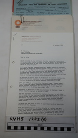
Ron White's Collection - 1920 - 2019
... W' embossed in red on the corner of the cover M) 100 Straitline, Starting Pistol Caps N) National Ice-cream Server with stainless steel spring Size 20 A) History of Ron White's Working Life: including papers relating to "Promotion & Staff Appointment" B) Ron White's Retirement - 11th Jan. 1985: papers, cards, letters, photos, disc/plaque C) Ron White's Certificates: Diploma of Mechanical Engineering; First Aid; D) Ron White's Correspondence - miscellaneous E) Ron White's History of the 'Kiewa Scheme' from 1936- 1966. ...Ron White was born in 1920. He received a Diploma of Mechanical Engineering at Footscray Technical School in 1946. He started work as a laboratory assistant and after several promotions was appointed Senior Operator in 1948. In 1949, he was Engineer, Grade 1 (Hydro Areas). After further promotions he became Assistant Area Engineer, Rubicon at new Eildon Power Station and Area Engineer, Kiewa in commissioning Mt Beauty Terminal Station and West Kiewa Power Station.. By 1956, he was the Area Operations Engineer at Kiewa and four years later the Kiewa Electrical Superintendent (Operations and Maintenance) . In 1961, he was officially recognised as deputy for the General Superintendent, Kiewa. In 1966 he was appointed General Superintendent Kiewa and Kiewa became 'a branch of the Transmission Department'. In 1974, the Rubicon / Eildon Area was also under Ron's control. His title was "Principal Hydro Engineer, Hydro Division, Transmission Operations Department. He held this position until his retirement in 1985.Ron White was an important identity in his role as Principal Hydro Engineer from 1966 to 1985 after the completion of the Kiewa Hydro Electric Scheme. His long period of service involved him in the construction, operation and maintenance of the SECV's Hydro Electric Schemes and administration of related catchment areas. He had a close association with the local communities and care for the welfare of employees. He lived in Mt Beauty and was well respected in the community and beyond. He passed away on 30 September 2019, aged 99 years.A) History of Ron White's Working Life: including papers relating to "Promotion & Staff Appointment" B) Ron White's Retirement - 11th Jan. 1985: papers, cards, letters, photos, disc/plaque C) Ron White's Certificates: Diploma of Mechanical Engineering; First Aid; D) Ron White's Correspondence - miscellaneous E) Ron White's History of the 'Kiewa Scheme' from 1936- 1966. Written 1986 F) Ron White's Photo album Includes photos of him and the 2003 bushfires G) Miscellaneous Photos (not labelled) from Ron's photo album. Possibly relatives including nieces and nephews. H) Pewter Mug presented to Ron - Water Board I) Wall hanging presented to Ron - Scouts J) Ron White's Slide Ruler & Mathematical Instruments K) Collection of 7 books owned by Ron L) Starting Pistol Caps box M) Ice-cream serverF) One photo of Ron with 'Ken Connors'. One photo with 'l to r: Norm Middleton, Graham Napier, Ron White, Les Peart.' G) 2003 fires has a note re time, date and whereabouts of fires H) "Presented To / Ron White / In Appreciation For Service / To The / Kiewa Valley / Water Authority / And / Its predecessor Bodies / December 1994 I) Wall hanging: On emblem - "Lord Baden-Powell Society / The Scout Association of Australia". On Name Plate below - Ronald K. White 1989" J) mathematical Instruments have 'R. W' embossed in red on the corner of the cover M) 100 Straitline, Starting Pistol Caps N) National Ice-cream Server with stainless steel spring Size 20 ron white, hydro engineer, kiewa hydro electric scheme -
 Kiewa Valley Historical Society
Boys' Club Programme, Y.M.C.A. of Australia
... Issued by National Committee YMCAs of Australia. The first 14 pages "Club Programmes" and last 6 Pages "Physical Games for the Gymnasium."...Issued by National Committee YMCAs of Australia. The first 14 pages "Club Programmes" and last 6 Pages "Physical Games for the Gymnasium." ...Athletics was an important activity for boys to be involved in. The Y.M.C.A. encouraged and supported communities to become members and gave them encouragement and support by providing programmes and activities.The Mt Beauty community established in the 1950s an athletics club which belonged to the YMCA before becoming involved with the Gra-Y and Hy-Y organisation.Brown cardboard cover with usty fastener. Cover has label cente font "Hints and Suggestions for Boys' Club Programmes. Issued by National Committee YMCAs of Australia. The first 14 pages "Club Programmes" and last 6 Pages "Physical Games for the Gymnasium."athletics, y.m.c.a., boys club programmes, mt beauty athletics club -
 Kiewa Valley Historical Society
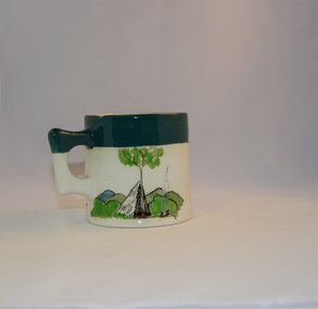
Mug Stoneware
... The Victorian Award of the National Rover Service Award(1980) has been named after Bill Waters. Bill Waters was also the leader of the first team that climbed Mount Bogong in winter in 1929. ...The Victorian Award of the National Rover Service Award(1980) has been named after Bill Waters. Bill Waters was also the leader of the first team that climbed Mount Bogong in winter in 1929. ...This ceramic mug is titled "Bill Bogong's Mug" in honour of one of Australia's Scouting (Rovers) notable office holders, Mr.W.F."Bill" Waters. He was born on 22nd August 1897 in Taralgon, Victoria, Australia and died 8th October 1968 in Fitzroy, Victoria. He was instrumental in the Rovers building two chalets in the Victorian Alps. The Victorian Award of the National Rover Service Award(1980) has been named after Bill Waters. Bill Waters was also the leader of the first team that climbed Mount Bogong in winter in 1929. Also was part of rescue team of what is now know as the Cleve Cole tragedy on Mt Bogong in the mid 1930's. There is also a water fall named after him Waters Falls on the Bogong High Plains. W.F."Bill" Waters aka "Bill Bogong" (Bogong mountain, were his ashes were scattered), was not only a prominent bush walker (Melbourne Walking Club) of the high country (Victorian Alps) but was instrumental in establishing two Chalets. One of these Chalets was the first one to be built on the Bogong High Plains. This item, "Bill Bogong's Mug" is what the Flinders Petrie(famous English Egyptologist/Archaelogist) Rover Crew(formed in 1940) presented newly invested members of the exclusive(200 membership) Alpine Rover Crew. The Melbourne Walking Club has a long history with the Victorian High Plains area, of which the Kiewa Valley is an integral part of the Victorian Alpine Region. Due to the connections Bill Waters has with the Bogong High Plains and Mt Bogong this cup has a lot of significance to the social history of the area.. Round glazed stoneware mug, white in colour, with a heritage green coloured band covering the top rim and handle. Written inscription on the front "Bill Bogong's Mug" in large print and beneath it, in smaller print, "with compliments from Flinders Petrie Rover Crew" The other side of the mug is a free hand landscaped drawing of green bush and blue hills with a tree supporting a tent and a camp fire (with smoke rising from it).To the left of the inscription is the Scout (Rover) emblem coloured black with an unraveled and unwritten signage scroll fowler ceramics, local alpine history, alpine rovers, scouts, mugs, mt bogong, bogong high plains -
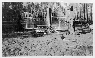 Eltham District Historical Society Inc
Photograph, Kinglake National Park. Gates into Jehosaphat Park; Shelley Harris, Ranger
... It is significant in being the first community sourced collection representing the places and people of the Shire's first one hundred years. sepp shire of eltham pioneers photograph collection kinglake kinglake national park ranger shelley harris jehosaphat park Digital image Kinglake National Park. ...Source: Mrs. McMinn, Kinglake.This photo forms part of a collection of photographs gathered by the Shire of Eltham for their centenary project book,"Pioneers and Painters: 100 years of the Shire of Eltham" by Alan Marshall (1971). The collection of over 500 images is held in partnership between Eltham District Historical Society and Yarra Plenty Regional Library (Eltham Library) and is now formally known as the 'The Shire of Eltham Pioneers Photograph Collection.' It is significant in being the first community sourced collection representing the places and people of the Shire's first one hundred years.Digital imagesepp, shire of eltham pioneers photograph collection, kinglake, kinglake national park, ranger, shelley harris, jehosaphat park -
 Eltham District Historical Society Inc
Photograph, Kinglake National Park, Valley of Jehosaphat
... It is significant in being the first community sourced collection representing the places and people of the Shire's first one hundred years. sepp shire of eltham pioneers photograph collection kinglake kinglake national park valley of jehosaphat. ...Source: Mrs. McMinn, Kinglake.This photo forms part of a collection of photographs gathered by the Shire of Eltham for their centenary project book,"Pioneers and Painters: 100 years of the Shire of Eltham" by Alan Marshall (1971). The collection of over 500 images is held in partnership between Eltham District Historical Society and Yarra Plenty Regional Library (Eltham Library) and is now formally known as the 'The Shire of Eltham Pioneers Photograph Collection.' It is significant in being the first community sourced collection representing the places and people of the Shire's first one hundred years.Digital imagesepp, shire of eltham pioneers photograph collection, kinglake, kinglake national park, valley of jehosaphat. -
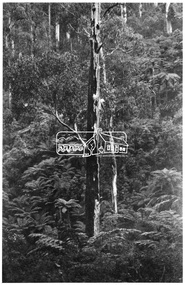
 Eltham District Historical Society Inc
Photograph, Kinglake National Park; near Kinglake Hotel
... It is significant in being the first community sourced collection representing the places and people of the Shire's first one hundred years. sepp shire of eltham pioneers photograph collection kinglake kinglake national park kinglake hotel Digital image Kinglake National Park; near Kinglake Hotel. ...Source: Mrs. McMinn, Kinglake.This photo forms part of a collection of photographs gathered by the Shire of Eltham for their centenary project book,"Pioneers and Painters: 100 years of the Shire of Eltham" by Alan Marshall (1971). The collection of over 500 images is held in partnership between Eltham District Historical Society and Yarra Plenty Regional Library (Eltham Library) and is now formally known as the 'The Shire of Eltham Pioneers Photograph Collection.' It is significant in being the first community sourced collection representing the places and people of the Shire's first one hundred years.Digital imagesepp, shire of eltham pioneers photograph collection, kinglake, kinglake national park, kinglake hotel -
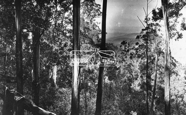 Eltham District Historical Society Inc
Negative - Photograph, Kinglake National Park; view from the Mountain Trail
... community sourced collection representing the places and people of the Shire's first one hundred years. sepp shire of eltham pioneers photograph collection kinglake kinglake national park mountain trail Digital image 4 x 5 inch B&W Neg Kinglake National Park; view from the Mountain Trail Negative Photograph ...The Kinglake National Park was established on 11,300 acres in the Shire of Eltham in 1928.This photo forms part of a collection of photographs gathered by the Shire of Eltham for their centenary project book,"Pioneers and Painters: 100 years of the Shire of Eltham" by Alan Marshall (1971). The collection of over 500 images is held in partnership between Eltham District Historical Society and Yarra Plenty Regional Library (Eltham Library) and is now formally known as 'The Shire of Eltham Pioneers Photograph Collection.' It is significant in being the first community sourced collection representing the places and people of the Shire's first one hundred years.Digital image 4 x 5 inch B&W Negsepp, shire of eltham pioneers photograph collection, kinglake, kinglake national park, mountain trail -
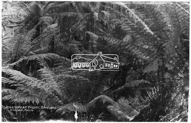 Eltham District Historical Society Inc
Photograph, Kinglake National Park; view from the Mountain Trail
... It is significant in being the first community sourced collection representing the places and people of the Shire's first one hundred years. sepp shire of eltham pioneers photograph collection kinglake kinglake national park view bush ferns Jehosophat Digital image Kinglake National Park; view from the Mountain Trail Photograph Photograph ...Kinglake National Park was established in 1928 on 11,300 acres in the Shire of Eltham. Jehosophat Valley was named by the Hotelier Frank Thomson's father, who was so struck with the grandeur of the valley in all its pristine beauty that he 'ejaculated the word Jehosophat.'This photo forms part of a collection of photographs gathered by the Shire of Eltham for their centenary project book,"Pioneers and Painters: 100 years of the Shire of Eltham" by Alan Marshall (1971). The collection of over 500 images is held in partnership between Eltham District Historical Society and Yarra Plenty Regional Library (Eltham Library) and is now formally known as 'The Shire of Eltham Pioneers Photograph Collection.' It is significant in being the first community sourced collection representing the places and people of the Shire's first one hundred years.Digital imagesepp, shire of eltham pioneers photograph collection, kinglake, kinglake national park, view, bush, ferns, jehosophat -
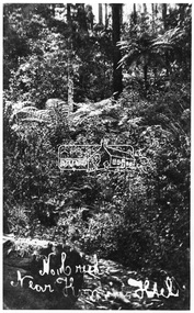 Eltham District Historical Society Inc
Photograph, Kinglake National Park; No. 1 Creek near Kinglake Hotel
... It is significant in being the first community sourced collection representing the places and people of the Shire's first one hundred years. sepp shire of eltham pioneers photograph collection kinglake kinglake national park no. 1 creek kinglake hotel Digital image Kinglake National Park; No. 1 Creek near Kinglake Hotel. ...Source: Mrs. McMinn, Kinglake.This photo forms part of a collection of photographs gathered by the Shire of Eltham for their centenary project book,"Pioneers and Painters: 100 years of the Shire of Eltham" by Alan Marshall (1971). The collection of over 500 images is held in partnership between Eltham District Historical Society and Yarra Plenty Regional Library (Eltham Library) and is now formally known as the 'The Shire of Eltham Pioneers Photograph Collection.' It is significant in being the first community sourced collection representing the places and people of the Shire's first one hundred years.Digital imagesepp, shire of eltham pioneers photograph collection, kinglake, kinglake national park, no. 1 creek, kinglake hotel -
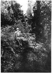 Eltham District Historical Society Inc
Photograph, Kinglake National Park; the Mountain Trail
... It is significant in being the first community sourced collection representing the places and people of the Shire's first one hundred years. sepp shire of eltham pioneers photograph collection kinglake kinglake national park mountain trail Digital image Kinglake National Park; the Mountain Trail. ...Source: Mrs. McMinn, Kinglake.This photo forms part of a collection of photographs gathered by the Shire of Eltham for their centenary project book,"Pioneers and Painters: 100 years of the Shire of Eltham" by Alan Marshall (1971). The collection of over 500 images is held in partnership between Eltham District Historical Society and Yarra Plenty Regional Library (Eltham Library) and is now formally known as the 'The Shire of Eltham Pioneers Photograph Collection.' It is significant in being the first community sourced collection representing the places and people of the Shire's first one hundred years.Digital imagesepp, shire of eltham pioneers photograph collection, kinglake, kinglake national park, mountain trail -
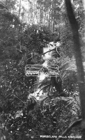 Eltham District Historical Society Inc
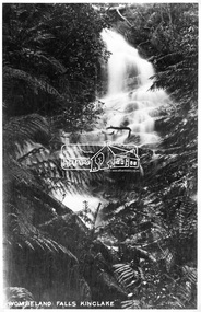
Negative - Photograph, Wombelano Falls, Kinglake
... community sourced collection representing the places and people of the Shire's first one hundred years. Kinglake National Park Shire of Eltham Pioneers Photograph Collection Water Falls Wombelano Falls Digital image 4 x 5 inch B&W Neg Wombelano Falls, Kinglake Negative Photograph ...Wombelano Falls is framed by a eucalypt forest and lush gullies in the Kinglake National Park. This image probably produced as a postcard.This photo forms part of a collection of photographs gathered by the Shire of Eltham for their centenary project book,"Pioneers and Painters: 100 years of the Shire of Eltham" by Alan Marshall (1971). The collection of over 500 images is held in partnership between Eltham District Historical Society and Yarra Plenty Regional Library (Eltham Library) and is now formally known as 'The Shire of Eltham Pioneers Photograph Collection.' It is significant in being the first community sourced collection representing the places and people of the Shire's first one hundred years.Digital image 4 x 5 inch B&W Negkinglake national park, shire of eltham pioneers photograph collection, water falls, wombelano falls -
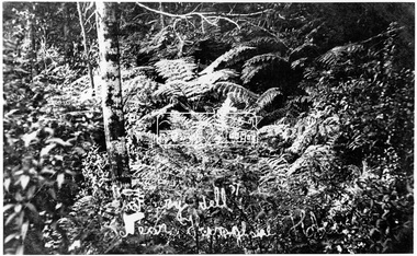
 Eltham District Historical Society Inc
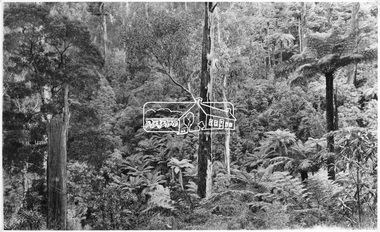
Photograph, Kinglake National Park, fern scene, Valley of Jehosaphat
... It is significant in being the first community sourced collection representing the places and people of the Shire's first one hundred years. sepp shire of eltham pioneers photograph collection kinglake kinglake national park valley of jehosaphat. bush Digital image Kinglake National Park, fern scene, Valley of Jehosaphat Photograph Photograph ...The Kinglake National park was established in 1928 and consisited of 11,300 acres located in the Shire of Eltham at that time. The famous Jehosophat Valley was named by the Hotelier Frank Thomson's father, who was so struck with the grandeur of the valley in all its pristine beauty that he 'ejaculated the word Jehosophat'.This photo forms part of a collection of photographs gathered by the Shire of Eltham for their centenary project book,"Pioneers and Painters: 100 years of the Shire of Eltham" by Alan Marshall (1971). The collection of over 500 images is held in partnership between Eltham District Historical Society and Yarra Plenty Regional Library (Eltham Library) and is now formally known as 'The Shire of Eltham Pioneers Photograph Collection.' It is significant in being the first community sourced collection representing the places and people of the Shire's first one hundred years.Digital imagesepp, shire of eltham pioneers photograph collection, kinglake, kinglake national park, valley of jehosaphat., bush -
 Eltham District Historical Society Inc
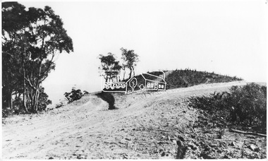
Photograph, Kinglake National Park, Bald Spur Lookout
... It is significant in being the first community sourced collection representing the places and people of the Shire's first one hundred years. sepp shire of eltham pioneers photograph collection kinglake kinglake national park bald spur lookout Digital image Kinglake National Park, Bald Spur Lookout. ...Source: Mrs. McMinn, Kinglake.This photo forms part of a collection of photographs gathered by the Shire of Eltham for their centenary project book,"Pioneers and Painters: 100 years of the Shire of Eltham" by Alan Marshall (1971). The collection of over 500 images is held in partnership between Eltham District Historical Society and Yarra Plenty Regional Library (Eltham Library) and is now formally known as the 'The Shire of Eltham Pioneers Photograph Collection.' It is significant in being the first community sourced collection representing the places and people of the Shire's first one hundred years.Digital imagesepp, shire of eltham pioneers photograph collection, kinglake, kinglake national park, bald spur lookout -
 Eltham District Historical Society Inc
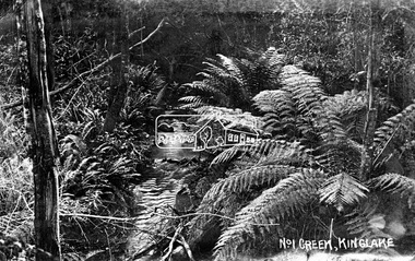
Negative - Photograph, No. 1 Creek, Kinglake, c.1916
... It is significant in being the first community sourced collection representing the places and people of the Shire's first one hundred years. shire of eltham pioneers photograph collection kinglake kinglake national park no. 1 creek Digital image 4 x 5 inch B&W Neg No. 1 Creek, Kinglake Negative Photograph ...This photo forms part of a collection of photographs gathered by the Shire of Eltham for their centenary project book,"Pioneers and Painters: 100 years of the Shire of Eltham" by Alan Marshall (1971). The collection of over 500 images is held in partnership between Eltham District Historical Society and Yarra Plenty Regional Library (Eltham Library) and is now formally known as the 'The Shire of Eltham Pioneers Photograph Collection.' It is significant in being the first community sourced collection representing the places and people of the Shire's first one hundred years.Digital image 4 x 5 inch B&W Negshire of eltham pioneers photograph collection, kinglake, kinglake national park, no. 1 creek -
 Eltham District Historical Society Inc
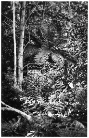
Photograph, Kinglake National Park, Fern Nook near Kinglake Hotel
... It is significant in being the first community sourced collection representing the places and people of the Shire's first one hundred years. sepp shire of eltham pioneers photograph collection kinglake kinglake national park Digital image Kinglake National Park, Fern Nook near Kinglake Hotel. ...Source: Mrs. McMinn, Kinglake.This photo forms part of a collection of photographs gathered by the Shire of Eltham for their centenary project book,"Pioneers and Painters: 100 years of the Shire of Eltham" by Alan Marshall (1971). The collection of over 500 images is held in partnership between Eltham District Historical Society and Yarra Plenty Regional Library (Eltham Library) and is now formally known as the 'The Shire of Eltham Pioneers Photograph Collection.' It is significant in being the first community sourced collection representing the places and people of the Shire's first one hundred years.Digital imagesepp, shire of eltham pioneers photograph collection, kinglake, kinglake national park -
 Eltham District Historical Society Inc
Photograph, Kinglake National Park, Wombelano Falls
... community sourced collection representing the places and people of the Shire's first one hundred years. sepp shire of eltham pioneers photograph collection kinglake kinglake national park wombeland falls waterfall postcard forest Digital image Kinglake National Park, Wombelano Falls Photograph Photograph ...Wombelano Falls is framed by a eucalypt forest and lush gullies in the Kinglake National Park. This image probably produced as a postcard.This photo forms part of a collection of photographs gathered by the Shire of Eltham for their centenary project book,"Pioneers and Painters: 100 years of the Shire of Eltham" by Alan Marshall (1971). The collection of over 500 images is held in partnership between Eltham District Historical Society and Yarra Plenty Regional Library (Eltham Library) and is now formally known as 'The Shire of Eltham Pioneers Photograph Collection.' It is significant in being the first community sourced collection representing the places and people of the Shire's first one hundred years.Digital imagesepp, shire of eltham pioneers photograph collection, kinglake, kinglake national park, wombeland falls, waterfall, postcard, forest
