Showing 1034 items matching "गुगल ड्रेनेज प्रगति(TG:e10838).gum"
-
 Linton and District Historical Society Inc
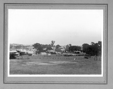
Photograph, Linton landscape - view from the school, looking to south-east
Undated black and white photograph, which mostly shows buildings in Sussex Street, Linton, near the corner of Sussex and Clyde Streets. Surrey Street can be seen in the foreground but there are no houses along it."View of Linton from school. Large tree gum planted was in front of cottage dad built when they were first married. Now half covered with ivy". "(16)".sussex street linton, surrey street linton -
 Port Melbourne Historical & Preservation Society
Tool - Ruler, City of Port Melbourne Electricity Supply Department, 1980s - 1990s
Given together with 972.03 and a lemon-scented gum seedling to Pat Grainger when she was naturalised at the Port Town Hall in 199230 cm yellow ruler stamped with 'City of Port Melbourne Electricity Supply Department'utilities - electricity, immigration -
Port Melbourne Historical & Preservation Society
Tool - Pen, Ballpoint, City of Port Melbourne and Borough by the Bay, 1980s - 1990s
Given together with 972.02 and a lemon-scented gum seedling to Pat Grainger when she was naturalised at the Port Town Hall in 1992Red and blue plastic ballpoint pens stamped with the City of Port Melbourne and 'Borough by the Bay'immigration -
 Port of Echuca
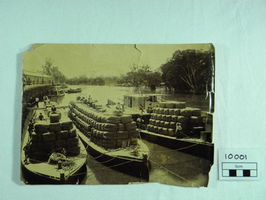
Photograph, P.S. Rodney with barges Horace & Nelson, c.1890
P.S Rodney with barges Horace & Nelson laden with wool bales bought into the Port to be unloaded onto rail trucks to go to markets in Melbourne. c.1890 Paddlesteamers travelled the river systems to bring wool from out- lying properties into the Port of Echuca to be transported by rail to Melbourne. This was prior to road & rail transport in the 1800'sOne of thousands of photos taken depicting the transportation of wool from out- lying properties to the rail head at Port of Echuca using paddlesteamers. P.S.Rodney alongside barges Horace & Nelson, tied to historic Echuca Wharf, with Pride of the Murray paddlesteamer & barge in back ground all vessels loaded with wool bales and crew resting on these. Riverbank lined with red gums. Handwritten in pen on lower left back corner "Rodney with barges Horace & Nelson c. 1890"farming, economy, p s rodney, port of echuca, wool bales, wharf, barges, horrace, nelson, paddlesteamer rodney, echuca -
 Halls Gap & Grampians Historical Society
Photograph - B/W, C ?
This is the ford over the Stoney Creek and shelter shed.The photo shows a track leading down to a large pergola type structure, surrounded by thick bush. There is a tall gum on the right of the picture, beside the track. A large branch of a tree can be seen in the top left foreground.access routes, roads -
 Halls Gap & Grampians Historical Society
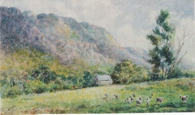
Photograph - Coloured
Painting is by Will Rees, an Australian Artist. Subject is a shepherd's hut owned by the D Alton Family on land where D'Alton's Resort now stands.Item is a coloured print of a painting. The range stands in the back ground. A hut stands middle of foreground with a stump in front . A taller gum tree stands to the right side of the photo. Print has soft muted colours.painting, landscape -
 Halls Gap & Grampians Historical Society
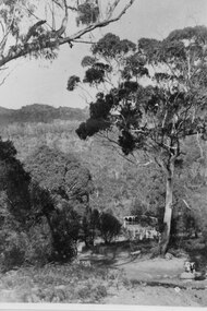
Photograph - B/W, c 1869
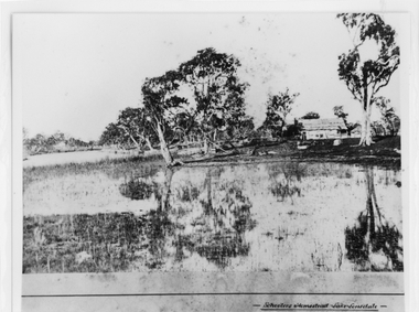
Photo is said to be of Schoolers' homestead,Lake Lonsdale. Miss Scouller was the teacher at Halls Gap Primary school in 1921.Spelling of Schooler varies from that on front of photo to 'Scouller' which appears in book "Bridging the Gap'.Photo shows bark roofed building on a bank of a body of water . A number of large gum trees surround the buildings-- tree reflections can be seen in the water. There appears to be extensive fencing around the buildings. The homestead is not visible.buildings, houses -
 Halls Gap & Grampians Historical Society
Photograph - B/W, C 1960s
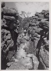
Photo is of area known as ' Silent Street'. It is on path to Pinnacle Lookout.Photo shows a man walking along slabs of rock that form a path between rocky outcrops. He is walking away from the camera. Various shrubs line the path. Gum trees can be seen in background.'Copyright photograph'. This photograph may be reproduced on condition that it is acknowledged as 'Victorian Railways Photograph', p3456- Silent Street . Halls Gap.scenery, wonderland range -
 Bendigo Historical Society Inc.
Document - CAMBRIDGE PRESS COLLECTION: RECEIPT - A. I. POOLE
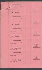
Sheet of five pink receipt forms with a sheet of yellow backing paper. Receipts in the name of A. I. Poole, Berriwillock. Date line ends 19--. Has space for 2d Duty Stamp if Necessary. Gummed back.business, printers, cambridge press, cambridge press collection, a i poole -
 El Dorado Museum Association Inc.
Photograph (item) - Digital Image
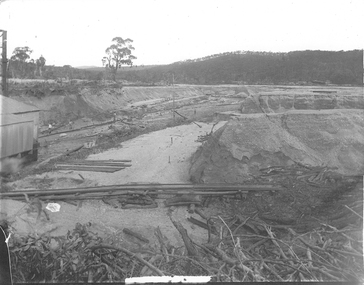
Cocks Pioneer Electric Gold & Tin Mine Company was formed in 1899. The company's first power station, located at the eastern end of the valley began operating with its 340 Kilowatt steam-powered generator. By 1909, from 2,500,000 cubic yards worked, reported recovery was 17,284 ounces of gold and 224 tons of tin ore. By 1909, Cocks Pioneer’s power plant had become inadequate and uneconomical. The barge was floated downstream about a mile, but lost time caused the operations to cease. Following testing, a new mine was established by diverting Reid's Creek at a cost of £25 000. Settling dams were built, one of which held 1,935,900 cubic feet. Sold earth banks, built against a wall of stringy bark saplings constructed and laced with vertical props, were built. In 1914, the company was reformed as Cock’s Pioneer Gold and Tin Mines NL, another power station was constructed at the western end of the township, near the junction of Clear and Reid's Creeks. From 6,800,000 cubic yards of material processed, the returns were 64,397 ounces of gold and 855 ton of tin. Cocks Pioneer mine then moved the barge downs stream and continued sluicing. In 1929 Cocks Pioneer Electric Gold and Tin Mining Company ceased operations due to a drop in values. Cock’s Pioneer Gold and Tin Mines NL carried on large-scale hydraulic sluicing operations until 1941. mining, mines, gold, tin, gold mining, tin mining, sluicing, cocks pioneer, el dorado, eldorado -
 Victorian Apiarists Association
Publication, 1st Australian Bee Congress, October 13-16, 1972
Just over A5 size soft cover book. Aqua cover with picture of Mugga Ironbark flowering on the front, colourful map of Australia on the back with honeycomb on it & surrounded by Australian birds on flowering gums 239 pagesThis volume was published under the guidance of - Prof. Dr. Eng. V Harnaj - President of Apimondia John Guilfoyle - President of the First Australian Bee congress Dr. Francis Smith - Editor of the scientific papers -
 Mt Dandenong & District Historical Society Inc.
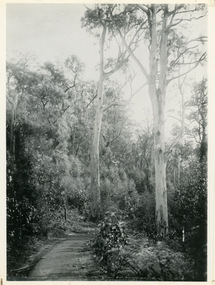
Photograph, Jasper Road Near Erith Lane 1920, 1920
View of Jasper Road, near Erith Lane taken in 1920. The road is tree lined with two significant gum trees in the foreground. This photograph has a detailed inscription on the back handwritten by John Lundy-Clarke in 1974.Jasper Road near Erith Lane 1920. This road has only a narrow right of way. It was put in as a road to serve “Cherry Farm”, connecting it to the Coach Road at the Elbow in 1904. It joins a wide surveyed road running from Inverness Road to the Coach Road at the Elbow and could possibly have been surveyed by Thomas Hand at the same time as Inverness Road. The name Jasper now applies to full length between Erith Lane and Coach Road. McGivern Bros widened it in 1937 and J L Clarke removed and stored much of the rock quarried in the widening. This was later sold to Dick Moorby who sold it to the builders of St Michaels Church in Falls Road. Comment by John Lundy-Clarke 10.5.1974 jasper road, erith lane, john lundy-clarke -
Bendigo Historical Society Inc.
Ephemera - LYDIA CHANCELLOR COLLECTION: CRUISE SHIP MENU, 1962
LYDIA CHANCELLOR COLLECTION: CRUISE SHIP Menu Front Cover Colour print of Koala in a gum tree and mountains in the background. Inside: Drins and Food Menus. Enroute Auckland to Suva Thursday May 31 1962 -
 Sunbury Family History and Heritage Society Inc.
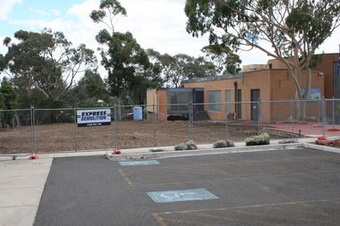
Photograph, Rosa McCall, 2nd January 2018
The former Sunbury Library was demolished and the empty site is ready for the construction of the new library. The existing building housed the George Evans Museum. A more modern Global Learning Centre is planned to be built on the site.A coloured photograph of a fenced site with a flat-roofed cream brick building adjacent to an area that has a been cleared in preparation for construction. A demolition sign is attached to the wire fence. Gum trees are growing in three background.libraries, global learning centre, sunbury, hume city council, macedon street, sunbury library -
Ringwood and District Historical Society
Newspaper Cutting, Ringwood "Don't Axe This Tree" article (Herald c 1965)
The 60ft high tree - a yellow box gum was due to be removed from Whitehorse Road for the duplication of the road. Despite protests, the tree was removed.Front page of newspaper 'The Herald' with article on photograph of tree in Ringwood about 1965. Photocopy. 'Don't Axe This Tree' +Additional Keywords: Hubbard / Benjamin / Kearsley / Nevitt / Grey, Mr'Don't Axe This Tree' -
 Greensborough Historical Society
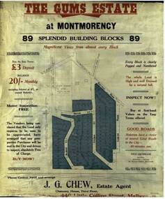
Advertising Leaflet, The Gums Estate, 28/11/1925
Sale brochure for The Gums Estate, 89 building blocks bordered by Rattray and Looker Roads Montmorency. J. G. Chew, Estate AgentColoured photocopy of sale brochure the gums estate, rattray road montmorency, looker road montmorency, sylvan street montmorency, alban street montmorency -
 Phillip Island and District Historical Society Inc.
Photograph Album, Kodak, Phillip Island Cemetery, c 1990
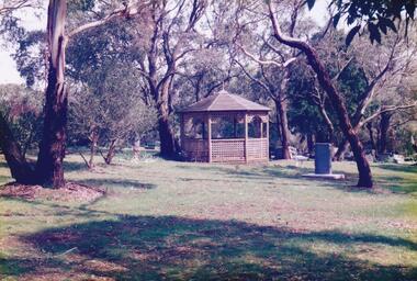
The Album was compiled by Nancy McHaffie late 1990's, with the assistance of Edith Jeffery's, with her book "Garden of Memories" and extensive knowledge of Phillip Island. The Cemetery lies back from the road and is surrounded by Manna Gums, rare Peppermint Gums, Blackwoods and other native trees. In all 25 acres of land were set aside as Crown Land in the land settlement of 1868. There are 6.2 acres of wetlands near the cemetery entrance. 6 Photographs of the Phillip Island Cemetery with views of the graves and the Gazebo.phillip island cemetery, nancy mchaffie, edith jeffrey -
 Phillip Island and District Historical Society Inc.
Photograph Album, Kodak, Phillip Island Cemetery, c 1990
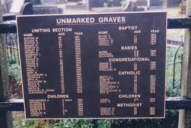
The Album was compiled by Nancy McHaffie late 1990's, with the assistance of Edith Jeffery's, with her book "Garden of Memories" and extensive knowledge of Phillip Island. The Cemetery lies back from the road and is surrounded by Manna Gums, rare Peppermint Gums, Blackwoods and other native trees. In all 25 acres of land were set aside as Crown Land in the land settlement of 1868. There are 6.2 acres of wetlands near the cemetery entrance.2 Photographs: 466-08 Notice of the Unmarked Graves. Although the land for the cemetery was granted in 1870, a survey was not made until 1903 hence the existence of unmarked graves. 466-09 A disastrous fire swept through the cemetery in 1943, destroying many structures around the graves - hence the rule "no wooden structures". the Hitching Posts were used for tying up hrses during a funeral service. They were erected in 1912 and now only two remain.phillip island cemetery, nancy mchaffie, edith jeffrey -
 Phillip Island and District Historical Society Inc.
Photograph Album, Kodak, Phillip Island Cemetery, c 1990
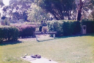
The Album was compiled by Nancy McHaffie late 1990's, with the assistance of Edith Jeffery's, with her book "Garden of Memories" and extensive knowledge of Phillip Island. The Cemetery lies back from the road and is surrounded by Manna Gums, rare Peppermint Gums, Blackwoods and other native trees. In all 25 acres of land were set aside as Crown Land in the land settlement of 1868. There are 6.2 acres of wetlands near the cemetery entrance.5 Photographs of the Garden of Remembrance. 466-10 - Garden of Remembrance sign 466-11 - On the 8th November 1990, two Life Members of the League, Mr Eddie Patton and Mr Ken Lang, planted a young seedling from the original Lone Pine from Gallipoli in the Memorial Garden 466-12 - The Returned Servicemens League placed a Flagpole and Granite Stone in the Memorial Garden in memory of the fallen 466-13 & 14 - Garden of Remembrance Plaquesphillip island cemetery, nancy mchaffie, edith jeffrey -
 Phillip Island and District Historical Society Inc.
Photograph Album, Kodak, Phillip Island Cemetery, c 1990
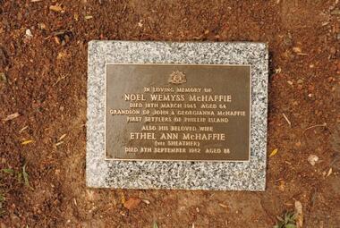
The Album was compiled by Nancy McHaffie late 1990's, with the assistance of Edith Jeffery's, with her book "Garden of Memories" and extensive knowledge of Phillip Island. The Cemetery lies back from the road and is surrounded by Manna Gums, rare Peppermint Gums, Blackwoods and other native trees. In all 25 acres of land were set aside as Crown Land in the land settlement of 1868. There are 6.2 acres of wetlands near the cemetery entrance.4 photographs relating to the McHaffie family. 466-15 & 466-16: Noel Wemyss & Vernon Suter Wemyss McHaffie were grandchildren of the first permanent European Settlers of Phillip Island (John David & Georgianna McHarrie who leased the whole Island as a sheep and cattle run for 45 years until Closer Settlement in 1868 reduced their holding to 640 acres and who are buried at the St. Kilda Cemetery, Melbourne). Noel's ashes are interred at the Phillip Island Cemetery and Vernon's were scattered at Ventnor Philip Island at the site of the original homestead. 466-17 & 466-18: As per the Plaque: "Mulberry Tree: Muberry cutting from original tree planted by John D McHaffie First Settlers Phillip Island 1842. Plaque by courtesy Cherry McFee 1987.phillip island cemetery, nancy mchaffie, edith jeffrey -
 Phillip Island and District Historical Society Inc.
Photograph Album, Kodak, Phillip Island Cemetery, c 1990
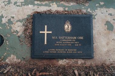
The Album was compiled by Nancy McHaffie late 1990's, with the assistance of Edith Jeffery's, with her book "Garden of Memories" and extensive knowledge of Phillip Island. The Cemetery lies back from the road and is surrounded by Manna Gums, rare Peppermint Gums, Blackwoods and other native trees. In all 25 acres of land were set aside as Crown Land in the land settlement of 1868. There are 6.2 acres of wetlands near the cemetery entrance.Lt. Commander M Batterham OBE RANVR was born in 1906 and later attended Geelong Grammar School. First attempt to join RAN was unsuccessful, due to health reasons. In 1942 he joined the Naval Volunteer Reserve. This was the beginning of a naval career which extended to peace-time in Canberra. He was awarded the OBE in 1952 for courage and devotion to duty. Maurice was laid to rest in the lawn section of the cenetery, August 1996 aged 90 years old.phillip island cemetery, nancy mchaffie, edith jeffrey -
 Phillip Island and District Historical Society Inc.
Photograph Album, Kodak, Phillip Island Cemetery, c 1990
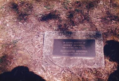
The Album was compiled by Nancy McHaffie late 1990's, with the assistance of Edith Jeffery's, with her book "Garden of Memories" and extensive knowledge of Phillip Island. The Cemetery lies back from the road and is surrounded by Manna Gums, rare Peppermint Gums, Blackwoods and other native trees. In all 25 acres of land were set aside as Crown Land in the land settlement of 1868. There are 6.2 acres of wetlands near the cemetery entrance.466-21: Henry Bennell was known as "Bricky" Bennell. Henry or Harry as he was sometimes called, was the Island's firs bricklayer. He was married to Elizabeth West, daughter of John West, who owned the first Chicory Kiln on the Island in what is now Thompson Avenue. Henry Died on September 14th, 1940, aged 68 years. 466-22: Captain David Reid J. B. Captain Reid served as a Councillor of the Phillip Island and Woolamai Shire in 1875. He was the first Trustee and President, as well as being instrumental in establishing a school at Rhyll on block 13 about 1870. He died in 1891 at the age of 75.phillip island cemetery, nancy mchaffie, edith jeffery -
 Phillip Island and District Historical Society Inc.
Photograph Album, Kodak, Phillip Island Cemetery, c 1990
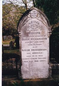
The Album was compiled by Nancy McHaffie late 1990's, with the assistance of Edith Jeffery's, with her book "Garden of Memories" and extensive knowledge of Phillip Island. The Cemetery lies back from the road and is surrounded by Manna Gums, rare Peppermint Gums, Blackwoods and other native trees. In all 25 acres of land were set aside as Crown Land in the land settlement of 1868. There are 6.2 acres of wetlands near the cemetery entrance.466-23: Joseph Richardson came to Australia in 1837 from Liverpool, England. Sarah Arbuckle and her two sisters arrived in 1850. Sarah and Joseph were married when gold was discovered in Victoria. They went to the diggings and had some success. Joseph bought land on Phillip Island when it was open to freehold selection in 1868. The family moved to Phillip Island shortly afterwards, to a house they built on a hill west of Cowes. They called their home "Everton" after a Liverpool suburb. The house still stands in Church Street, known as "Tallawalla". 466-24: The McIlwraith family came from Melton, Victoria to Heath Hill, Rhyll in 1869. They played an important part in the early history of Phillip Island. James was a foundation member of the Trust, John and Alan played their part in the local scene. John was President and Alan Secretary of the Cemetery Trust for many years.phillip island cemetery, nancy mchaffie, edith jeffery -
 Phillip Island and District Historical Society Inc.
Photograph Album, Kodak, Phillip Island Cemetery, c 1990
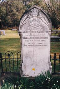
The Album was compiled by Nancy McHaffie late 1990's, with the assistance of Edith Jeffery's, with her book "Garden of Memories" and extensive knowledge of Phillip Island. The Cemetery lies back from the road and is surrounded by Manna Gums, rare Peppermint Gums, Blackwoods and other native trees. In all 25 acres of land were set aside as Crown Land in the land settlement of 1868. There are 6.2 acres of wetlands near the cemetery entrance.466-25: William and Alice Richardson: Alice Barnard married William Richardson at Hawthorn, April 1887. Alice's father Fredrick was a Model Maker employed at the Melbourne Museum. Alice died in childbirth having her third child, Joseph in 1892. Baby Joseph died in April 1893, eight months later at Rhyll. 466-26: The Forrest Family: The Forrest family were amongst our early settlers. The Forrest Caves are named after them. Matthew Forrest arrived by dray from Tarradale on 9th November 1869. He died in 1916 at the age of 75. His Grandson, Peter Forrest Sr. has recorded that Matthew was the first to plant Marum Grass on the Island to prevent erosion.phillip island cemetery, nancy mchaffie, edith jeffery -
 Phillip Island and District Historical Society Inc.
Photograph Album, Kodak, Phillip Island Cemetery, c 1990
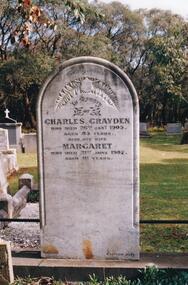
The Album was compiled by Nancy McHaffie late 1990's, with the assistance of Edith Jeffery's, with her book "Garden of Memories" and extensive knowledge of Phillip Island. The Cemetery lies back from the road and is surrounded by Manna Gums, rare Peppermint Gums, Blackwoods and other native trees. In all 25 acres of land were set aside as Crown Land in the land settlement of 1868. There are 6.2 acres of wetlands near the cemetery entrance.466-27: Charles Grayden: Charles arrived from England on the "Robert Ben" about 1835. On arrival he went bush. He later married Margaret Larkie in St. James' old Cathedral, Melbourne on 15th September, 1842. They arrived at Hastings in 1860 then came to Phillip Island to live on Block 33, Newhaven in the year 1867. He died 26th January 1905 aged 85. Margaret died 21st June 1907 aged 81. She is also buried in this grave. 466-28: Joseph Bauer: Joseph was the son of our first owner of the Isle of Wight Hotel. His father came to the Island in 1870 and bought a small private house, then added to it in the style of a Swiss House. It became one of the most comfortable hotels in Victoria. Joseph died aged 19, in 1878.phillip island cemetery, nancy mchaffie, edith jeffery -
 Phillip Island and District Historical Society Inc.
Photograph Album, Kodak, Phillip Island Cemetery, c 1990
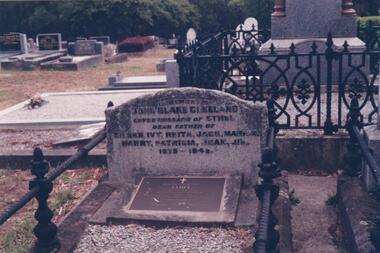
The Album was compiled by Nancy McHaffie late 1990's, with the assistance of Edith Jeffery's, with her book "Garden of Memories" and extensive knowledge of Phillip Island. The Cemetery lies back from the road and is surrounded by Manna Gums, rare Peppermint Gums, Blackwoods and other native trees. In all 25 acres of land were set aside as Crown Land in the land settlement of 1868. There are 6.2 acres of wetlands near the cemetery entrance.466-29: John Blake Cleeland lived in the house his father built, "Woolamai House" in Newhaven. His property ran cattle, horses and angora goats. He had a great love of the sea although he never went to sea. He logged all shipping movements around the Eastern passage of Westernport. He was Captain-in-charge of the Rocket Apparatus Station at Newhaven, which was a rescue service for shipping. 466-30: Eleanor Blake (nee Lucas) came out from Ireland in 1860 together with her husband Edward Hudson Blake and children. For most of her life in Australia, she resided at Hastings. Her youngest daughter Isabella married John Cleeland, both of whom are buried in the cemetery. Eleanor moved from Hastings to "Woolamai House" in later years. 466-31: Margaret Jane Cleeland (nee Kennon) married John Blake Cleeland on May 21st 1903 at South Yarra. She was the daughter of Stanley Stowell Kennon, a farmer and her mother was Isabella (nee Turner). Margaret died in 1909 at the age of 30 years. At the time of her death she was survived by three children: Eileen Henrietta, Ivy Florence & Reita Vermont.phillip island cemetery, nancy mchaffie, edith jeffery, cleeland -
 Phillip Island and District Historical Society Inc.
Photograph Album, Kodak, Phillip Island Cemetery, c 1990
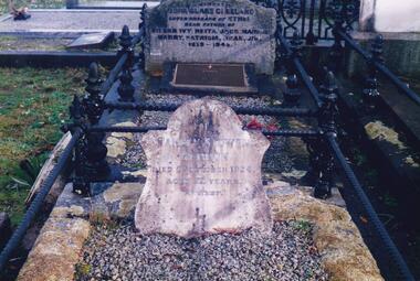
The Album was compiled by Nancy McHaffie late 1990's, with the assistance of Edith Jeffery's, with her book "Garden of Memories" and extensive knowledge of Phillip Island. The Cemetery lies back from the road and is surrounded by Manna Gums, rare Peppermint Gums, Blackwoods and other native trees. In all 25 acres of land were set aside as Crown Land in the land settlement of 1868. There are 6.2 acres of wetlands near the cemetery entrance.466-32: Stanley Stowel Kennon Sr. was born in Melbourne in 1852. He spent many years at Newhaven and Cowes. He was 24 years old when he spent six weeks on Seal Rocks obtaining Seal Oil. In 1888 he rescued Sir William Irvine and a friend when they were marooned on a small island whilst out fishing. He was presented with a gold watch and chain for his bravery. Stanley was known as one of the most capable and daring sailors ever connected to Phillip Island. He died in 1924 aged 72. 466-33: Lucy Cox was the wife of George Cox who was the first official mailman to Phillip Island. George had a love of the sea from boyhood serving as a British Sailor. He heard of the discovery of gold in Australia which brought him to Australia to try his luck. He built a hut on the foreshore opposite the Isle of Wight Hotel. He lived there until he disappeared; it is thought he drowned. Lucy died 3rd September 1888.phillip island cemetery, nancy mchaffie, edith jeffery, george cox, lucy cox, stanley kennon -
 Phillip Island and District Historical Society Inc.
Photograph Album, Kodak, Phillip Island Cemetery, c 1990
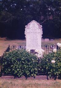
The Album was compiled by Nancy McHaffie late 1990's, with the assistance of Edith Jeffery's, with her book "Garden of Memories" and extensive knowledge of Phillip Island. The Cemetery lies back from the road and is surrounded by Manna Gums, rare Peppermint Gums, Blackwoods and other native trees. In all 25 acres of land were set aside as Crown Land in the land settlement of 1868. There are 6.2 acres of wetlands near the cemetery entrance.466-34: Captain J. B. Lock. John Barnard Lock was associated with the trading vessels to operate from Phillip Island when the settlers had most of their goods brought from Melbourne. He died in 1908 and is laid to rest in the family grave. The grave is surrounded by metal railing and flowers. 466-35: David Charles Justice. David came to the Island in 1898. He was a blacksmith, coachbuilder, farrier, agricultural engineer, wheelmaker, shipbuilder and farmer. He purchased a farm from the Harbison Estate in 1911 in the Ventnor township. He assisted Mr Will Kennon in building a punt used to recover equipment from the wreck of the "Speke". "Dinny" as he was called, married Isabella Miller (an early settlers' family). He died in November 1943 aged 79. Isabella died in October 1936 aged 86. phillip island cemetery, nancy mchaffie, edith jeffery, captain john barnard lock, david charles justice, isabella justice -
 Phillip Island and District Historical Society Inc.
Photograph Album, Kodak, Phillip Island Cemetery, c 1990
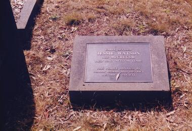
The Album was compiled by Nancy McHaffie late 1990's, with the assistance of Edith Jeffery's, with her book "Garden of Memories" and extensive knowledge of Phillip Island. The Cemetery lies back from the road and is surrounded by Manna Gums, rare Peppermint Gums, Blackwoods and other native trees. In all 25 acres of land were set aside as Crown Land in the land settlement of 1868. There are 6.2 acres of wetlands near the cemetery entrance.466-36: Jessie Watson was a daughter of the McGregor family who came to the Island in the very early days. Their selection was one of the most exposed areas on the Island. Jessie was married for a brief period and continued, with her brother Charlie, to work the family farm. Jessie was a hard worker and died in 1963 aged 98. The Plaque on her grave was donated by the Phillip island & District Historical Society. 466-37: Malcolm Sutherland. Malcolm died age 8 years while on a holiday on Phillip Island. His father was Dr. Alexander Sutherland who conducted his own school "Carlton College" Melbourne. Dr Sutherland was also appointed to the Melbourne Public Library committee for the papers taken to England by Governor La Trobe in May 1894. Malcolm was the only son of Alexander & Lizzie Sutherland.phillip island cemetery, malcolm sutherland, jessie watson nee mcgregor, nancy mchaffie, edith jeffery -
 Phillip Island and District Historical Society Inc.
Photograph Album, Kodak, Phillip Island Cemetery, c 1990
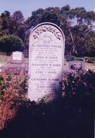
The Album was compiled by Nancy McHaffie late 1990's, with the assistance of Edith Jeffery's, with her book "Garden of Memories" and extensive knowledge of Phillip Island. The Cemetery lies back from the road and is surrounded by Manna Gums, rare Peppermint Gums, Blackwoods and other native trees. In all 25 acres of land were set aside as Crown Land in the land settlement of 1868. There are 6.2 acres of wetlands near the cemetery entrance.466-38: Rev Alexander Robb, DD. Rev Robb had been a missionary in Old Calabar and Jamaica and was the first minister of the Cowes Presbyterian Church from 1890-1901. Services were also held in the Public Hall at Rhyll. A daughter, Kathleen, like her parents, is buried in the cemetery. Kathleen was married to Harry West. 466-39: James Hill. Jimmy, as he was fondly called, came to Phillip Island in 1920 and purchased the Hotel, known as Woods Family Hotel (later the Phillip Island Hotel in Walpole Street). A milestone occurred whilst in his capable hands he installed an electric light plant, (32 volts), the first on the Island. He also made hundreds of cement bricks with which he built his own home. He died in 1937 aged 68. His only child Dorothy Edhouse aged 98, is also buried with her father.phillip island cemetery, james hill, rev alexander robb, nancy mchaffie, edith jeffery