


Historical information
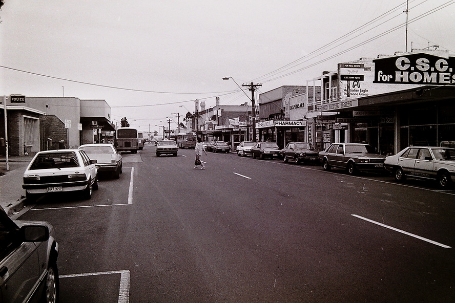
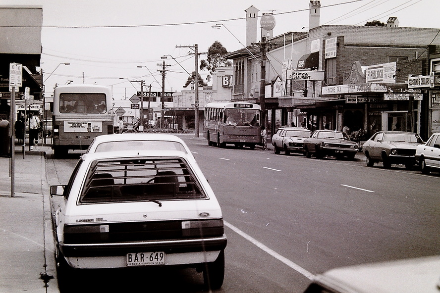
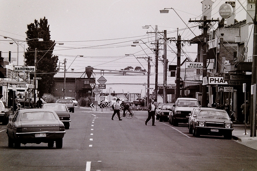
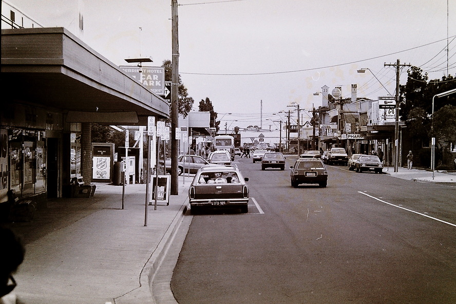
These photographs, taken by The Advocate in 1990, provide views of Sun Crescent, Sunshine, looking east from Watt Street towards Hampshire Road. The images document the appearance of one of Sunshine's principal commercial precincts on the southern side of the railway line.
Visible in the photographs are a range of businesses that served the local community, including the Sunshine Police Station, C.S.C. for Homes Real Estate, UFS Dispensary, State Bank of Victoria, Agostino's Cellars, Ministry of Housing and Construction Maintenance Office, , Pizza Restaurant, Derrimut Hotel and Kolliou Hardware Store
Sun Crescent Shopping Centre emerged in the 1960s–1970s as a redeveloped section of Hampshire Road, created when the road alignment was altered and the former 1920s–1930s shop rows were renamed Sun Crescent.
It became a small but important neighbourhood retail strip serving the residential blocks around the Sunshine Railway Station and Town Hall precinct.
1920s–1930s — Original Hampshire Road shops
Before Sun Crescent existed, the area was part of the main Hampshire Road commercial strip.
Shops between 107–117 Hampshire Road were built during the 1923–1925 period, including:
Homewood’s Café (a major social hub)
Confectioners
Grocers
Butchers
Timber yards
Small specialty shops
This cluster formed part of Sunshine’s early civic and retail centre.
1960s — Road realignment and renaming
During Sunshine’s mid‑century redevelopment, the section of Hampshire Road near the Town Hall was realigned.
The old shop row at 107–117 Hampshire Road was renamed Sun Crescent.
This renaming marks the birth of the Sun Crescent Shopping Centre.
1970s — Formation of a neighbourhood shopping strip
By the 1970s, Sun Crescent had developed into a small but active local shopping centre.
Typical businesses included:
Milk bars
Small grocers
Hairdressers
Takeaway shops
Service businesses
Local professional rooms
Its customer base came from the dense residential blocks around the station, Town Hall, and Sunshine Technical School.
1980s–1990s — Stable neighbourhood centre
Sun Crescent remained a modest but steady retail strip, overshadowed by the larger Hampshire Road and Sunshine Plaza precincts but still serving:
Commuters
Local residents
Students
Workers from nearby civic buildings
Some older shops were redeveloped or replaced with modern commercial units.
2000s–2020s — Modern mixed‑use strip
Today, Sun Crescent functions as:
A secondary retail strip within the Sunshine Major Activity Centre
A mix of small shops, services, and professional suites
A transitional zone between the station precinct and residential streets
Its heritage value lies in its connection to the original 1920s Hampshire Road shops and the mid‑century renaming that created the Sun Crescent identity.
Significance
The images provide a valuable record of the commercial activity, small businesses and streetscape of central Sunshine at the beginning of the 1990s, illustrating the diverse range of services and enterprises that contributed to the economic and social life of the town centre.
Physical description
Digital scans of black and white negatives
Inscriptions & markings
6843.01 - Sunshine Shopping Centre Sun Crescent Sunshine 1990 Photographs (Advocate 492.3).JPG
6843.02 - Sunshine Shopping Centre Sun Crescent Sunshine 1990 Photographs (Advocate 492.3).JPG
6843.03 - Sunshine Shopping Centre Sun Crescent Sunshine 1990 Photographs (Advocate 492.3).JPG
6843.04 - Sunshine Shopping Centre Sun Crescent Sunshine 1990 Photographs (Advocate 492.3).JPG
